 Service


I3S / Scene Layer Package
I3S, which stands for Indexed 3D Scene Layer, is an open 3D geospatial data standard led by Esri and adopted by the OGC (Open Geospatial Consortium). Its accompanying format, the Scene Layer Package (SLPK), packages all scene layer resources into a single archive file. Built on modern web technologies such as JSON and REST, it is adapted to cloud, web, and mobile environments, supporting efficient streaming, storage, and visualization of large-scale heterogeneous 3D data. It is compatible with multiple types of 3D content including 3D objects, oblique photogrammetry, point clouds, and BIM. It is now widely supported by major GIS software such as ArcGIS and ContextCapture.
2026-06-24 17:03:50
OpenSCENARIO (.xosc)
OpenSCENARIO (.xosc) is a standardized XML format maintained by the ASAM (Association for Standardization of Automation and Measuring Systems) organization, specifically designed for describing dynamic scenarios in traffic simulation. It focuses on the behavioral interactions of traffic participants such as vehicles and pedestrians, and can reference static road network files such as OpenDRIVE. Through a hierarchical storyboard structure, it defines event trigger conditions and action sequences, serving as the core universal standard for achieving scenario reusability and cross-tool interoperability in the field of autonomous driving virtual testing.
2026-06-24 16:59:34
Mapbox Schema API
Mapbox Schema API is a set of tools and specifications provided by Mapbox for defining and managing map data structures. It allows developers to describe map layers, data sources, and their style properties in a standardized manner, ensuring consistency of map data across different platforms and tools. It is commonly used for customizing map styles or precisely controlling the rendering rules of map elements when integrating geographic data.
2026-06-18 14:20:43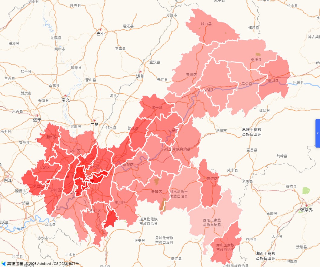
GeoJSON API
GeoJSON API is not a standardized web service protocol but rather a geospatial data interchange format based on JSON. It is commonly used as the data carrier for geographic information system (GIS) data interfaces, transmitting geometric objects such as points, lines, and polygons along with their associated attributes. Its structure strictly adheres to the RFC 7946 specification and exclusively supports the WGS84 coordinate system. Typical objects include Feature (containing geometry and properties) and FeatureCollection. It is widely used for data loading and rendering in web mapping platforms such as Leaflet, Mapbox, and Tianditu (天地图). Developers can embed GeoJSON data directly via URL parameters for map visualization, or have backend services dynamically generate and return responses in this format.
2026-06-18 14:15:31
Polar Stereographic (Elliptical) Projection
Polar Stereographic (Elliptical) Projection is a conformal projection centered on the poles, formed by orthographically projecting the Earth's surface from the pole onto a plane. The meridians appear as radiating straight lines, and the parallels appear as concentric circles (or circular arcs). By employing elliptical parameters, it more accurately matches the Earth's ellipsoidal shape, maintaining relatively low distortion in polar regions. It is commonly used for polar map production and navigation.
2026-06-18 14:05:38
Bertin 1953 Projection
Bertin 1953 Projection is an equal-area world map projection designed by French cartographer Jacques Bertin in 1953. Its core objective is to accurately represent the relative areas of countries and regions worldwide, making it particularly suitable for visualizing socio-economic data. The projection achieves strict area proportionality by highly compressing polar regions and deforming the entire Earth's surface into an approximately elliptical shape, with both meridians and parallels appearing as smooth curves. Although it does not preserve shape (non-conformal) or distance (non-equidistant), it maintains strict equal-area properties, achieving good overall visual balance and regional comparability. It remains one of the important non-traditional projections in modern thematic cartography.
2026-06-18 14:01:46
Monte Mario (EPSG:4265)
Monte Mario (EPSG:4265) is Italy's official two-dimensional geographic coordinate system. Named after the Monte Mario datum and based on the International 1924 ellipsoid, it covers the entire territory of Italy (including San Marino and Vatican City). It is primarily used for geodetic surveying and offshore mineral management. Its coordinate axes are latitude and longitude, measured in degrees. It can be transformed to common coordinate systems such as WGS84 and ETRS89, with an accuracy of approximately 4 meters when transforming to WGS84.
2026-06-12 16:04:19
DHDN (Deutsches Hauptdreiecksnetz)
DHDN (Deutsches Hauptdreiecksnetz) is the old national geodetic datum of the Federal Republic of Germany, corresponding to EPSG code 4314. It is also often referred to as the Lauenberg Datum or Potsdam Datum. Based on the Bessel 1841 ellipsoid, its original fundamental point was TP Lauenberg. After this point was destroyed by sand and gravel extraction, the Helmert Tower in Potsdam became the new central point. DHDN served as the common coordinate basis for land surveying in the old federal states of Germany. With the advent of satellite geodetic techniques, the importance of the hierarchical triangulation network gradually declined. Starting in the 2010s, DHDN has been replaced by the ETRS89 coordinate system. Today, it is mainly used for onshore geodetic surveying and national digital mapping in the former West German states, covering areas such as Baden-Württemberg and Bavaria.
2026-06-12 15:54:25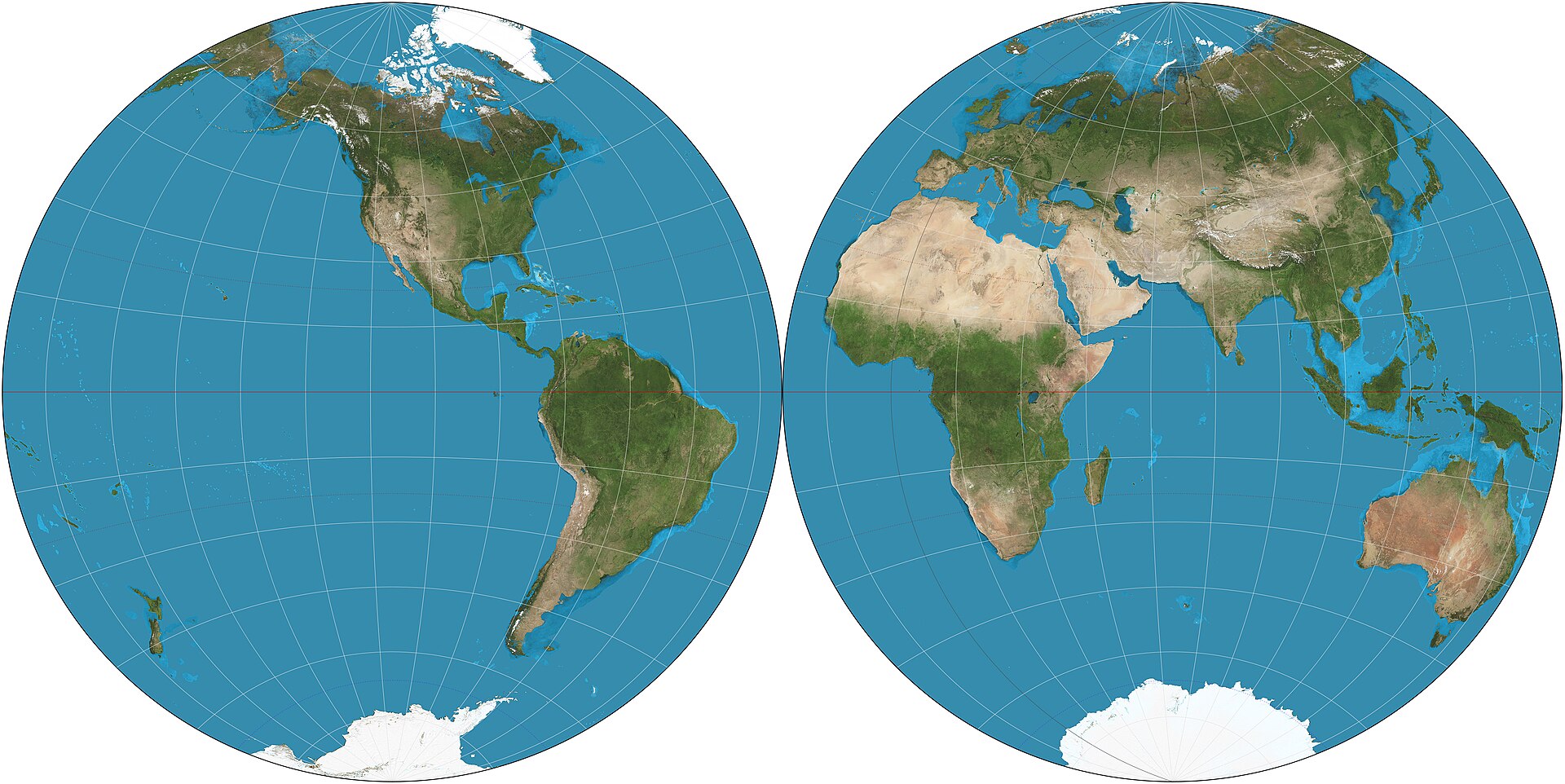
Nicolosi Globular Projection
Nicolosi Globular Projection is a pseudocylindrical compromise world map projection introduced by the Italian cartographer Giambattista Nicolosi in 1660. It is one of the best-known early globular projections and was widely used before modern mathematical projections became standard. The projection represents the world in a rounded form and was valued for its visually balanced appearance. It is neither equal-area nor conformal, and today it is mainly of historical interest.
2026-05-28 17:41:15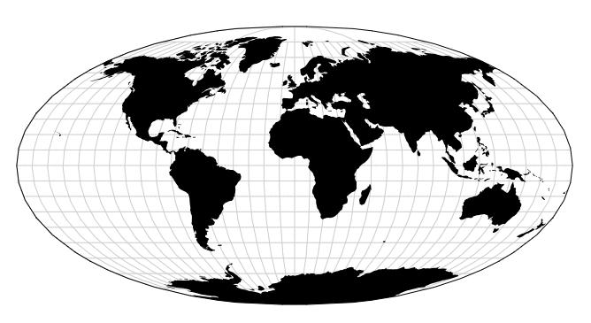
Apian Globular Projection
Apian Globular Projection is a pseudocylindrical world map projection introduced by Peter Apian in the 16th century. It belongs to the family of early globular projections developed during the Renaissance, when cartographers sought visually appealing ways to represent the whole world. The projection is neither equal-area nor conformal, but it was valued for its balanced appearance and for presenting the world in a rounded, compact form. Today it is mainly of historical interest.
2026-05-28 17:37:14