 Service

_1762327362104.png)
Azimuthal Equidistant Projection
Azimuthal equidistant projection is a map projection that is drawn to accurately maintain direction and distance from a single point (reference point) on the Earth. Its greatest feature is that the straight-line distance and azimuth angle from the center point to all other points are accurately represented on the map. It is often used in applications where accuracy of direction and distance is important, such as air navigation and communications.
2025-11-05 15:21:19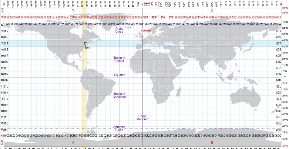
MGRS
MGRS coordinate system, also known as the Military Grid Reference System, is a standard coordinate system used by NATO military organizations. It is based on the Universal Transverse Mercator (UTM) system and further divides each UTM area into small squares of 100km x 100km. These blocks are identified by two connected letters, with the first letter representing the east-west position of the longitude zone and the second letter representing the north-south position.
2025-11-05 15:16:23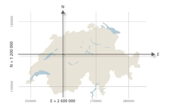
Swiss LV95
Swiss LV95 is a projection coordinate system adopted by the Swiss government, based on the CH1903+/LV95 standard, and is a variant of the Gauss Kruger projection designed specifically for planar surveying in the Swiss region. It solves the problem of direct use of spherical data in engineering and mapping by converting geographic coordinates (such as WGS84) into planar coordinates. This coordinate system is widely used in navigation, land management, and infrastructure planning in Switzerland, and its coordinate values are usually expressed in meters.
2025-11-05 15:14:49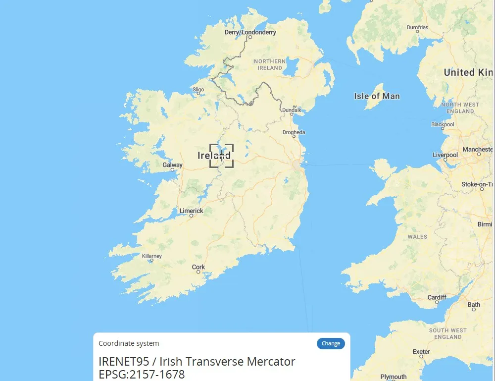
Irish Transverse Mercator
Irish Transverse Mercator (ITM) is a transverse Mercator projection coordinate system designed specifically for Ireland, using the ETRS89 ellipsoid as the reference. The central meridian of its projection is 8 degrees west longitude, and the geographic coordinates of the Irish region are converted into plane coordinates through the horizontal axis isometric cylindrical projection method to reduce deformation and meet national surveying and mapping needs. This coordinate system is the primary projection system for official maps and geospatial data of Ireland.
2025-11-05 15:13:00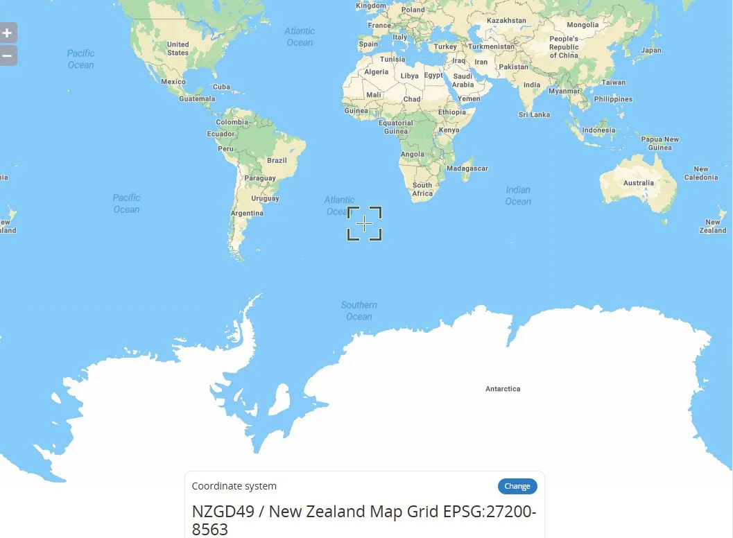
NZMG (New Zealand Map Grid – EPSG:27200)
New Zealand Map Grid (NZMG) coordinate system is a projected coordinate system used in New Zealand. Based on the Transverse Mercator projection, it is primarily used for mapping and georeferencing within New Zealand. It projects the Earth's surface onto a flat surface, centered on the South and North Islands of New Zealand. It uses specific central meridians and scale parameters to minimize projection distortion. This coordinate system is widely used in surveying, engineering, and land management in New Zealand. Coordinates are typically expressed in meters, with an origin near the South Island.
2025-11-05 15:11:00
Belgian Lambert 72 (EPSG:31370)
Belgian Lambert 72 is a regional geodetic coordinate system based on the Lambert Conformal Conic Projection used in Belgium. It is based on the Belgian geodetic datum established in 1972. This projection transforms the Earth's spheroid onto a flat surface and is suitable for mapping and geographic information system (GIS) applications in Belgium and the surrounding area. Its EPSG code is 31370. Unlike geocentric systems (e.g., WGS-84), this system is classified as a "local datum" because the center of the ellipsoid does not coincide with the Earth's center of mass.
2025-11-05 15:09:48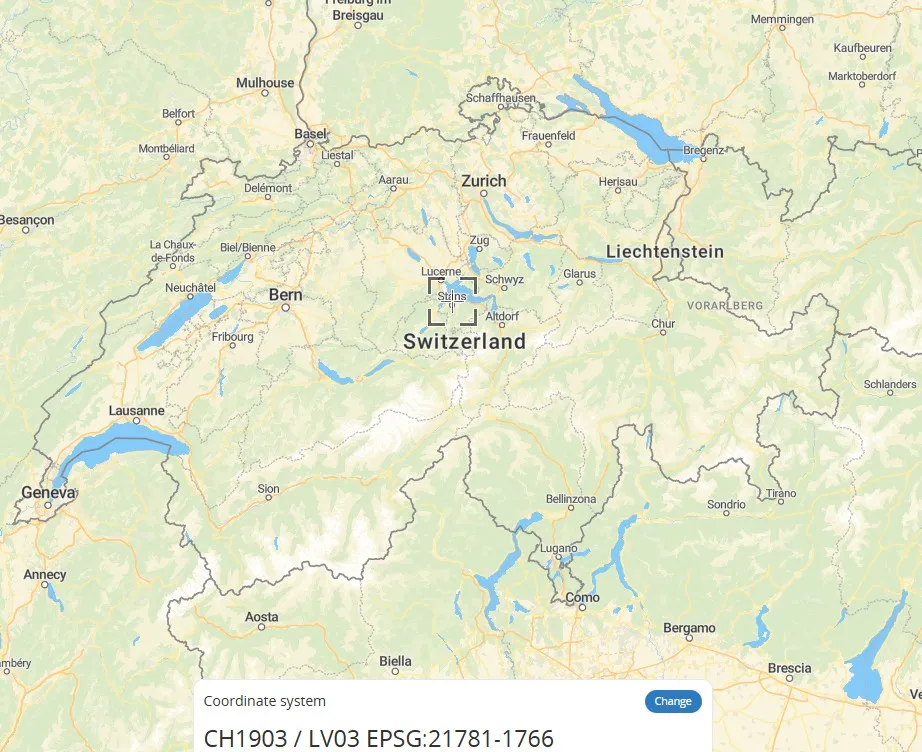
CH1903 / LV03 (Old Swiss National Coordinate System – EPSG:21781)
CH1903/LV03 is the national Cartesian coordinate system used by Switzerland. It uses the former Bern Observatory as its reference point (mandatory definition: 600,000 meters east longitude, 200,000 meters north latitude) and uses metric units to simplify positioning calculations. This coordinate system is based on the CH1903 geodetic datum. Its improved version, CH1903+, relocates the reference point to the Zimmerwald Observatory, but the coordinate error between the two is kept within 3 meters, making it suitable for mapping services throughout Switzerland. Unlike globally accepted geographic coordinate systems such as WGS84, CH1903 is a projected coordinate system that uses Cartesian (X, Y) coordinates to enable precise measurement of local areas.
2025-11-05 15:08:15
TM35FIN (Finnish Transverse Mercator coordinate system – EPSG:3067)
TM35FIN is a two-dimensional rectangular coordinate system widely used in Finland. An extension of ETRS89/UTM 35N, it adopts the Transverse Mercator projection with a central meridian of 27°E. TM35FIN is measured in meters and covers the entire territory of Finland and the surrounding sea areas. Designed for engineering surveying and topographic mapping, it offers high accuracy and regional adaptability.
2025-11-05 15:07:16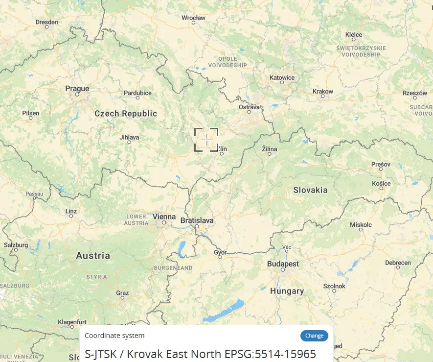
S-JTSK / Krovak East North - SJTSK - EPSG:5514
S-JTSK / Krovak is the local coordinate system used by the Czech Republic. Its core is based on the Krovak projection, a variant of the oblique conformal conic projection. By adjusting the central meridian and standard parallels, this coordinate system optimizes cartographic accuracy in Central Europe (such as the Czech Republic and Slovakia), effectively controlling angular and areal distortions. It is particularly suitable for large-scale topographic mapping. The relationship between S-JTSK and Krovak is that the former directly uses the latter as its mathematical foundation, forming a unified national planar coordinate system.
2025-11-05 15:06:32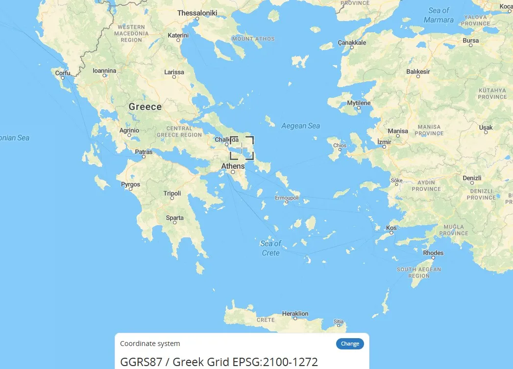
Greek Grid (Greek National Coordinate System – EPSG:2100)
Greek Grid is a plane rectangular coordinate system based on a projection specific to Greece, a type of geographic grid coordinate system (GRID). It divides the Earth's surface into virtual grid lines, projecting spatial coordinates onto a plane to form a locally applicable coordinate system. It is commonly used in mapping and engineering surveying in Greece. Unlike universal geographic coordinates (latitude and longitude), this coordinate system directly represents plane positions using x and y values, making it suitable for precise positioning in small areas.
2025-11-05 15:05:37