 Service

Mapbox
Nov 5,2025
GISBox is a one-stop 3D GIS data editing, conversion and publishing platform that supports editing in multiple GIS formats such as OSGB/GEOTIFF/RVT, converting to 3DTiles/Terrain and publishing.
Introduction
Mapbox is a US-based map and location service provider that provides APIs and SDKs for developers to help them build custom map apps and visualization tools. It covers map data from all over the world and uses WebGL technology to create high-performance 2D and 3D maps. It supports real-time data visualization, route calculation, geocoding, and other features. By utilizing an open source toolchain, you can quickly build location-based services in a variety of fields, including navigation, logistics, and smart cities. It features vector tile technology and a flexible style system, and also provides global base map data and satellite imagery.

File Structure
The Mapbox development framework is primarily divided into four core modules:
- Map Core Layer: Central functionalities including data I/O, resource management, rendering engine, and map controls.
- SDK Wrapper Layer: Implementation of platform-specific API interfaces for iOS, Android, and other supported platforms.
- Foundation & External Libraries: Dependency libraries such as Boost, SQLite, and other supporting components.
- Functional Modules: Over 20 specialized submodules handling tasks like style parsing, tile management, and text rendering (e.g.,
style/,text/,tile/directories).
Pros
- High Customizability: Design map appearances freely using JSON style files, supporting brand color integration and dynamic data visualization.
- Cross-Platform Support: Provides SDKs for iOS, Android, Web, and desktop platforms enabling rapid integration.
- Real-Time Data Integration: Handles dynamic data including traffic information, geofencing, and route calculation - ideal for logistics and navigation applications.
- Global Coverage & Frequent Updates: Regularly updates worldwide map data to ensure the latest information is always available.
- 3D & Visualization Capabilities: Supports 3D mapping, terrain data, heatmaps, trajectory animations, and other advanced visualizations.
Cons
- High Costs: Free tier imposes limits on API calls and map displays, requiring paid plans for commercial use.
- Steep Learning Curve: Significant time investment required to master style definitions, vector tile concepts, and other advanced features.
- China Mainland Restrictions: Real-time traffic and other functions face usage limitations domestically, necessitating local data source integration.
- Resource Intensive: 3D mapping and dynamic rendering demand high-performance devices, with performance degradation on low-spec hardware.
- Network Dependency: Limited offline capabilities may cause map display delays in unstable connection environments.
Application Scenario
Mapbox is used in a wide range of fields, including travel navigation (online vehicle dispatch route planning, etc.), logistics tracking, smart cities (traffic flow analysis), commercial site selection (display of real estate surrounding facilities), tourism platforms (scenic spots and route recommendations), social applications (location sharing), and game development (3D map rendering). Through real-time data and highly customized services, Mapbox is driving the digital transformation of various industries.
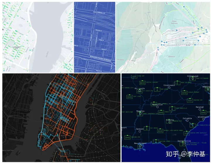
Example
- New 3D styles improve navigation and location understanding | Mapbox Standard.
_1763976198917.png)
- Example UI configuration of Mapbox open source tools.
File Opening Mode
- Cesium loading a custom Mapbox basemap.
