Service

LAS/LAZ (LiDAR Point Cloud Format)
Nov 24,2025
GISBox is a one-stop 3D GIS data editing, conversion and publishing platform that supports editing in multiple GIS formats such as OSGB/GEOTIFF/RVT, converting to 3DTiles/Terrain and publishing.
Introduction
LAS/LAZ (LiDAR Point Cloud Format) files are standard formats for storing 3D point cloud data acquired through LiDAR technology, established by the American Society for Photogrammetry and Remote Sensing (ASPRS). The LAS format uses a binary structure to store attributes such as 3D coordinates (X, Y, Z), intensity, return number, and classification for each point. LAZ is a compressed version of LAS that significantly reduces file size while maintaining data integrity.
File Structure
LAS/LAZ (LiDAR Point Cloud Format) file structure primarily consists of the following components:
- File Header: Stores metadata including file signature ("LASF" identifier), version number, point data record format, coordinate reference system (defined by WKT or GeoTIFF tags), spatial extent (min/max X/Y/Z values), and point count.
- Variable Length Records: Used to store extended information such as projection parameters, sensor details, and custom metadata.
- Point Data Records: Each point record contains fields for coordinates, intensity, return information, classification, and other attributes.
Pros
- Preserves Complete Point Cloud Information: Supports storage of LiDAR-specific attributes such as position, intensity, classification, and return numbers, ensuring data integrity.
- Standardization and Cross-Platform Compatibility: Established by ASPRS, it unifies output formats across different hardware/software systems, facilitating data exchange and interoperability.
- Efficient Compression (LAZ): As a compressed version, LAZ significantly reduces storage requirements while maintaining data precision.
- Wide Industry Adoption: Extensively utilized in fields including topographic mapping, urban modeling, and power line inspection.
Cons
- Large File Size: Uncompressed LAS files require substantial storage space, impacting both storage efficiency and data transfer performance.
- Dependence on Specialized Software: Reading and visualizing these files typically requires GIS or point cloud processing tools (e.g., GISBox, PCL), creating a technical barrier for non-expert users.
- High Conversion Cost: Direct use for web-based visualization often necessitates conversion into lightweight formats like 3D Tiles, involving complex preprocessing workflows.
Application Scenario
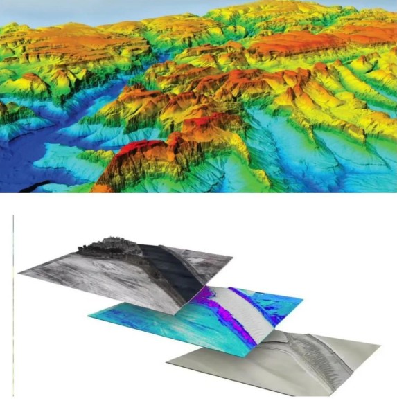
The LAS/LAZ format, as a standard for LiDAR point cloud data storage, is widely applied across multiple core domains of geographic information systems. In topographic mapping, it is used to generate high-precision Digital Elevation Models (DEM) and Digital Surface Models (DSM). For urban planning, it supports 3D city modeling and infrastructure management. In forestry resource surveys, it enables analysis of forest structure, biomass estimation, and ecological monitoring. Additionally, the format is utilized in disaster assessment (e.g., analyzing terrain changes after floods or earthquakes), cultural heritage preservation (e.g., 3D scanning and digital archiving of historical buildings), and autonomous driving for obstacle detection and high-definition map construction. Its standardization and extensibility make it a vital tool for cross-industry data exchange.
Example
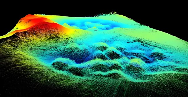
- LAS/LAZ point cloud data rendering.
File Opening Mode
- LiDAR point cloud, 3D terrain modeling.