
 Service


DIMAP (DIMAP (Metadata format for SPOT / Pleiades remote sensing imagery))
DIMAP stands for Digital Image Map. It is an open remote sensing image distribution data format specification jointly introduced by the French company Spot Image, Satellus, and the French Space Agency CNES. The early version 1.1 was primarily used for SPOT 5 satellite data distribution. Subsequently, the iterated DIMAP v2 version was adapted for high-resolution satellites such as Pléiades. It can integrate GeoTIFF or JPEG2000 image files and comes with rich metadata including satellite orbit information, imaging parameters, Rational Polynomial Coefficients (RPC), and coordinate systems. It supports high-precision image geometric correction with few ground control points and can be directly read and parsed in mainstream remote sensing processing software such as ENVI and GDAL, greatly reducing the operational threshold for remote sensing image geometric processing.
2026-09-24 16:08:53
SAFE (Sentinel Satellite Data Format)
SAFE (Sentinel Satellite Data Format) is a European standard archive format specifically designed by the European Space Agency (ESA) for the Sentinel series of satellites. It is essentially a directory folder encapsulating complete remote sensing data. It uses the XML-format manifest.safe as its core metadata entry point and internally integrates binary image data, preview images, KML geographic overlay layers, and various other file types. It offers excellent extensibility and can uniformly carry satellite products across the entire Sentinel series at different levels and in different modes. It is the universal standard format for ESA's Earth observation data archiving and distribution.
2026-09-24 16:01:01
ERS / ERMapper Raster
ERMapper Raster (abbreviated as ERS) is a proprietary raster data format of the ER Mapper remote sensing software under Hexagon Geospatial. It consists of a text-format .ers header file (storing image attributes, metadata, and georeferencing information) and a raw image data file with no extension. It supports multi-band storage, can carry various raster data types such as photographic imagery and terrain elevation, automatically includes coordinate system information, and accommodates multiple numeric data types including 8-bit, 16-bit, and 32-bit. It is widely used in GIS-related fields such as remote sensing and surveying.
2026-08-27 19:09:09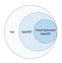
COG (Cloud Optimized GeoTIFF)
COG (Cloud Optimized GeoTIFF) is an official OGC standard officially released in July 2023. It is optimized based on the traditional GeoTIFF format. Through a special file organization method featuring built-in tiles and multi-scale overviews, it enables clients to use HTTP range requests to on-demand retrieve the required local image content without downloading the entire large raster file. It is fully compatible with conventional GIS software while significantly improving the online streaming loading, visualization, and processing efficiency of geographic raster data such as remote sensing imagery and DEMs in cloud environments. It has now been widely adopted in geoscience data distribution scenarios by organizations such as NASA.
2026-08-27 18:57:43
Zarr
Zarr is a chunked, compressed N-dimensional array storage format designed for cloud-native workflows and high-performance computing. It splits large multidimensional scientific datasets, such as meteorological, remote sensing, and genomic data, into small independent chunks that are stored separately. Zarr supports multiple compression algorithms, including zstd and Blosc, and can be stored directly on local file systems, in ZIP archives, or in cloud object storage such as AWS S3. It natively supports parallel read/write access and lazy loading. Compared with NetCDF and HDF5, Zarr is better suited to large-scale data collaboration and distributed processing in cloud environments, and it has become one of the main backend formats for scientific computing tools such as xarray and Dask.
2026-07-10 17:06:26
EPT (Entwine Point Tile)
EPT (Entwine Point Tile) is a hierarchical spatial indexing format for large point cloud datasets, developed as part of the Entwine ecosystem. It organizes point cloud data into a tiled, octree-based structure so that clients can stream, query, and visualize only the portions they need. EPT is widely used for web-based point cloud delivery and visualization, especially for LiDAR and other large 3D geospatial datasets. Its main advantage is efficient access to massive point clouds without requiring the entire dataset to be loaded at once.
2026-07-10 16:16:34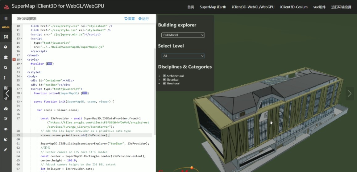
I3S / Scene Layer Package
I3S, which stands for Indexed 3D Scene Layer, is an open 3D geospatial data standard led by Esri and adopted by the OGC (Open Geospatial Consortium). Its accompanying format, the Scene Layer Package (SLPK), packages all scene layer resources into a single archive file. Built on modern web technologies such as JSON and REST, it is adapted to cloud, web, and mobile environments, supporting efficient streaming, storage, and visualization of large-scale heterogeneous 3D data. It is compatible with multiple types of 3D content including 3D objects, oblique photogrammetry, point clouds, and BIM. It is now widely supported by major GIS software such as ArcGIS and ContextCapture.
2026-06-24 17:03:50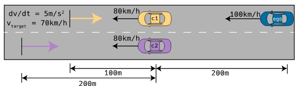
OpenSCENARIO (.xosc)
OpenSCENARIO (.xosc) is a standardized XML format maintained by the ASAM (Association for Standardization of Automation and Measuring Systems) organization, specifically designed for describing dynamic scenarios in traffic simulation. It focuses on the behavioral interactions of traffic participants such as vehicles and pedestrians, and can reference static road network files such as OpenDRIVE. Through a hierarchical storyboard structure, it defines event trigger conditions and action sequences, serving as the core universal standard for achieving scenario reusability and cross-tool interoperability in the field of autonomous driving virtual testing.
2026-06-24 16:59:34
OpenDRIVE (.xodr)
OpenDRIVE (.xodr) is an open standard file format used to describe static road networks in autonomous driving simulation. Based on the XML structure, it can precisely represent critical information such as road geometry, lane layout, and traffic signs. Maintained by the ASAM organization, it is primarily used in high‑definition maps and driving simulators, supporting data exchange between different simulation platforms and ensuring high realism and interoperability when testing and validating autonomous driving systems in virtual environments.
2026-05-25 13:46:15
SDTS (Spatial Data Transfer Standard)
SDTS (Spatial Data Transfer Standard) is a spatial data exchange standard developed in the United States, designed to enable lossless conversion of geographically referenced data between different computer systems. By defining a unified three‑layer model (conceptual, logical, and format), it ensures the integrity of vector and raster data during transmission and supports the simultaneous exchange of metadata. The standard was confirmed as a U.S. Federal Information Processing Standard (FIPS 173) in July 1992. Led by the U.S. Geological Survey (USGS), SDTS has been widely used for spatial data sharing among federal agencies, local governments, and commercial organizations.
2026-05-25 13:41:51