 Service

Oblique Mercator Projection
Jan 31,2026
GISBox is a one-stop 3D GIS data editing, conversion and publishing platform that supports editing in multiple GIS formats such as OSGB/GEOTIFF/RVT, converting to 3DTiles/Terrain and publishing.
Introduction
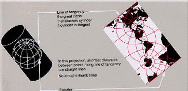
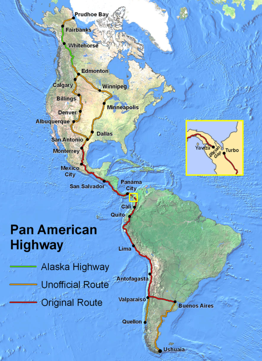
Oblique Mercator Projection differs from the standard Mercator and Transverse Mercator projections by orienting the axis of the projection cylinder obliquely relative to the Earth's rotational axis and equator. This projection is designed to minimize distortion along a specific straight line or great circle, making it well-suited for high-precision representation of regions that are elongated in a diagonal direction. Notable examples of its use include mapping the Alaska Highway, long-distance pipelines, and geological structures that extend diagonally.
Projection Basic
The Oblique Mercator Projection is a conformal (angle-preserving) projection based on the Mercator projection. Its most distinctive feature is the ability to rotate the central axis to any azimuth. The reference line is not the equator or a meridian, but rather a user-defined centerline—typically a great circle or geodesic aligned with the main axis of the target area. Along this centerline, scale distortion is minimized, while distortion increases with distance from it. Mathematically, it is defined based on ellipsoidal or spherical models and involves complex rotational transformations and coordinate calculations, requiring advanced geodetic computations for its implementation.
Pros
- High Suitability for Diagonal Regions: By aligning the projection axis with the elongated direction of a region, it can naturally represent diagonally extending geographic features and effectively suppress distortion in linear structures.
- Preservation of Conformality: As a derivative of the Mercator projection, it maintains angular accuracy, making it suitable for map representations and engineering applications that require local precision in direction and shape.
- Advantageous for Linear Infrastructure Representation: It can depict long-distance, directional infrastructure such as roads, railways, power lines, and pipelines with consistent accuracy.
- Flexible Design Capability: The centerline and azimuth can be arbitrarily set, allowing it to be used as a custom projection tailored to a specific region.
Cons
- Low Versatility: As it assumes a region extending in a specific direction, it is not well-suited for broad or irregularly shaped areas.
- Complex Calculation and Setup: With numerous projection parameters, incorrect definition of the centerline or azimuth may inadvertently increase distortion.
- Increased Distortion at Peripheries: Scale and area distortion become more pronounced with distance from the centerline, requiring careful consideration when setting the projection extent.
- Low Recognition in General Use: Compared to projections like UTM or Lambert Conformal Conic, its frequency of use is lower, and software support and practical examples are limited.
Application Scenario
The Oblique Mercator Projection is employed in situations requiring high-precision representation of geographically elongated features in diagonal directions. Representative examples include mapping diagonal transportation infrastructure like the Alaska Highway and analyzing regions where borders, geological structures, or river basins extend diagonally. It is also effective in specialized fields that prioritize directional and angular accuracy, such as the planning and management of long-distance pipelines and power grids, as well as in aeronautical charts and engineering survey maps, playing a crucial role as a high-precision projection tailored to specific regions.
Example
1. Conceptual diagram of the Oblique Mercator Projection.
2. The continents of North and South America depicted using the Oblique Mercator Projection.
Related GIS Projections
Vertical Near-side Perspective Projection
Two-point Equidistant Projection
References
https://en.wikipedia.org/wiki/Oblique_Mercator_projection
https://pro.arcgis.com/en/pro-app/latest/help/mapping/properties/hotine-oblique-mercator.htm