
 Service


Plate Carrée (Simple Equidistant Rectangular Projection)
Plate Carrée (Simple Equidistant Rectangular Projection) is one of the most basic cylindrical projections. It directly maps the Earth's longitude and latitude at equal intervals onto a planar rectangular coordinate system—that is, longitude linearly corresponds to the horizontal axis and latitude linearly corresponds to the vertical axis—forming a rectangular grid with a 2:1 aspect ratio. This projection is extremely simple to compute, but area and shape distortion are very severe at high latitudes. Historically, it was therefore mainly used for early world map production and, in modern times, for panoramic textures and raster geographic data storage.
2026-09-24 16:47:57
Transverse Cylindrical Equal Area Projection
Transverse Cylindrical Equal Area Projection is a type of map projection that uses a transversely oriented cylindrical surface as the projection surface, projecting the graticule of the Earth's ellipsoid onto the cylindrical surface under equal-area conditions and then unrolling it into a plane. Its cylinder axis is perpendicular to the Earth's axis of rotation, and the cylindrical surface is typically made tangent to a specific meridian of the Earth. This tangent central meridian appears as a straight line after projection and maintains equal-area, distortion-free characteristics. The Equator is a straight line perpendicular to the central meridian, and all other meridians and parallels are symmetrically distributed curves. This type of projection strictly ensures that the area ratio of regions before and after projection remains exactly consistent, producing no area distortion. It is often used in thematic mapping scenarios that require precise statistical analysis of regional areas.
2026-09-24 16:44:18
Lambert Azimuthal Equal Area (Modified)
Lambert Azimuthal Equal Area (Modified) is an equal-area azimuthal projection proposed by the German mathematician Johann Heinrich Lambert in 1772. Its core characteristic is maintaining a strictly proportional relationship between the area of any region on the map and the actual area on the Earth's surface. At the same time, shapes and angles are significantly distorted, with the effect becoming more pronounced in regions farther from the projection center. The term "Modified" does not refer to a separate projection type, but rather to parameter adjustments made to the standard spherical model in practical applications. For example, using the WGS84 ellipsoid instead of a sphere, setting the projection center to a specific region such as China or Europe, or using auxiliary sphere parameters to optimize regional area fidelity. This makes it suitable for national surveying, environmental statistics, and polar science mapping. At the projection center, there is no distortion and directions are accurate, with a circular boundary at the periphery. It is mainly used to display global or hemispheric-scale distribution data, such as species distribution, climate patterns, and geological structure analysis.
2026-09-24 16:36:52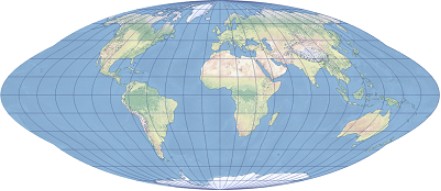
Goode Homolosine Projection
Goode Homolosine Projection, also known as the Goode Equal Area Projection, is an interrupted pseudo-cylindrical equal-area projection developed by John Paul Goode in 1925. It combines the Mollweide projection for regions outside 40°44′ north and south latitude with the sinusoidal projection for the equatorial region in between, reducing distortion over global landmasses or oceans as much as possible by interrupting portions of the meridians. It strictly maintains proportional area equivalence between the map and the ground. It is often used for small-scale thematic world maps that require precise area comparisons, but it cannot simultaneously preserve the continuity of both land and ocean and is not suitable for navigation purposes.
2026-08-27 19:58:22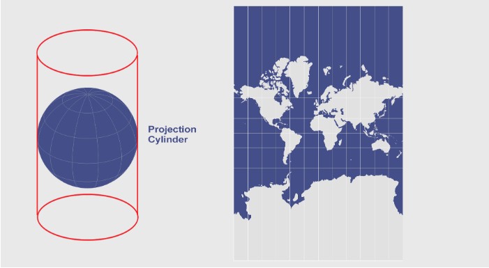
Mercator Equal Area Projection
Mercator Equal Area Projection, also known as the Cylindrical Equal Area Mercator Projection, is a normal-aspect equal-area cylindrical projection developed from the conventional conformal Mercator projection. It adjusts the latitudinal coordinate calculation formula so that the area ratio of any region on the map exactly matches that of the corresponding region on the Earth, completely eliminating the excessive area exaggeration at high latitudes found in the traditional Mercator projection. However, it also abandons the conformal property of the traditional Mercator, resulting in noticeable local angle, shape, and direction distortion, and it can no longer display rhumb lines as straight lines. Therefore, it is no longer suitable for marine navigation applications and is instead more often used in thematic cartography that requires accurate statistical representation of global area proportions.
2026-08-27 19:54:09
Cylindrical Equal Area Projection
Cylindrical Equal Area Projection, also commonly known as the Lambert Cylindrical Equal Area Projection, is a type of cylindrical projection that preserves area. It was proposed in 1772 by the Swiss mathematician Johann H. Lambert. This projection maps the Earth's meridians and parallels onto a cylindrical surface, which is then unrolled into a plane. Meridians appear as equally spaced, parallel vertical lines, while parallels are horizontal straight lines perpendicular to the meridians. The spacing between parallels decreases toward the poles, and the poles are projected as straight lines with the same length as the Equator. This projection strictly ensures that relative areas on the map are consistent with those on the ground, but shape and angle distortion increase significantly with latitude. It is more suitable for large-scale mapping near the Equator and is often used in scenarios requiring precise area comparisons, such as climate maps and population distribution maps.
2026-08-27 19:48:49

Globe Projection
Globe Projection is a display and projection technology that maps the Earth's surface or spherical information directly onto a three-dimensional globe model. Unlike traditional flat map projections, it uses a spherical screen or virtual globe to present panoramic, 360-degree imagery, providing better spatial continuity and immersion in all directions. This technology typically relies on multiple projectors working with edge blending and spherical correction algorithms to seamlessly stitch images onto spherical or dome-shaped screens. It is widely used in planetariums, science museums, exhibitions, and immersive educational environments, allowing audiences to feel as if they are inside the real Earth or outer space.
2026-07-29 10:50:43
Polar Stereographic (Elliptical) Projection
Polar Stereographic (Elliptical) Projection is a conformal projection centered on the poles, formed by orthographically projecting the Earth's surface from the pole onto a plane. The meridians appear as radiating straight lines, and the parallels appear as concentric circles (or circular arcs). By employing elliptical parameters, it more accurately matches the Earth's ellipsoidal shape, maintaining relatively low distortion in polar regions. It is commonly used for polar map production and navigation.
2026-06-18 14:05:38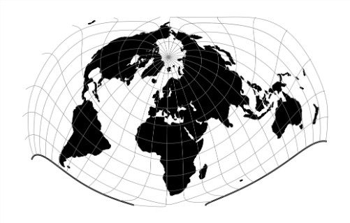
Bertin 1953 Projection
Bertin 1953 Projection is an equal-area world map projection designed by French cartographer Jacques Bertin in 1953. Its core objective is to accurately represent the relative areas of countries and regions worldwide, making it particularly suitable for visualizing socio-economic data. The projection achieves strict area proportionality by highly compressing polar regions and deforming the entire Earth's surface into an approximately elliptical shape, with both meridians and parallels appearing as smooth curves. Although it does not preserve shape (non-conformal) or distance (non-equidistant), it maintains strict equal-area properties, achieving good overall visual balance and regional comparability. It remains one of the important non-traditional projections in modern thematic cartography.
2026-06-18 14:01:46