Service

Esri ArcGIS Online
Nov 5,2025
GISBox is a one-stop 3D GIS data editing, conversion and publishing platform that supports editing in multiple GIS formats such as OSGB/GEOTIFF/RVT, converting to 3DTiles/Terrain and publishing.
Introduction
Esri ArcGIS Online is a cloud-based geographic information system (GIS) platform that allows users to create, edit, and share interactive maps and spatial data through a browser without installing specialized software. It supports multi-terminal access and team collaboration, and integrates authoritative global basemaps and analysis tools. It is suitable for governments, businesses, and educational institutions to quickly visualize and apply geographic information.
File Structure
The file structure of Esri ArcGIS Online primarily consists of the following:
- Users: Users in ArcGIS Online are a fundamental component of the platform; they create, manage, and share geographic content.
- Groups: Groups are a way to organize and manage projects in ArcGIS Online, facilitating collaboration and sharing across teams.
- Content: Content is the core component of ArcGIS Online and includes various geographic data, layers, web maps, web scenes, web tools, and web apps.
- Tags: In ArcGIS Online, users can add tags to content to make it easier to search and discover.
Pros
- Feature-Rich: Provides a wide range of geospatial analysis and mapping tools, enabling users to create, share, and analyze maps, access data from multiple sources, and leverage powerful analytical tools to process geographic information.
- Comprehensive Ecosystem: A rich selection of plug-ins and extensions meet the diverse needs of various industries and application scenarios.
- Convenient Data Management and Sharing: Users can easily bring data from multiple sources into ArcGIS Online for synchronization, enrichment, and adaptability.
- High Security and Reliability: Based on industry standards and defense-in-depth security mechanisms, ArcGIS Online provides every user with security controls at various levels, including application, network, and infrastructure. Adherence to strict security principles ensures data confidentiality, integrity, and availability.
Cons
- Steep learning curve: For novice users, ArcGIS Online can have a steep learning curve, requiring time and effort to master its complex functions and operations.
- High cost: The relatively high licensing fees can be a significant consideration for users on a limited budget.
- Insufficient localization: Compared to some localized GIS platforms, ArcGIS Online may lack localization capabilities. Some features and services specific to the domestic market may require secondary development to meet requirements.
- High server requirements: The server hardware requirements are high, which may increase operating costs, especially for enterprises with limited resources.
Application Scenario
ArcGIS Online, Esri's cloud-based geographic information platform, is primarily used for spatial data sharing and decision support within government departments, business site selection and logistics optimization for businesses, natural resource monitoring and analysis by environmental protection agencies, spatial teaching and research in education and scientific research, and real-time map query and emergency response coordination for public services. Its core value lies in enabling multi-terminal, cross-departmental geographic information collaboration and intelligent analysis through the web.
Example
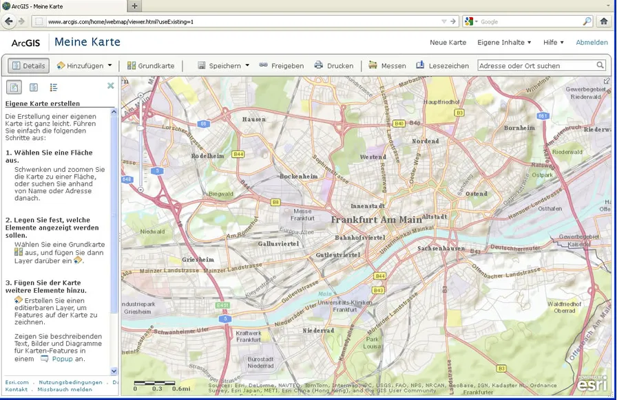
1. Legend editing for ArcGIS.
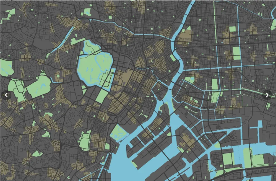
2. ArcGIS Online.