Service

Google Maps Platform
Nov 5,2025
GISBox is a one-stop 3D GIS data editing, conversion and publishing platform that supports editing in multiple GIS formats such as OSGB/GEOTIFF/RVT, converting to 3DTiles/Terrain and publishing.
Introduction
Google Maps Platform is one of the most widely used map services in the world, providing detailed map data, navigation, real-time traffic information, Street View imagery, and more. It is a cloud-based map service provided by Google, and through a wide range of APIs and SDKs, developers can integrate map display, route guidance, spot search, and other functions into their own applications. It is used in a wide range of industries, including logistics, retail, and mobility.
File Structure
The typical file structure for a development project utilizing the Google Maps Platform is as follows:
- src/: Directory containing the project's source code. Components include:
- Configuration files (e.g.,
map-config.js) containing API keys and other settings - React component files (e.g.,
Map.js,Marker.js) - Entry point (e.g.,
index.js) - Style files (e.g.,
styles.css) - public/: Stores public resources such as HTML templates (e.g.,
index.html) - package.json: Project management file containing dependency information, version details, build scripts, etc.
- README.md: Documentation file describing the project overview, installation instructions, basic usage, build procedures, etc.
Pros
- Global Coverage: The Google Maps Platform covers nearly every country and region worldwide, providing detailed road maps, satellite imagery, and terrain information. This makes it exceptionally valuable for travelers and explorers.
- Rich and Powerful Features: Equipped with real-time traffic updates, multiple display modes, robust search capabilities, and diverse navigation routing options, it meets a wide range of user needs.
- Easy and Efficient Integration: Its comprehensive APIs and SDKs enable seamless embedding in web and mobile applications. It also integrates smoothly with other Google services like Search, Assistant, Calendar, and Photos.
- Security and Compliance: The platform maintains high standards for data usage and regulatory compliance, ensuring secure service utilization.
Cons
- Data accuracy can be an issue: some location information and real-time GPS are inaccurate, and 3D satellite imagery technology is limited.
- User experience of some features is poor: for example, lane guides are incorrect or don't match actual exit signs, and "keep straight" is displayed repeatedly. The energy efficiency route feature has also been met with mixed reviews.
Application Scenario
Google Maps Platform is widely used in travel navigation, logistics delivery, location-based services, business analytics, and other fields. In addition to providing real-time route planning and traffic information to individual users, it also helps businesses optimize delivery routes and network layouts, and supports developers to integrate map services into various apps, such as taxi software, food delivery platforms, and travel apps. In addition, it also plays an important role in public works such as urban planning and disaster response, supporting decision-making through visualization of geographic data.
Example
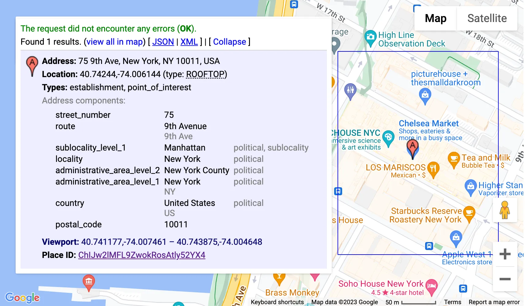
1. Introducing the Route Optimization API on Google Maps Platform.
_1763976157712.png)
2. Google's simulated 3D tiles.
File Opening Mode
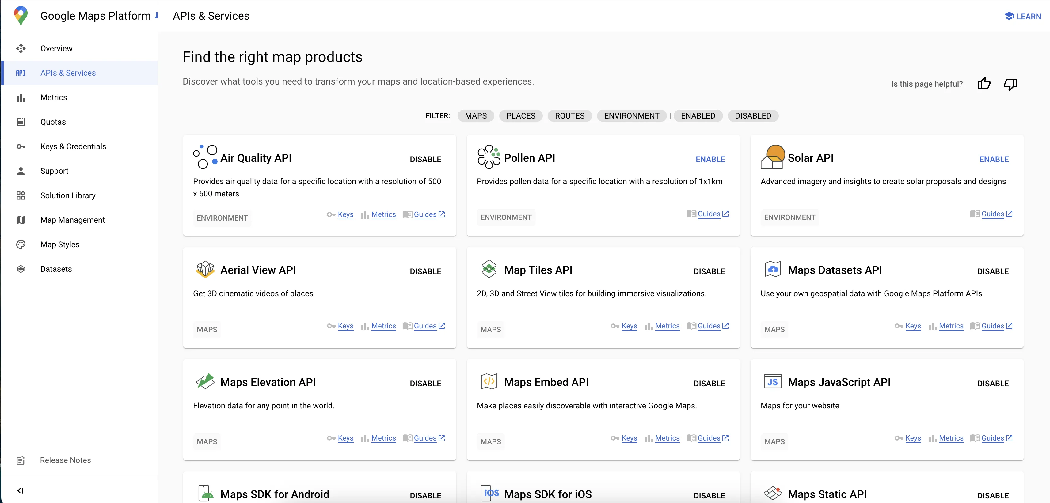
1. You can view reports and project configuration files from the Google Maps Platform dashboard.