 Service

CADRG (Compressed ARC Digitized Raster Graphics)
Dec 5,2025
GISBox is a one-stop 3D GIS data editing, conversion and publishing platform that supports editing in multiple GIS formats such as OSGB/GEOTIFF/RVT, converting to 3DTiles/Terrain and publishing.
Introduction
CADRG (Compressed ARC Digitized Raster Graphics) is an abbreviation for "Compressed ARC Digitized Raster Graphics," primarily used for storing and transmitting raster images in geospatial data. It is commonly employed in military and surveying fields. This format optimizes data storage efficiency through compression technology and supports high-precision digital representation of geographic information, typically requiring professional software for import and processing. In GIS applications, CADRG format often needs to be converted to a file geodatabase raster to improve subsequent analysis efficiency.

File Structure
The file structure of CADRG (Compressed ARC Digitized Raster Graphics) mainly includes the following components:
- File Header Structure: Contains basic identification information of the file, such as file type, version number, and other metadata, used to define the overall properties and encoding standards of the file.
- Data Area Structure: Stores compressed raster image data, generated by scanning source documents. It uses the Equal Arc-Second Raster Chart (ARC) system for geographic registration, dividing the Earth into 18 latitude bands to achieve spatial positioning.
- Index Area Structure: Records the storage location and length information of data blocks, supporting random access and efficient reading. It typically includes key metadata such as offset addresses and page counts.
- Metadata Structure: Contains geographic registration parameters, coordinate system information, data source descriptions, etc., ensuring the correct parsing and use of raster data in GIS applications.
Pros
- High Compression Rate and Storage Efficiency: CADRG uses a dedicated compression algorithm, significantly reducing the storage space required for raster images. This makes it suitable for the transmission and archiving of large-scale geospatial data.
- Standardized Geographic Registration: Based on NGA's Equal Arc-Second Raster Chart system, the Earth is divided into 18 latitude bands, ensuring precise geographic reference information for each image.
- Adaptability to Professional Fields: Optimized for military and surveying fields, CADRG supports high-precision geographic information representation. In software like ENVI, its output color quantization effects are improved, making it suitable for applications requiring strict color management, such as terrain shading or contour generation.
- Completeness of Metadata: Includes comprehensive metadata (such as coordinate system, projection parameters, data sources, etc.), supporting rapid retrieval and spatial analysis.
Cons
- Technical Closedness and Compatibility Limitations: The compression algorithm is not publicly disclosed, making it difficult for non-specialized software (e.g., general GIS tools) to directly parse the data.
- High Processing Complexity: CADRG places high demands on hardware resources, especially when processing large-scale or high-resolution data, often requiring high-performance computers.
- Challenges in Statistical Calculation and Dynamic Updates: In ArcGIS, it is recommended to avoid calculating statistics or building pyramids for CADRG source data, as this may affect display performance. Additionally, data updates require regeneration through professional tools, making it less convenient than vector formats (e.g., Shapefile).
- Limitations in Applicable Scenarios: CADRG is primarily designed for static geographic data storage and is not suitable for scenarios requiring frequent editing or dynamic updates.
Application Scenario
CADRG (Compressed ARC Digitized Raster Graphics) is mainly used in military surveying and geographic information system (GIS) fields, supporting the storage and transmission of high-resolution image maps on a global scale and providing precise geographic reference information for military operations. Meanwhile, in GIS software such as ArcGIS, CADRG serves as a professional raster data format for building base maps, supporting multi-source data integration, and spatial analysis. It meets the demand for efficient geospatial information processing in scenarios such as military planning and operational command.
Example
1. Vector and raster file cropping.

File Opening Mode
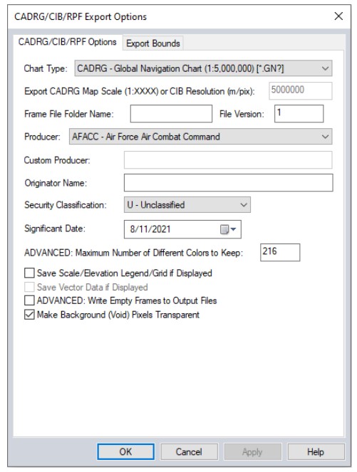
1. CADRG/CIB export options dialog box, allowing users to configure export settings.
Related GIS files
References
- https://www.bluemarblegeo.com/knowledgebase/global-mapper/Formats/CADRG_CIB_RPF.htm
- https://pt.filedesc.com/file/cadrg
- https://www.arcgis.com/home/item.html?id=cae102a1a9434233a3791b3198e10b1c