 Service

Natural Earth Projection
Jan 31,2026
GISBox is a one-stop 3D GIS data editing, conversion and publishing platform that supports editing in multiple GIS formats such as OSGB/GEOTIFF/RVT, converting to 3DTiles/Terrain and publishing.
Introduction
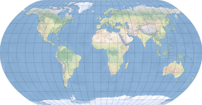
Natural Earth Projection is a pseudocylindrical world map projection proposed in 2009 by Tom Patterson and Bo Jenny. Designed to prioritize visual naturalness and overall balance, it is characterized by its ability to depict a harmonious global image without excessively distorting the shapes of landmasses and oceans. As a compromise projection that does not strictly adhere to equal-area, conformal, or equidistant properties, it is widely adopted for applications that value clarity and aesthetics, such as statistical maps, educational maps, printed materials, and web maps.
Projection Basic
The Kavrayskiy VII projection is a pseudocylindrical projection, representing the central meridian as a straight line and arranging parallels as horizontal straight lines. Meridians are drawn as curves, spaced almost equally near the equator and gradually narrowing toward higher latitudes. The projection formula is relatively simple, designed to suppress longitudinal stretching while forming a smooth overall shape. As a result, the world appears as a horizontally elongated, near-elliptical shape, avoiding excessive expansion of the polar regions.
Pros
- Well-Balanced Global Representation: The visual proportions of continents, their shapes, and the expanse of oceans appear natural, minimizing discomfort when viewing the world as a single map.
- Suppressed Distortion at High Latitudes: Unlike projections like Mercator, it avoids extreme expansion at high latitudes, representing regions such as Greenland and Antarctica with a more realistic impression.
- Compatibility with Visual Design: It harmonizes well with map design and infographics, making it less likely to interfere with information when used as a base map or thematic map.
- Optimized for World Map Use: It is specifically designed for purposes that require a global, panoramic understanding rather than precise local surveying.
Cons
- Unsuitable for Strict Surveying Applications: Since it does not strictly satisfy equal-area, conformal, or equidistant properties, it is not appropriate for quantitative analyses such as distance measurement or area comparison.
- Lack of Guaranteed Local Accuracy: Distortion levels vary by region, making it unsuitable for applications requiring detailed treatment of specific areas.
- Non-Standard as a Geodetic Reference: Unlike geographic coordinate systems in EPSG or national geodetic standards, it is not adopted as a reference coordinate system for geospatial analysis.
- Implementation Dependency in Projection Transformation: Primarily used for visualization purposes, its rendering quality and accuracy may vary across GIS software implementations.
Application Scenario
The Natural Earth Projection excels in situations that require an intuitive and panoramic representation of the entire world. It is widely used in educational geography materials, world distribution maps overlaid with statistical data, reports addressing international relations or environmental issues, and background maps for websites or printed materials. Its greatest value lies in providing a visually stress-free representation of the Earth in contexts where "ease of understanding" and "natural appearance" are prioritized over precise measurement.
Example
1. A map projection using the Natural Earth Projection centered on Greenwich.
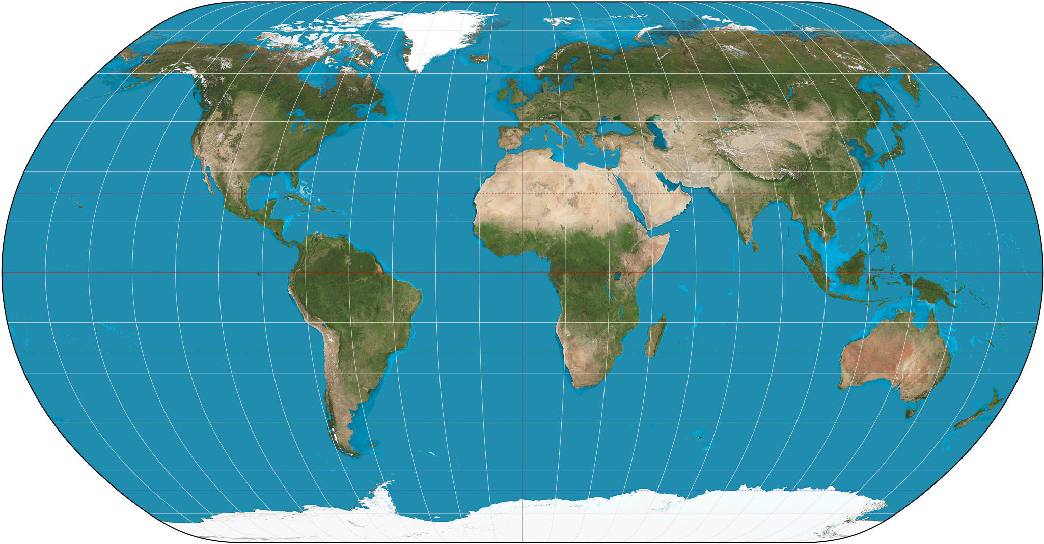
2. A natural global Earth projection.
Related GIS Projections
Vertical Near-side Perspective Projection
Two-point Equidistant Projection