 Service

Chamberlin Trimetric Projection
Dec 29,2025
GISBox is a one-stop 3D GIS data editing, conversion and publishing platform that supports editing in multiple GIS formats such as OSGB/GEOTIFF/RVT, converting to 3DTiles/Terrain and publishing.
Introduction
Chamberlin Trimetric Projection is a map projection method devised by William Chamberlin in the early 20th century. This projection is characterized by its accurate preservation of distances from any three arbitrarily chosen points on the Earth's surface. It is classified as a "compromise projection," as it does not fully belong to any of the conformal, equal-area, or equidistant categories. It excels in representing regions centered around specific reference points and has been used for experimental and academic purposes to intuitively understand geographical relationships.
Projection Basic
Chamberlin Trimetric Projection is not a format with files or data structures but is instead defined by mathematical and geometric principles. Its fundamental components are based on the following concepts:
- Three Reference Points (Control Points): Three arbitrarily selected locations on the Earth's surface, from which distances are accurately reproduced on the map.
- Distance Preservation Condition: The geodesic distances from any location to the three reference points are depicted as the same distances on the plane.
- Geometric Configuration: Each location is defined as the intersection of three distance circles (circles centered on the reference points), arranged based on triangulation principles.
- Locally Optimized Distortion Distribution: Distortions in shape and distance are relatively minimal near the projection center but increase as the distance from the reference points grows.
Pros
- Accurate Distance Preservation from Multiple Reference Points: Distances from three points are simultaneously and accurately represented, making it suitable for map expressions that emphasize spatial relationships between specific locations.
- Flexible Projection Design: Reference points can be arbitrarily chosen, allowing customization for specific regions or research subjects.
- Intuitive Understanding of Geographical Relationships: Near the center, shape distortion is minimal, making it easier to visually grasp the relative positional relationships between locations.
- High Theoretical and Educational Value: Serves as a teaching tool for understanding the trade-offs between distance preservation and projection distortion, aiding in the comprehension of map projection methods.
Cons
- Unsuitable for Global Maps: Due to uneven distortion distribution, it is not ideal for creating maps of large areas or the entire world.
- Not Standardized: Lacks international standard definitions such as EPSG codes and is often not natively supported by mainstream GIS software.
- Relatively Complex Calculations: Implementation and computational processes are more cumbersome compared to other common projection methods, as they rely on three-point distance criteria.
- Limited Practical Use: Rarely used in practical fields such as aviation, surveying, or web mapping, resulting in restricted applications.
Application Scenario
Chamberlin Trimetric Projection is primarily utilized for academic research and educational purposes. It is well-suited for regional analyses centered around specific three points and geographical visualizations that prioritize distance relationships. It is often used as an example for comparing the characteristics of map projections or validating theoretical concepts. Additionally, it holds value in the study of historical projection methods and as a resource to demonstrate the diversity of map expressions. Its significance lies more in conceptual and educational contexts within the fields of geography and cartography rather than in practical GIS applications.
Example
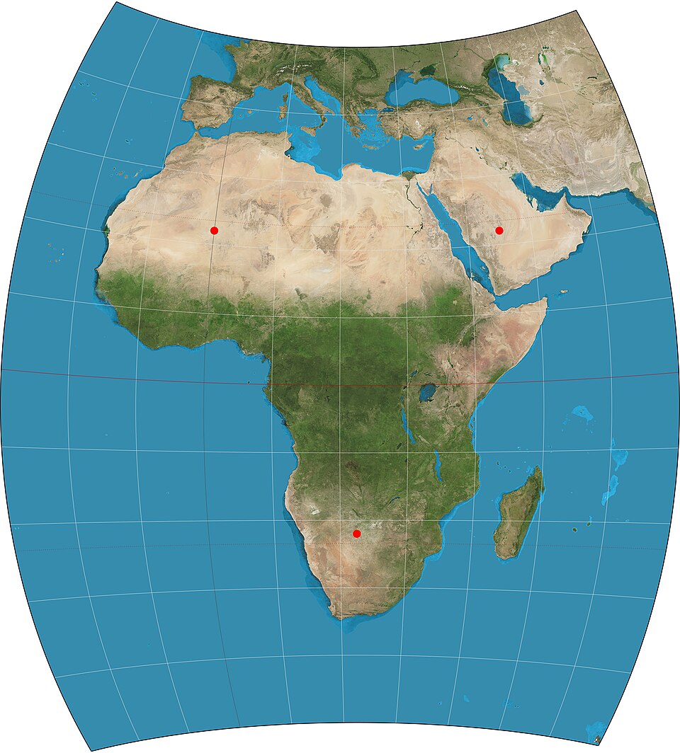
1. Map of Africa using the Chamberlin Trimetric Projection.
Related GIS Projections
Vertical Near-side Perspective Projection
Two-point Equidistant Projection