 Service

Bonne Projection
Nov 5,2025
GISBox is a one-stop 3D GIS data editing, conversion and publishing platform that supports editing in multiple GIS formats such as OSGB/GEOTIFF/RVT, converting to 3DTiles/Terrain and publishing.
Introduction
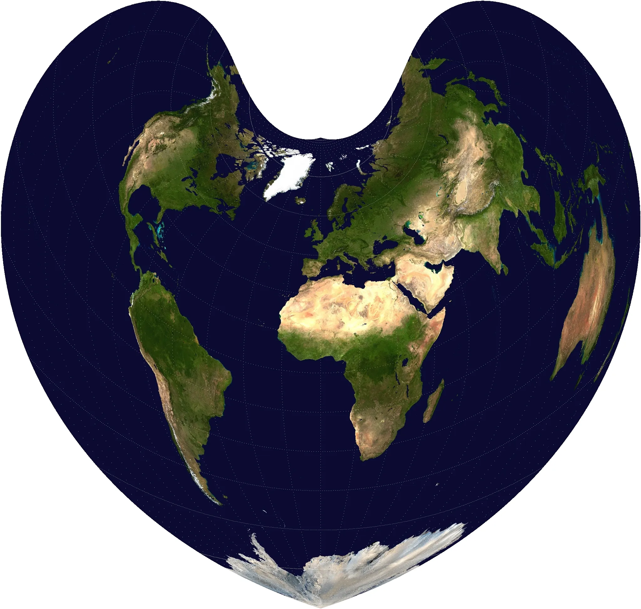
Bonne Projection is a type of pseudo-conic projection in which all parallels are represented as concentric circular arcs, and meridians are drawn radiating from a central parallel. It was once widely used in the fields of geography and surveying because it minimizes distortion of area and shape at specific reference parallels (standard parallels). A distinctive feature of this projection is that the resulting map appears as a large heart, and it has historically been used for producing maps of countries and continents, particularly those of Europe.
Projection Basic
The Bonne Projection, as a representative example of pseudo-conic projections, has the following characteristics:
- Parallels as concentric arcs: All parallels of latitude are depicted as circular arcs centered around a reference latitude, maintaining even spacing.
- Meridians as radiating lines: Meridians spread out radially from the reference latitude, converging near the poles.
- Minimized area distortion: Around the reference latitude, both area and shape distortions are minimal, offering high local accuracy.
- Customizable for specific regions: By adjusting the reference latitude, the projection can optimize display accuracy for any chosen latitude band.
Pros
- There is minimal distortion of shape and area around the reference latitude.
- It is well-suited for depicting mid-latitude regions, offering high map accuracy.
- The structure of parallels and meridians is easy to understand, making it user-friendly for geodetic work and route planning.
- It is also suitable for historical and decorative mapmaking, featuring a visually distinctive appearance.
Cons
- Distortion increases rapidly as the distance from the reference latitude grows.
- Shapes are prone to distortion near the polar regions and the equator.
- It has limited versatility for modern global mapping applications and is gradually being replaced by other projection methods.
- The projection formulas are somewhat complex, making calculations and comprehension challenging for beginners in some cases.
Application Scenario
The Bonne projection is suitable for creating maps centered on a specific latitude band (especially mid-latitude regions), and historically was widely used for French and German national maps, continental geographical data, and academic research maps. Its unique heart-shaped appearance also makes it popular for decorative maps, exhibition graphics, and educational materials. While its practical use has declined in modern times, it remains valuable for regional maps and historical reconstruction projects.
Example
1. Bonne projection of the Earth (standard parallel is 45 degrees north).
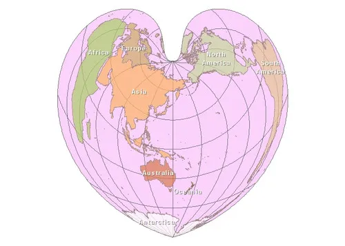
2. Bonne projection example.
Related GIS Projections
Transverse Mercator Projection
Longitude / Latitude Projection