 Service

TM35FIN (Finnish Transverse Mercator coordinate system – EPSG:3067)
Nov 5,2025
GISBox is a one-stop 3D GIS data editing, conversion and publishing platform that supports editing in multiple GIS formats such as OSGB/GEOTIFF/RVT, converting to 3DTiles/Terrain and publishing.
Introduction
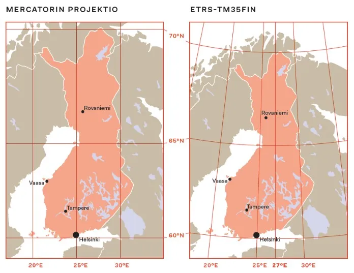
TM35FIN is a two-dimensional rectangular coordinate system widely used in Finland. An extension of ETRS89/UTM 35N, it adopts the Transverse Mercator projection with a central meridian of 27°E. TM35FIN is measured in meters and covers the entire territory of Finland and the surrounding sea areas. Designed for engineering surveying and topographic mapping, it offers high accuracy and regional adaptability.
Coordinate System Composition
- Datum Ellipsoid and Geoid: The GRS 1980 ellipsoid is used, with a semi-major axis of 6,378,137 meters and an oblateness of 1/298.257222101. It is referenced to the Finnish National Geoid and corrected using gravity measurements and GPS data.
- Projection and Parameters: Transverse Mercator (UTM), central meridian 27°.
- Coordinate Axes and Directions: Easting (E) and Northing (N) are positive, measured in meters, suitable for high-precision measurements.
- Technical Standards and Specifications: EPSG code 3067, maintained by the Finnish Land Survey, ensures synchronization of parameters with the national datum network.
Pros
- High Accuracy and Regional Compatibility: The TM35FIN utilizes the GRS 1980 ellipsoid and the Finnish National Geoid. Through local parameter optimization, it ensures measurement accuracy throughout Finland, including high-latitude areas, making it particularly suitable for engineering stakeout and topographic mapping.
- Compatible with Global Coordinate Systems: As an extension of ETRS89/UTM 35N, the TM35FIN aligns closely with the WGS84 ellipsoid, facilitating seamless integration with GPS data and international Geographic Information Systems (GIS).
- Simplified Engineering Applications: The Transverse Mercator (UTM) projection and fixed false easting (500,000 meters) eliminate negative coordinate values, simplifying coordinate calculations and drawing annotations for engineering projects within Finland.
Cons
- Limited Coverage: Designed specifically for Finland, data beyond Finnish territory (e.g., in neighboring countries or maritime areas) requires conversion to other coordinate systems (e.g., ETRS89/UTM 35N), increasing data exchange complexity.
- High-Latitude Projection Distortion: Although the central meridian is set at 27°E, slight distance and area distortions still occur in northern Finland (near the Arctic Circle), requiring additional corrections during precision measurements.
- High Technical Requirements: Requires specialized software that supports coordinate conversion (e.g., EPSG code 3067), which may increase the learning curve for users outside the surveying and mapping field.
Application Scenario
TM35FIN is a widely used 2D rectangular coordinate system in Finland, primarily used for engineering surveying, topographic mapping, and geographic information system (GIS) data integration. Its high accuracy and regional adaptability make it ideal for infrastructure projects within Finland, such as buildings, roads, and bridges. It is also suitable for map production at scales from 1:500 to 1:500,000. This coordinate system is compatible with ETRS89/UTM 35N, facilitating international data exchange. However, its coverage is limited, and coordinate conversion is required beyond Finnish territory.
Example
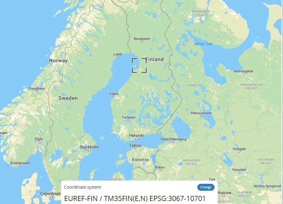
1. Finnish Transverse Mercator coordinate system – EPSG:3067.
2. The central meridian of ETRS-TM35FIN is 27° East longitude.
Related GIS Coordinate Systems
References
- https://epsg.io/3067
- https://spatialreference.org/ref/epsg/3067/
- https://dev.solita.fi/2017/12/12/gis-coordinate-systems.html