 Service

McBryde–Thomas Flat-Polar Sinusoidal Projection
Jan 27,2026
GISBox is a one-stop 3D GIS data editing, conversion and publishing platform that supports editing in multiple GIS formats such as OSGB/GEOTIFF/RVT, converting to 3DTiles/Terrain and publishing.
Introduction
McBryde–Thomas Flat‑Polar Sinusoidal Projection is a compromise world map projection designed by American cartographers F. Webster McBryde and Paul D. Thomas in the mid‑20th century. It aims to balance area distortion, shape preservation, and visual readability. This projection adopts a flat‑pole design in polar regions to reduce high‑latitude stretching and incorporates sinusoidal meridian distribution to improve shape accuracy in mid‑to‑low latitudes. It is suitable for global‑scale thematic mapping and educational communication purposes.
Projection Basic
The McBryde–Thomas Flat‑Polar Sinusoidal Projection is constructed based on the following geometric and mathematical principles:
- Projection Type: Compromise pseudocylindrical projection
- Pole Treatment: Poles are represented as horizontal line segments (flat poles), effectively controlling area inflation in high‑latitude regions
- Meridian Shape: The central meridian is a straight line, while other meridians are symmetric sinusoidal curves with spacing adjusted according to latitude
- Parallel Shape: Parallels are equally spaced straight lines, maintaining orthogonality and visual regularity
- Mathematical Model: Meridian curvature is adjusted using a sine function, with meridian spacing scaled proportionally to cos(φ/√2) at latitude φ
- Applicable Range: Global‑scale maps, with particular emphasis on balancing shape and area in mid‑latitude regions
Pros
- Controlled Distortion in Polar Regions: The flat‑pole design avoids extreme stretching in polar areas typical of traditional sinusoidal projections, improving visual perception at high latitudes
- High Shape Fidelity in Mid‑Latitudes: Sinusoidal meridians provide near‑true shape representation in mid‑to‑low latitude regions
- Balance Between Area and Angle Distortion: Achieves an optimal balance between overall area error and local angular distortion, outperforming purely equal‑area or conformal projections
- Visually Continuous and Harmonious: Smooth meridian curves and parallel parallels create a harmonious map layout, suitable for public display and publishing
- High Computational Efficiency: Simple analytical formulas facilitate digital cartography and interactive map generation
Cons
- Neither Strictly Equal‑Area nor Conformal: Cannot meet the requirements of professional analysis scenarios that demand precise area comparison or angle preservation
- Significant Distortion at Map Edges: Pronounced shape stretching occurs at the eastern and western edges of the map, especially in mid‑to‑high latitudes
- Cognitive Barrier for Non‑Experts: Flat poles and curved meridians may hinder non‑specialist readers' understanding of polar geographical relationships
- Limited Standardized Support: Most mainstream GIS software requires custom coordinate systems or plugins to implement this projection
- Unsuitable for Large‑Scale Mapping: The global‑scale design leads to considerable directional and distance errors at local scales
Application Scenario
The McBryde–Thomas Flat‑Polar Sinusoidal Projection is primarily used for public communication and educational display of global thematic maps, especially in contexts that require balancing visual appeal with geographical accuracy. For example: UNESCO could use this projection to create world heritage site distribution maps; climate agencies could employ it to illustrate global temperature zones or ocean current patterns; and educational publishers often adopt this projection for world political maps in primary and secondary school geography textbooks. Additionally, this projection holds potential for interactive digital media maps, as its smooth curves and regular grid are well‑suited for dynamic zooming and information overlay, providing the public with an intuitive and harmonious framework for global spatial cognition.
Example
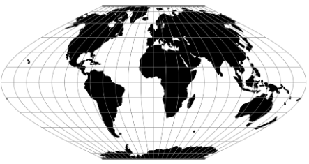
1. The McBryde-Thomas flat-polar quartic projection is shown centered on Greenwich.
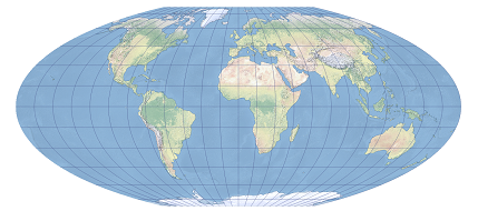
2. McBryde-Thomas Flat-Polar Sinusoidal.
Related GIS Projections
Vertical Near-side Perspective Projection
Two-point Equidistant Projection