 Service

MGRS
Nov 5,2025
GISBox is a one-stop 3D GIS data editing, conversion and publishing platform that supports editing in multiple GIS formats such as OSGB/GEOTIFF/RVT, converting to 3DTiles/Terrain and publishing.
Introduction
MGRS coordinate system, also known as the Military Grid Reference System, is a standard coordinate system used by NATO military organizations. It is based on the Universal Transverse Mercator (UTM) system and further divides each UTM area into small squares of 100km x 100km. These blocks are identified by two connected letters, with the first letter representing the east-west position of the longitude zone and the second letter representing the north-south position.
Coordinate System Composition
1. Basic framework: MGRS is based on the UTM (Universal Transverse Mercator) projection system, dividing the Earth's surface into 60 longitude zones and 20 latitude zones, with each UTM area further divided into 100 kilometer square grids.
2. Encoding structure: MGRS coordinates consist of three parts: UTM area number, 100 kilometer grid identification, and eastbound and northbound values.
3. Accuracy grading: MGRS supports multi-level accuracy, with character length determining the positioning range: 15 characters correspond to meter level accuracy, 11 characters correspond to 10 meter level accuracy, 9 characters correspond to 100 meter level accuracy, and 7 characters correspond to kilometer level accuracy.
Pros
1. High precision and grading flexibility: MGRS is based on the UTM system and can achieve meter level positioning through 15 character encoding. It also supports 13/11/9/7 character grading to meet the accuracy requirements of different scenarios.
2. Fast transmission and usability: The combination of letters and numbers is shorter than latitude and longitude, making it easier for rapid verbal or wireless transmission on the battlefield. The 100km x 100km grid division can effectively control positioning errors within a hundred meters.
3. Military and civilian compatibility: In addition to military use, MGRS is adopted by the United States National Grid (USGS) and Florida Fire Protection System, seamlessly compatible with UTM maps, and suitable for emergency communication and disaster management.
Cons
1. Dependent on UTM projection limitations: MGRS needs to convert latitude and longitude through UTM projection, and polar regions (such as the North Pole) need to switch to the UPS system, which may result in complexity and error accumulation in coordinate conversion.
2. Character length and memory burden: High precision (such as 15 characters) coordinate strings are long and prone to errors during manual recording or verbal transmission, requiring electronic device assistance for parsing.
3. The fixity of regional division: A 100km grid may cover a large area in densely populated areas, while remote areas may be overly subdivided, resulting in efficiency differences in practical applications.
Application Scenario
The MGRS coordinate system is mainly used in the military field for rapid and accurate positioning of battlefield targets, facilitating tactical command and fire support. In addition, it is also adopted in civilian fields such as emergency communication, disaster management, and logistics transportation, especially in scenarios that require rapid positioning. MGRS is also used for remote sensing image segmentation, such as spatial partitioning of Sentinel-2 satellite data, to facilitate data management and retrieval.
Example
1. MGRS grid area identification code.

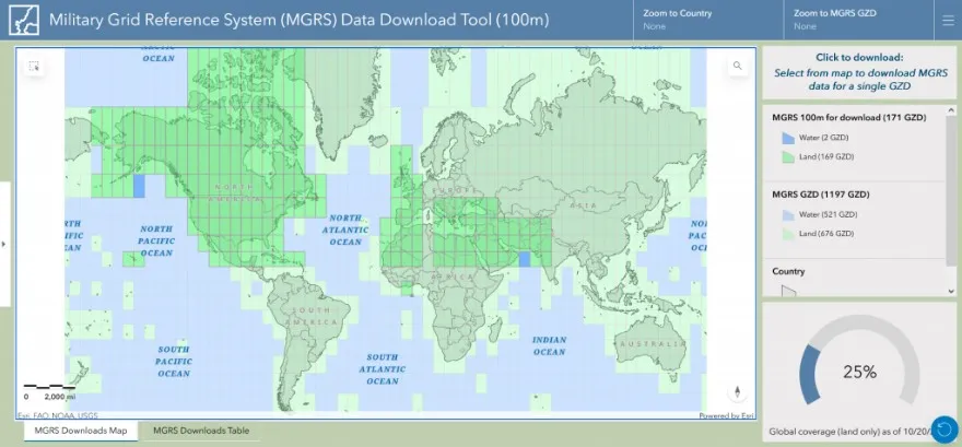
2. Application data of MGRS.
Related GIS Coordinate Systems
References
- https://blog.csdn.net/kupepoem/article/details/139697424
- https://mgrs-data.org/data-downloads/
- https://www.wikiwand.com/zh-cn/articles/%E5%86%9B%E4%BA%8B%E7%BD%91%E6%A0%BC%E7%B3%BB%E7%BB%9F