 Service

Patterson Cylindrical Projection
Jan 31,2026
GISBox is a one-stop 3D GIS data editing, conversion and publishing platform that supports editing in multiple GIS formats such as OSGB/GEOTIFF/RVT, converting to 3DTiles/Terrain and publishing.
Introduction
Patterson Cylindrical Projection is a pseudocylindrical projection proposed in 2014 by Tom Patterson, a cartographic editor at the National Geographic Society. Designed to emphasize visual balance, it aims to mitigate the excessive polar distortion seen in projections like Mercator and the vertical distortion characteristic of sinusoidal projections. As a result, it can depict the entire world with a gentle and natural impression. Although not an equal-area or conformal projection, it evenly distributes distortions in area, shape, and distance, making it suitable for modern world map representations.
Projection Basic
The Patterson Cylindrical Projection is a cylindrical projection with the equator as its standard parallel. Meridians are represented as equally spaced straight lines, while parallels are arranged as non-linear straight lines. Its mathematical formula is not a simple linear function but is designed to gradually vary the scale from low to high latitudes, gently suppressing expansion near the polar regions. This structure allows the entire Earth to fit within a rectangular frame while maintaining visual stability.
Pros
- Excellent Visual Balance: By minimizing polar exaggeration while keeping distortion near the equator low, it provides an intuitive and balanced representation of the entire world.
- Well-Suited to Modern World Maps: It delivers a world image with minimal visual discomfort for political maps, general-purpose educational materials, and infographics.
- Compatibility with Rectangular Layouts: As a cylindrical projection, it is easily adaptable to rectangular canvases for web maps or printed materials.
- Effective Alternative to Mercator: In contexts not requiring navigation, it offers a more equitable representation of the Earth compared to the Mercator projection, which exhibits extreme area distortion.
Cons
- Not Equal-Area or Conformal: It does not strictly preserve area, angles, or distance, making it unsuitable for quantitative spatial analysis or surveying purposes.
- Shape Distortion at High Latitudes: Compression of shapes occurs near the polar regions, limiting accurate representation of Greenland and Antarctica.
- Unsuitable for Academic or Engineering Use: Due to its aesthetic focus, it is rarely used as a foundational projection for GIS analysis or scientific computations.
Application Scenario
The Patterson Cylindrical Projection is primarily suitable for map representations that provide an overview of the entire world. It is effectively used in contexts that demand visual clarity and a neutral impression, such as educational maps, media publications, political maps illustrating international relations, and background maps for websites or presentations. Additionally, as a projection aligned with modern cartographic trends that avoid extreme distortion, it is gaining attention for map production that prioritizes design and readability.
Example
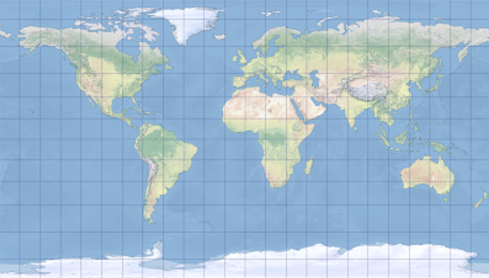
1. A map projection using the Patterson Cylindrical Projection centered on Greenwich.
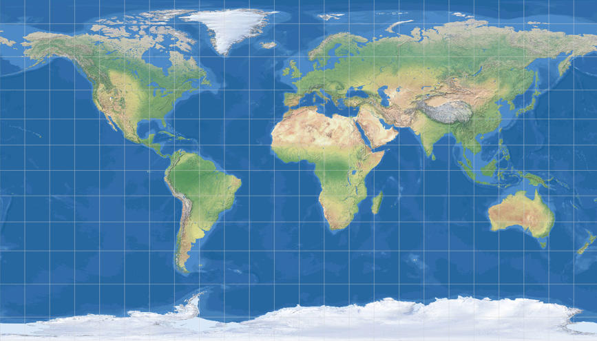
2. The Patterson Cylindrical Projection.
Related GIS Projections
Vertical Near-side Perspective Projection
Two-point Equidistant Projection