Service

JPGIS (Japanese Geographic Information Standard)
Oct 31,2025
GISBox is a one-stop 3D GIS data editing, conversion and publishing platform that supports editing in multiple GIS formats such as OSGB/GEOTIFF/RVT, converting to 3DTiles/Terrain and publishing.
Introduction
JPGIS (Japan Geographic Information Standard) is a geographic information standardization system developed by the Geographical Survey Institute of Japan. It aims to enable digital sharing and circulation of geographic data nationwide. Based on 1:25,000 scale topographic map vector data, the standard uses the UTM projection as the spatial reference framework and is compatible with the Lambert projection for small and medium-scale data.

File Structure
- Basic metadata layer: Contains basic attributes such as dataset identification information, coordinate system definitions (such as the Japanese Plane Coordinate System or WGS84), timestamps, and copyright notices. It is typically stored in XML or JSON format.
- Spatial data storage layer: Vector data uses points, lines, and polygons as basic units, supporting Shapefile or GeoJSON formats and is compatible with standard map data from the Geographical Survey Institute of Japan. Raster data is stored in blocks (such as JPEG DOM or TIFF DEM) and supports multi-resolution pyramid structures.
- Attribute data association layer: Spatial data is linked to attribute tables using unique identifiers (such as feature IDs). Attribute fields contain structured information such as administrative division codes and classification codes. These attributes are typically stored in database tables or CSV formats, conforming to the field specifications established by the Japan GIS Standardization Committee.
- Extended function modules: 3D models integrate OBJ or oblique photography models, suitable for scenarios such as geological hazard monitoring. Dynamic interfaces enable real-time data sharing via REST APIs or web services, supporting the needs of the e-Nation public platform.
- Quality control and verification mechanism: Built-in data integrity verification rules, such as topology checking and logical consistency verification, and quality assessment based on the GB/T 18316 standard to ensure that data meets the technical requirements of the Geospatial Information Authority of Japan.
Pros
- Standardization and Compatibility: JPGIS strictly adheres to international geographic information standards (such as the ISO 19100 series) while being optimized for Japanese needs to ensure compatibility with global GIS systems. Its data formats (such as vector and raster) support seamless integration with the Geographical Survey Institute's 1:25,000 standard maps, facilitating cross-platform applications.
- High-Precision Data Support: Utilizing the UTM projection and the Japanese Plane Coordinate System, JPGIS supports 3D models (such as the OBJ format) and a dynamic data interface (REST API).
- Scalability and Wide Application: The e-Nation platform enables public data sharing, supports multi-level storage (from national to local), and spatial analysis capabilities, covering diverse areas such as disaster prevention and land use.
Cons
- High Implementation Complexity: Strict adherence to the Geospatial Information Authority of Japan's technical specifications (e.g., field coding and quality control) is required, placing high demands on data collection and processing processes, increasing implementation costs for small and medium-sized institutions.
- Challenges with Dynamic Data Updates: Real-time data interfaces (e.g., web services) rely on a stable network environment and require regular maintenance of benchmarks (e.g., 1,000 electronic benchmarks nationwide), placing high demands on infrastructure.
- 3D Model Limitations: While 3D models such as oblique photography are supported, processing large amounts of data can encounter performance bottlenecks, requiring specialized hardware and optimized algorithms.
Application Scenario
JPGIS (Japan Geographic Information Standard) applications include integrating topographic map data into national land planning to support disaster prevention and resource management; enabling cross-departmental information sharing through standardized GIS data to improve the efficiency of public service collaboration; optimizing the travel experience for international tourists through multilingual signage systems; and leveraging real-world 3D technology to monitor geological hazard risks in a refined manner. Furthermore, the standard promotes the development of e-land and promotes the intelligent application of geographic information in areas such as transportation and the environment.
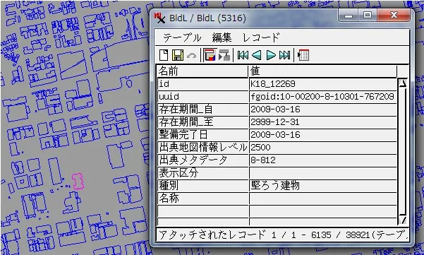
Example
- View multiple data in JPGIS format Road Edge.

File Opening Mode
- Open the JPGIS format building perimeter.