Service

Mapillary API
Nov 5,2025
GISBox is a one-stop 3D GIS data editing, conversion and publishing platform that supports editing in multiple GIS formats such as OSGB/GEOTIFF/RVT, converting to 3DTiles/Terrain and publishing.
Introduction
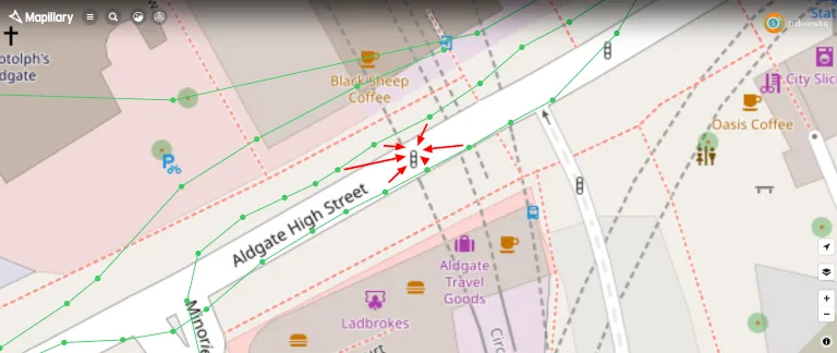
Mapillary API allows developers to access data from Mapillary's crowdsourced Street View platform, supporting geotagged photos, videos, and traffic-related information. Through this API, developers can integrate Street View data into their applications for mapping services, traffic analysis, or computer vision tasks. Its functionality includes image retrieval, metadata querying, and collaboration with object detection models (e.g., AP/mAP evaluation metrics). This API primarily serves technical scenarios requiring large-scale Street View data, such as autonomous driving and smart city projects.

File Structure
- SDK Core Library: Contains native dynamic libraries (such as .a or .so files) and basic API interfaces for map loading, data parsing, and interactive features.
- Resource Files: Stores icons (such as the image or character fields in the symbols configuration), stylesheets (JSON format), and default map assets.
- Templates and Examples: Provides quick-integration project templates (such as the View-based application template) and sample code (such as the MapViewer instance), covering basic functionality.
- Documentation and Metadata: Contains API reference documentation (HTML/PDF), version notes, and schema definition files (such as mapfile.json for configuration validation).
- Dependencies and Tools: Integrates third-party libraries (such as geocoding tools) and development toolchains (such as debugging tools and simulator configuration).
Pros
- Crowdsourced Data Advantages: Relying on street-level imagery and videos uploaded by users worldwide, it offers extensive coverage and frequent updates, making it suitable for applications requiring real-time or diverse geographic data.
- Openness and Integration: Support for OAuth 2.0 authorization and an access token mechanism facilitates developer integration into third-party platforms (such as WebGIS or mobile apps).
- Technical Ecosystem Support: Deep integration with open-source tools (such as OpenSfM) supports structure-from-machine (SfM) reconstruction and geo-alignment, making it suitable for 3D scene reconstruction.
- Privacy-Friendly Design: Compared to Google Street View, its crowdsourced model prioritizes user privacy controls, and uploaded data can be selectively disclosed.
Cons
- Reliance on user contributions: Data quality is limited by user-uploaded content, which may result in uneven coverage or low resolution.
- API Complexity: Requires authorization processes (such as OAuth 2.0) and token management, creating a barrier to entry for novice developers.
- Functional Limitations: Lacks advanced map customization features (such as Apple MapKit's mixed styles or elevation rendering), resulting in limited visualization flexibility.
- Cost and Stability: Enterprise-level APIs can be costly, and crowdsourced data updates can lead to volatile interface responses.
Application Scenario
The Mapillary API is primarily used for crowdsourced street view data collection and visualization, allowing developers to integrate real-time image maps into logistics navigation, urban planning, or tourism services. When combined with open-source tools such as OpenSfM, it can assist with 3D reconstruction and geo-alignment, making it suitable for autonomous driving environment modeling or ecological monitoring. Furthermore, the ability to label landmarks through machine learning can enhance the interactive experience of commercial maps (such as real estate displays). The crowdsourcing nature of this API makes it more flexible in covering remote areas or frequently updated scenarios (such as disaster assessments), but it still relies on the quality of user-uploaded data.
Example
1. Mapillary Vistas Dataset.
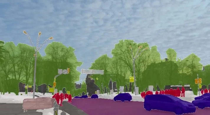
2. Object detection via Mapillary.
File Opening Mode
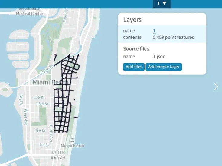
1. Import the json file into the mapshaper website for visualization.