 Service

Kavrayskiy VII Projection
Jan 31,2026
GISBox is a one-stop 3D GIS data editing, conversion and publishing platform that supports editing in multiple GIS formats such as OSGB/GEOTIFF/RVT, converting to 3DTiles/Terrain and publishing.
Introduction
Kavrayskiy VII Projection is a world map projection classified as a pseudocylindrical projection. It was proposed in 1939 by the Russian cartographer Vladimir V. Kavrayskiy. Unlike projections that strictly preserve properties such as equal area or conformality, it is designed to visually represent the entire Earth in a balanced manner. It notably controls distortion in area and shape at high latitudes, avoiding extreme exaggeration and presenting a moderate appearance. This projection has primarily been used for thematic and overview world maps.
Projection Basic
The Kavrayskiy VII projection is a pseudocylindrical projection, representing the central meridian as a straight line and arranging parallels as horizontal straight lines. Meridians are drawn as curves, spaced almost equally near the equator and gradually narrowing toward higher latitudes. The projection formula is relatively simple, designed to suppress longitudinal stretching while forming a smooth overall shape. As a result, the world appears as a horizontally elongated, near-elliptical shape, avoiding excessive expansion of the polar regions.
Pros
- Visually Balanced Representation: Rather than strictly preserving area, shape, or distance, this projection distributes distortion across the entire map. This prevents specific regions from being excessively emphasized, providing an intuitive and easily understandable world map.
- Relatively Moderate Distortion at High Latitudes: Unlike the Mercator projection, which expands polar regions infinitely, this projection displays a realistic continental layout, including the polar areas.
- Suitability for Thematic Maps: It is well-suited for thematic maps showing global trends such as population distribution, climate zones, or vegetation belts, as it minimizes visual bias and is ideal for explanatory purposes.
Cons
- Lacks Strict Cartographic Properties: It is neither equal-area, conformal, nor equidistant, making it unsuitable for precise area comparisons, angle measurements, or distance calculations.
- Unsuitable for Surveying or Analytical Purposes: It cannot be used for quantitative spatial analysis or geodetic computations and is limited to visualization and display applications.
- Limited Software Support: Compared to projections like Mercator or Robinson, it is less commonly implemented and may not be included as a standard option in some GIS software.
Application Scenario
The Kavrayskiy VII Projection is used in situations where clear representation of global distributions or trends is required. It is suitable for educational world maps, overview maps for geography, climate, or environmental studies, and explanatory maps in academic publications or reports. Its value lies in applications that prioritize visual fairness and readability on a global scale over precise representation of specific regions. Thus, it is an effective projection for map expressions aimed at "communicating the big picture" rather than precise analysis.
Example
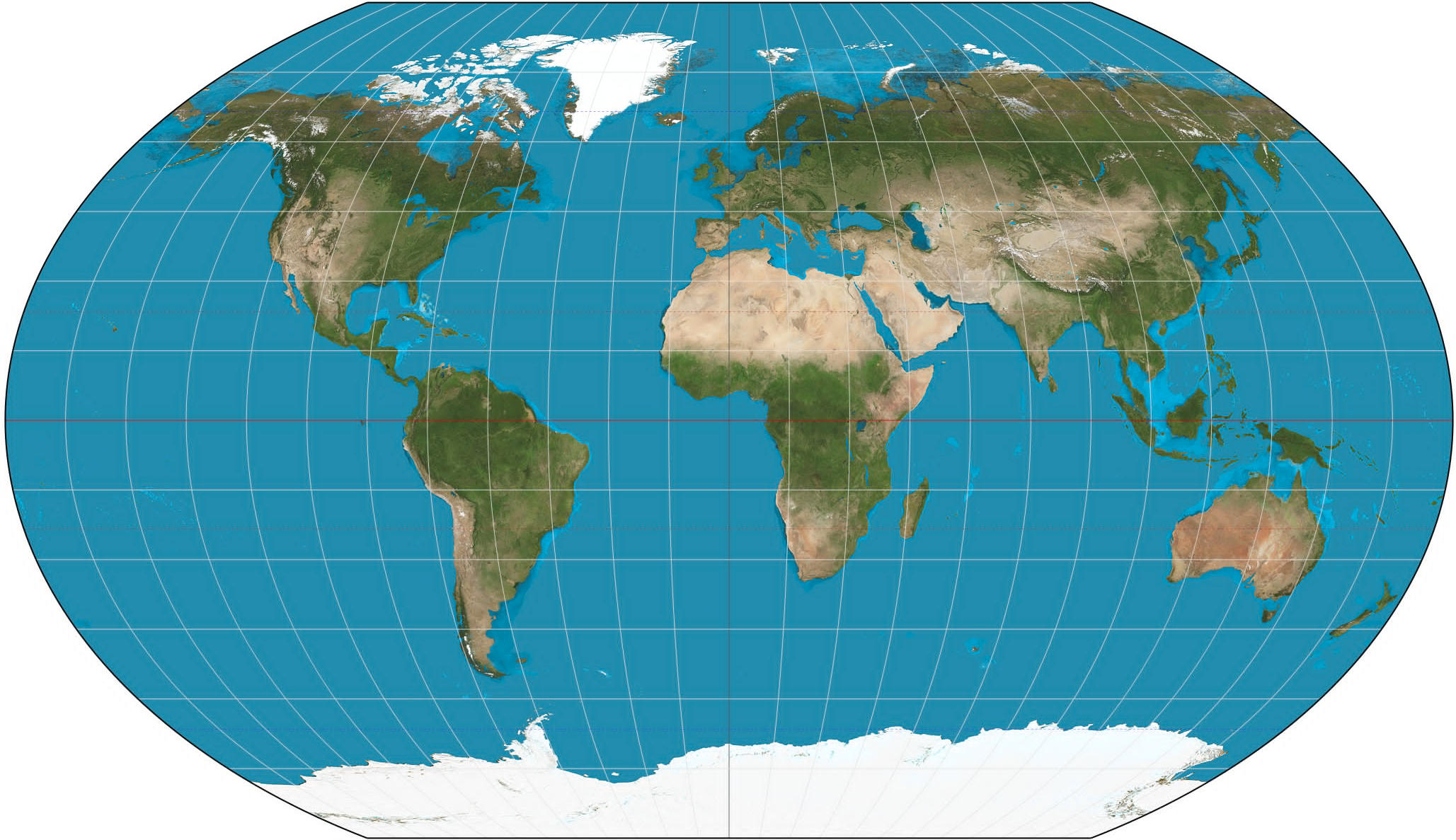
1. A world map projection by Kavrayskiy VII.
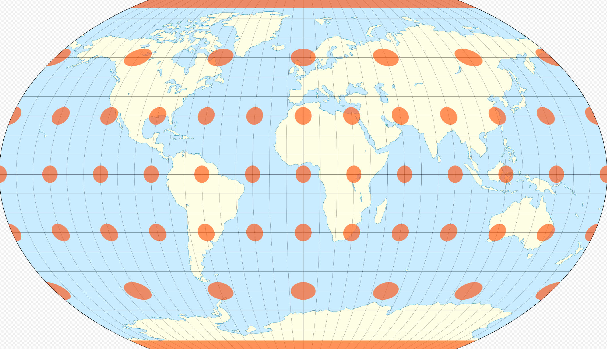
2. Kavrayskiy VII projection with Tissot's indicatrix.
Related GIS Projections
Vertical Near-side Perspective Projection
Two-point Equidistant Projection