 Service

Cassini Projection
Nov 5,2025
GISBox is a one-stop 3D GIS data editing, conversion and publishing platform that supports editing in multiple GIS formats such as OSGB/GEOTIFF/RVT, converting to 3DTiles/Terrain and publishing.
Introduction
Cassini Projection is a type of equilateral transverse Mercator projection devised by the Italian astronomer Jacques Cassini in the 18th century, and is intended to accurately represent areas along the central meridian. It is suitable for mapping elongated areas oriented north-south because it causes little distortion of shape and distance on and around the central meridian. However, distortion of shape and area increases the further away from the central meridian. Historically, it was used for many land surveys and military maps in the 19th century.
Projection Basic
- The Cassini Projection is a method that projects the Earth's surface onto a cylinder and then positions this cylinder by rotating it 90 degrees relative to the Earth's axis of rotation. Its specific characteristics are as follows:
- It can accurately preserve distances and directions along the central meridian and its parallels.
- Distortion in distance and shape in the east-west direction becomes more pronounced as one moves away from the central meridian.
- Its equidistant property is limited to the direction of the central meridian and does not hold true across the entire map.
- Visually, the central portion appears in nearly correct shape, while the areas toward the edges appear stretched in the east-west direction.
Pros
- High accuracy in shape and distance around the central meridian.
- Capable of accurately representing elongated regions in the north-south direction.
- The projection's calculation formulas are relatively simple, making it easy to implement in practical applications.
- It is compatible with old maps and historical survey data.
Cons
- Distortion increases rapidly as one moves away from the central meridian.
- It is not suitable for global maps, with accuracy decreasing for wide-area representations.
- It cannot simultaneously preserve both area and shape accurately.
- It is not well-suited for mapping regions that extend widely in the east-west direction.
Application Scenario
The Cassini projection is suitable for precise surveying of small areas near the central meridian and for regional mapping. It has been used for railway planning, border surveying, and military mapping, particularly in countries and regions that are long in the north-south direction (e.g., Chile, Norway, Italy, etc.). It is also used for cultural heritage surveys and geographical research that require compatibility with historical survey data. In recent years, it has also been applied to the topographical analysis of specific corridor areas and river basins.
Example
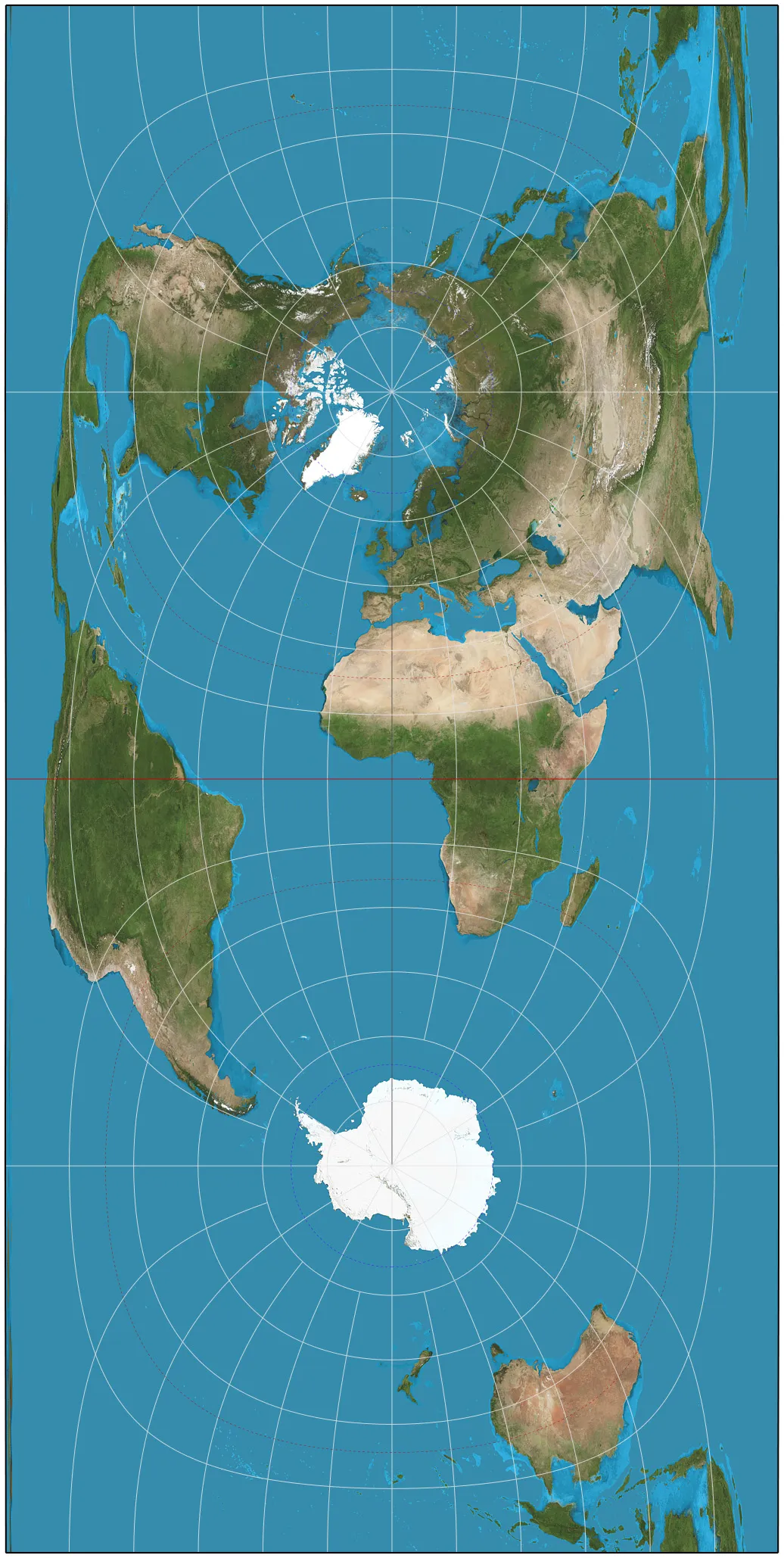
1. Cassini projection of the world.
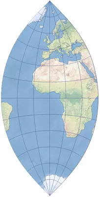
2. Shows the Cassini transverse cylindrical equirectangular map projection centered on Greenwich.
Related GIS Projections
Transverse Mercator Projection
Longitude / Latitude Projection