Service

OpenLayers
Nov 5,2025
GISBox is a one-stop 3D GIS data editing, conversion and publishing platform that supports editing in multiple GIS formats such as OSGB/GEOTIFF/RVT, converting to 3DTiles/Terrain and publishing.
Introduction
OpenLayers is an open-source JavaScript library for creating interactive maps and geographic information system (WebGIS) applications on web pages. It supports a variety of map data sources, including tiled maps (such as OpenStreetMap and Google Maps), vector data (such as GeoJSON), and WGS-compliant WMS/WFS services. Through its rich API and layer management capabilities, developers can implement map operations such as zooming, panning, and annotation, and support custom styles and extension plug-ins.s OpenStreetMap and Mapbox. Its core strengths lie in its small size (approximately 39-42KB), fast loading speed, and compatibility with major browsers and older versions of Internet Explorer. Leaflet is widely used in data visualization, geographic information display, and other scenarios, and is particularly well-suited for projects with high mobile compatibility requirements.

File Structure
The OpenLayers file structure is primarily divided into the following core modules:
- Base Type and Utility Module: This includes basic data types such as Class.js (class definitions), Bounds.js (geographic bounds), and LonLat.js (coordinate processing) in the BaseTypes directory, as well as Util.js (general utility functions) and Console.js (debugging console).
- Map Core Module: Map.js serves as the main entry point for the map container; Layer.js defines the base layer class; View.js controls the view logic; Tile.js and its subclasses (such as Tile/Image.js) handle tile loading and rendering.
- Data Interaction and Request Module: Ajax.js and Request.js (including XMLHttpRequest.js) handle network requests; Projection.js manages coordinate projection conversions and supports geographic data services such as WMS/WFS.
- Interaction and Event System: Events.js implements event monitoring and dispatching; files in the Interaction directory handle user actions (such as zooming and drawing); Marker.js and Popup.js manage annotation and popup interactions. Layer and rendering module: includes multiple layer types, such as Layer/Google.js (Google Maps integration), Layer/SphericalMercator.js (Spherical Mercator projection), and specific implementations of vector/raster layers.
Pros
- Comprehensive Functionality: It supports the richest 2D GIS functionality, covering a variety of data sources, including tile maps (such as OpenStreetMap), vector data (GeoJSON), and WMS/WFS services. It also provides advanced features such as layer management and spatial analysis.
- Flexibility and Extensibility: Open source and a flexible API design allow for highly customized map styles and interaction logic, and are compatible with third-party plugins (such as 3D rendering extensions).
- Cross-Platform Compatibility: Developed based on web standards, it supports multiple browsers and is well-adapted for mobile devices.
Cons
- Steep learning curve: Due to its complex functionality and difficult-to-understand API documentation, it takes a long time for beginners to master it.
- Performance bottleneck: Rendering delays may occur when processing large-scale point data or complex layers, requiring optimization techniques such as clustering.
- Visualization limitations: The default map style is simple, and aesthetics require additional development effort.
Application Scenario
OpenLayers is widely used in WebGIS development, supporting the overlay of multiple layers (such as tile maps and vector data) and spatial analysis (such as buffer calculations). It is suitable for visualization and decision support in fields such as smart cities and environmental monitoring. In logistics and transportation, it can track vehicle trajectories in real time and optimize routes, while also providing interactive map navigation and resource display for the cultural and tourism industries. Furthermore, its flexible data source compatibility (such as GeoJSON and WMS) and cross-platform nature make it a preferred tool for customized mapping applications in education, real estate, and other fields.
Example
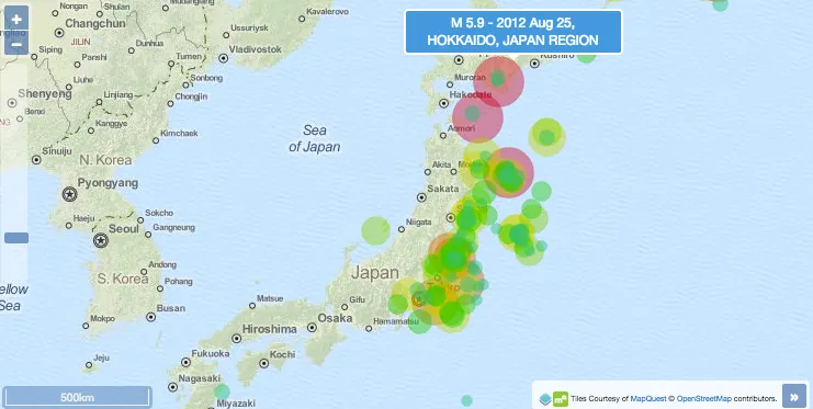
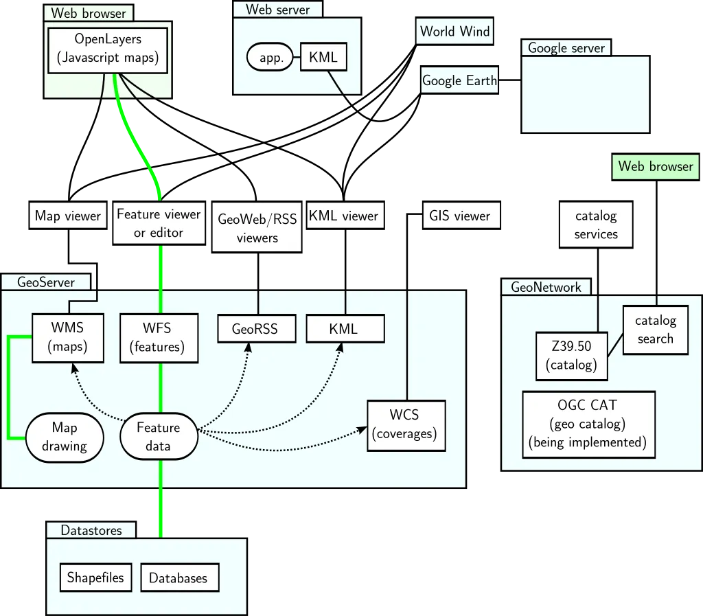
1. OpenLayers can communicate through several protocols.
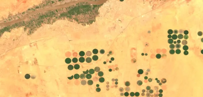
2. OpenLayers loads projected coordinate GeoTIFF images.
File Opening Mode
1. OpenLayers.