Service

Lambert-93 (French Lambert 93 coordinate system - EPSG:2154)
Nov 5,2025
GISBox is a one-stop 3D GIS data editing, conversion and publishing platform that supports editing in multiple GIS formats such as OSGB/GEOTIFF/RVT, converting to 3DTiles/Terrain and publishing.
Introduction
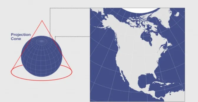
Lambert-93 is the projection coordinate system used by the French National Geographic Information System (IGN). A variant of the Lambert Conformal Conic projection, it is based on the WGS 84 ellipsoid and is suitable for planimetric mapping of metropolitan France and surrounding areas. It features dual standard parallels (44° and 49° North) to reduce distortion. Coordinates are expressed in meters and are commonly used in topographic mapping, land management, and GIS data integration. Compared to the UTM or Gauss-Krüger projections, this coordinate system is more suitable for conformal mapping requirements in mid-latitudes.
Coordinate System Composition
- Geographic Datum (Ellipsoid): Based on the GRS80 ellipsoid (semimajor axis 6,378,137 meters, flattening 1/298.257222101), compatible with WGS84.
- Projection Type: Lambert Conformal Conic projection ensures no angular distortion.
- Dual Standard Parallels: The first standard parallel is 44°N to reduce distortion in southern France; the second standard parallel is 49°N to optimize accuracy in northern France.
- Central Meridian: Set to 3°E, serving as the reference for the coordinate system's vertical (X) axis.
- Origin: Lacan in the Charente-Maritime department in southwestern France (actual origin coordinates: X=0, Y=0).
- Units: Plane rectangular coordinates are in meters (m), with millimeter-level accuracy supported.
Pros
- Mid-latitude Optimization: Using dual standard parallels (44°N and 49°N) to optimize projection distortion, the distortion rate is less than 0.1‰ (i.e., less than 10 cm per kilometer) within metropolitan France, meeting the needs of high-precision surveying and mapping.
- Conformal Projection: Using the Lambert Conformal Conic projection, angles are preserved, making it suitable for engineering stakeout, navigation, and orientation-sensitive applications (such as military and cadastral surveying).
- Coordinate Value Standardization: A false offset design (false easting +500,000 meters, false northing +6,000,000 meters) ensures positive coordinate values throughout France, avoiding the computational complexity associated with negative coordinates.
- Legal Compulsion and Data Consistency: French law mandates the use of this coordinate system for public projects, ensuring seamless compatibility with national topographic maps, cadastral data, and GIS databases (such as the IGN National Geographic Database). Seamless integration with the European framework: Based on ETRS89 (European Geodetic Reference System), it is compatible with global frameworks (such as WGS84) through a seven-parameter transformation, supporting cross-border data integration.
Cons
- Limited Applicability: Covers only metropolitan France (42°–51°N). Overseas territories (such as Guyana and Réunion) require a separate projection (Lambert-Guyane), resulting in inconsistent coordinate systems across the country.
- Extended Cross-Region Distortion: Beyond metropolitan France (e.g., Corsica or border regions), projection distortion increases significantly (>0.1‰), requiring a coordinate system switch.
- Unsuitable for Global Applications: As a local coordinate system, it does not support global positioning. Fusion with data from other countries requires coordinate conversion (e.g., WGS84 to Lambert-93), introducing additional error risks.
- Separate Vertical Reference: Provides only horizontal coordinates (X/Y). Elevations require a separate altitude system (e.g., the IGN69 geoid model), increasing the complexity of 3D data processing.
Application Scenario
As the official plane rectangular coordinate system of mainland France, the Lambert-93 coordinate system is primarily used in engineering surveying and mapping, cadastral management, national infrastructure projects, and airborne lidar. Its high precision and conformal characteristics ensure the accuracy of measurement data. Through legal enforcement and locally optimized design, it provides a standardized spatial data benchmark for France, but its scope of application is strictly limited to mainland France.
Example
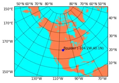
1. Lambert conic projection.
2. French Lambert 93 coordinate system.