Service

LandsatLook Viewer API - USGS Landsat Satellite Imagery Service
Nov 5,2025
GISBox is a one-stop 3D GIS data editing, conversion and publishing platform that supports editing in multiple GIS formats such as OSGB/GEOTIFF/RVT, converting to 3DTiles/Terrain and publishing.
Introduction
USGS Landsat Look Viewer API is an online tool provided by the United States Geological Survey (USGS) that allows users to browse and download Landsat satellite images since 1972, supporting multiple data types and advanced query functions. LandsatLook Viewer API aims to provide Geographic Information System (GIS) users with an efficient and convenient way to obtain and analyze Landsat images, and is an important tool for remote sensing research and environmental monitoring. Users can obtain more detailed instructions and development support by reading the official documentation.
Data Format Overview
LandsatLook Viewer API - USGS Landsat data mainly has the following processing levels and formats:
1. Level-1 (L1) data:
- Basic remote sensing image information, not atmospherically corrected, widely used for basic analysis.
- Includes L1TP (terrain precision correction) and L1GT (system terrain correction).
- The data format is usually GeoTIFF, supporting multispectral band analysis.
2. Level-2 (L2) data:
- Radiation correction and atmospheric correction are performed for L1 data, providing surface reflectance data and surface temperature information.
- The data is usually processed to facilitate direct remote sensing analysis and application, suitable for more advanced scientific research.
Pros
1. Comprehensive data coverage: Provides global satellite images, suitable for long-term research and global monitoring.
2. Multispectral data support: Data in multiple bands facilitates object classification and environmental analysis.
3. Easy access: Simplifies the data acquisition process without downloading large amounts of data.
4. Automated processing: Supports batch processing and automatic analysis to improve efficiency.
5. High reliability: USGS ensures data accuracy and quality.
6. Real-time updates: Provides the latest data, suitable for emergency response.
7. Multiple data formats: Supports GeoTIFF, JPEG, etc. to meet different needs.
8. Multi-language support: Applicable to multiple programming environments such as Python, R, JavaScript, etc.
9. Visualization tools: Convenient for users to generate maps and images.
10. Custom query: Supports filtering data by parameters such as time and location.
11. Security: Provides a security authentication mechanism to protect data access.
Cons
1. Limited spatial resolution
The spatial resolution of the Landsat series satellites is mainly 30 meters (15 meters for the panchromatic band), which cannot meet the needs of high-precision mapping (such as building identification) and needs to be combined with higher-resolution satellite data (such as Sentinel-2).
2. Low temporal resolution
The revisit period of a single satellite is 16 days. Affected by cloud cover, the actual frequency of available data may be lower, which is difficult to meet high-frequency monitoring needs (such as short-term vegetation changes).
3. Insufficient resolution of the thermal infrared band
The thermal infrared band resolution of Landsat 8/9 is 100 meters, which affects the accuracy of surface temperature inversion and needs to be downscaled or combined with other data sources.
4. Landsat 7 data missing problem
After 2003, the scan line corrector (SLC) of Landsat 7 failed, resulting in missing strips in the image, which needs to be repaired later, which may affect the integrity of the data.
5. API usage threshold
Programming basics are required to fully utilize the API functions, and there may be learning costs for non-technical personnel or small research teams.
Application Scenario
LandsatLook Viewer API (USGS Landsat) is widely used in natural resource monitoring, agricultural management, urban planning, disaster assessment, climate change research and other fields due to its free and open, multispectral imaging and long-term data accumulation.
Example
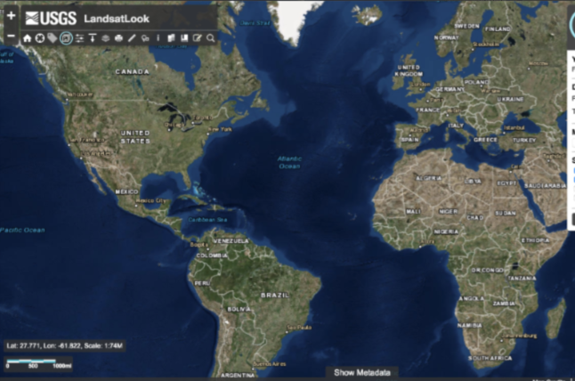
1. Check the download area.
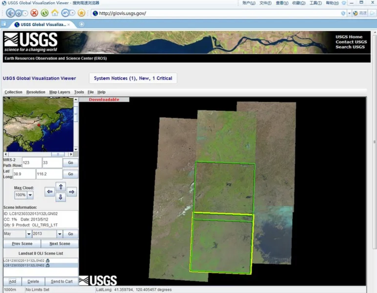
2. LandsatLook Viewer.