 Service

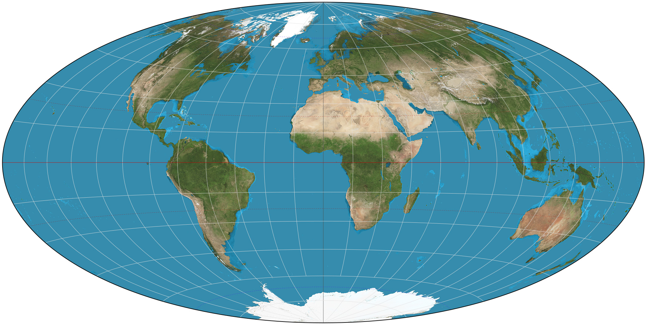
Hammer Aitoff Projection
Nov 5,2025
GISBox is a one-stop 3D GIS data editing, conversion and publishing platform that supports editing in multiple GIS formats such as OSGB/GEOTIFF/RVT, converting to 3DTiles/Terrain and publishing.
Introduction
Hammer projection is a modification of the Lambert azimuthal equal-area projection, also known as the Hammer–Aitoff projection. It was developed in 1892 by German cartographer Ernst von Hammer, who was inspired by the work of Russian cartographer David A. Aitoff and, as such, represents an improvement on the Aitoff projection.
Projection Basic
The Hammer projection is an equal-area projection, which means it maintains the proportions of areas on the map consistent with the actual proportions of areas on the Earth's surface. This property is achieved through a mathematical transformation that converts latitude and longitude coordinates on the Earth's surface to coordinates on a flat surface while preserving the proportions of areas.
Pros
- High fidelity in mid-latitude regions: Minimal distortion in shape, area, and scale near standard parallels (e.g., 45°N/S), making it ideal for displaying geographic information in mid-latitude areas (e.g., Europe, North America, China).
- Balanced global distortion: Compared to other cylindrical projections (e.g., Mercator), it offers milder stretching at the poles and compression at the equator, resulting in more visually proportional global maps.
- Intuitive and easy to read: Straight, perpendicular meridians and parallels align with human perception, facilitating direction judgment and distance estimation.
- Historical and practical value: Widely used in British atlases, it remains suitable for educational purposes, world maps, and general reference applications.
Cons
- Significant distortion at high latitudes: Severe shape and area distortion near the poles (e.g., Greenland appears overly large), limiting its use for polar research or high-latitude navigation.
- Neither equal-area nor conformal: Fails to preserve both area and angle simultaneously, restricting its utility in precise measurements (e.g., land planning) or navigation (e.g., maritime charts).
- Limited versatility: Less adaptable than specialized projections (e.g., Lambert Conformal Conic for aviation, Albers Equal-Area for statistics) for targeted applications.
- Competition from modern alternatives: The rise of digital mapping and dynamic projections (e.g., adaptive Mercator) partially addresses its fixed-perspective limitations.
Application Scenario
The Hammer projection is particularly well-suited for small-scale world maps, particularly for thematic world maps depicting regional features and analyses requiring accurate areas. It balances distortion across the globe, making the mid-latitudes appear proportional while avoiding excessive stretching of the polar regions.
Example
1. Hammer projection of the world.
2. The Hammer projection with Tissot's indicatrix of deformation.

Related GIS Projections
Transverse Mercator Projection
Longitude / Latitude Projection