Service

DEM (Digital Elevation Model Format)
Jan 22,2026
GISBox is a one-stop 3D GIS data editing, conversion and publishing platform that supports editing in multiple GIS formats such as OSGB/GEOTIFF/RVT, converting to 3DTiles/Terrain and publishing.
Introduction
DEM (Digital Elevation Model) is a universal terrain data format and concept that represents ground surface elevation in a grid-based (raster) numerical form. Each grid cell stores a corresponding elevation value, enabling quantitative analysis of terrain undulation and shape. As a vendor-neutral general-purpose format, DEM is widely used and regarded as a fundamental and essential spatial dataset across various fields, including terrain analysis, cartography, simulation, disaster prevention, and environmental analysis.

File Structure
DEM is primarily structured as raster data, consisting of elevation information and spatial reference details for accurate interpretation. Typically, each cell has a specific ground resolution (e.g., 5m, 10m, 30m), with elevation values (usually in meters) stored as cell values. Accompanying metadata includes the data's row and column counts, cell size, geographic extent, coordinate reference system (geographic or projected coordinate system), and definitions for missing values (NoData). DEM is often provided in multiple implementation formats, such as GeoTIFF, ASCII Grid, and NetCDF, allowing selection based on application needs and analysis environments.
Pros
- Intuitive and Quantitative Terrain Representation: DEM stores terrain undulation as numerical data, enabling both intuitive visualization of elevation distribution and direct use in quantitative analysis.
- Versatility for Diverse Analyses: Serves as foundational data for various terrain analyses, including slope and aspect calculation, watershed analysis, viewshed analysis, and hillshade generation.
- Easy Integration with Other Geospatial Data: As a standard raster format in GIS, DEM can be easily overlaid with other datasets, such as land use maps, vegetation data, and meteorological data.
- High Data Availability: DEM datasets based on satellite observations (e.g., SRTM, ASTER) and airborne LiDAR surveys are widely published by governments and research institutions, offering diverse resolutions from regional to global scales.
Cons
- Accuracy Constraints Due to Resolution: As a grid-based format, DEM may fail to accurately represent fine terrain features (e.g., small ridges, valleys, or artificial structures) when resolution is coarse.
- Errors from Generation Methods: Satellite or photogrammetric DEMs can be influenced by vegetation or buildings, meaning they may not always accurately represent the true ground surface.
- Large Data Volume: High-resolution DEMs can become extremely large, increasing computational loads and storage burdens during storage, transfer, and analysis.
- Application-Specific Preprocessing Required: For applications like hydrological analysis, preprocessing steps such as sink filling or smoothing may be necessary to avoid errors in results.
Application Scenario
DEM serves as a core dataset for all terrain-based spatial analyses. In disaster prevention, it is used for flood inundation analysis, landslide hazard assessment, and tsunami simulations, supporting disaster prediction and evacuation planning. In urban planning and civil engineering, DEM aids in landform design, road and railway route planning, and landscape evaluation. In environmental and natural sciences, it is indispensable for hydrological cycle analysis, ecosystem modeling, and topographic correction in climate models. Additionally, DEM is widely applied in fields like 3D mapping, visualization, simulation, gaming, and VR, providing a foundational dataset for realistic terrain representation.
Example
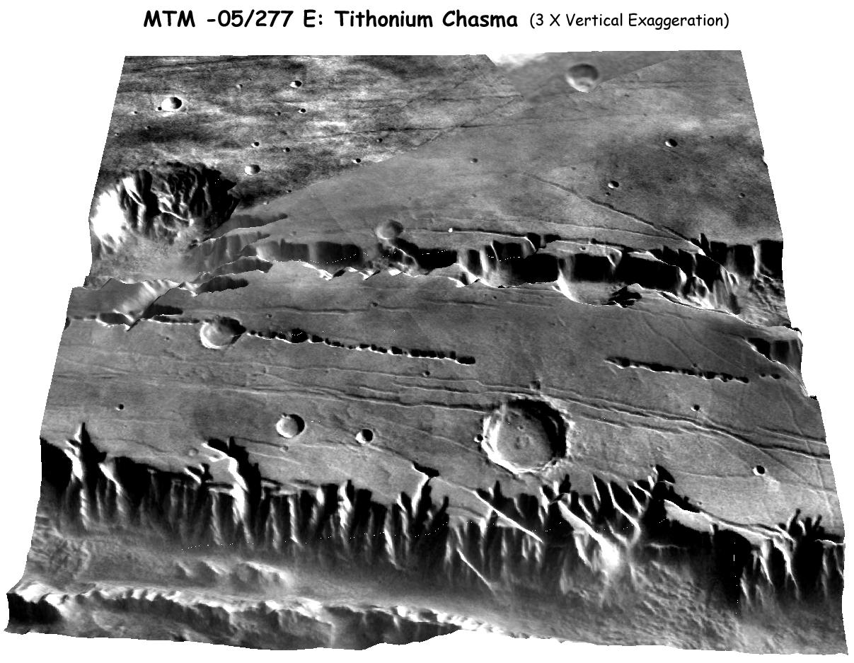
1. A three-dimensional visualization of DEM data for Mars' Tithonium Chasma.
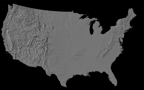
2. A hillshade map of the contiguous United States.
File Opening Mode
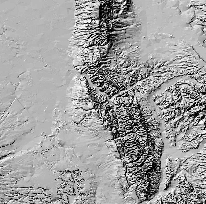
1. Example visualization of DEM data: Around Chitose Izumi-Sato area.