 Service

CityGML (City Geography Markup Language)
Oct 31,2025
GISBox is a one-stop 3D GIS data editing, conversion and publishing platform that supports editing in multiple GIS formats such as OSGB/GEOTIFF/RVT, converting to 3DTiles/Terrain and publishing.
Introduction
CityGML, an international standard for the exchange of 3D city model data developed by the Open Geospatial Consortium (OGC), uses XML encoding to uniformly describe the geometric, topological, semantic, and appearance attributes of urban elements. Its modular architecture includes 13 thematic extension modules, supporting hierarchical modeling and multiple levels of detail (LOD) representation for various surface objects, such as buildings, roads, and vegetation. The Application Domain Extension (ADE) mechanism enhances the description of domain-specific attributes, such as parametric modeling of utility networks.
File Structure
- Root element: The top-level container for the entire CityGML file. All city geographic data is nested within this element. It serves as the "skeleton" of the file structure, integrating all subsequent sub-elements to ensure data integrity and standardization.
- Metadata description: Stores basic file management information, including the data creator, creation time, update history, data source (such as a surveying and mapping agency), and data accuracy level. Its core function is to provide an "identity" for the data, facilitating subsequent management, traceability, and sharing.
- City object collection: Contains specific city geographic elements and is the "core content area" of the file. Each <cityObjectMember> corresponds to a separate city object.
- Coordinate system definition: Specifies the spatial reference datum for the geographic data in the file, including planar coordinate systems (such as Gauss-Krüger) and elevation datums (such as the 1985 National Elevation Datum). This is typically specified through EPSG codes (such as EPSG:4490, representing the 2000 National Geodetic Coordinate System). This ensures the accuracy and consistency of the data's spatial positioning and avoids coordinate discrepancies between data from different sources.
- Appearance Information Collection: Describes the visual attributes of city objects and is key to achieving 3D model visualization.
- Extended Custom Elements: Meet the personalized data needs of specific scenarios and embody the flexibility of CityGML.
- Object Property Description: Supplements the non-geometric attribute information of city objects and refines the details of <cityObjectMember>.
Pros
- Standardization and Semantic Modeling: As an OGC/ISO standard format, it supports GIS/BIM data exchange and provides over 300 semantic attribute definitions.
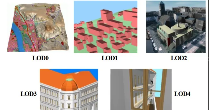
- Multi-level modeling capabilities: Five levels of detail (LOD0-LOD4) cover everything from area outlines to interior structures, supporting the coexistence of multiple levels of detail.
- Modular Scalability: A core module and 13 specialized modules are freely combinable, and the ADE mechanism supports customized extensions for energy, cultural relics, and other areas.
Cons
- High barrier to entry: Relying on a professional GIS toolchain, XML/GML encoding requires technical background.
- Data processing bottlenecks: Inefficient processing of large files, and common topological errors requiring additional repair.
- Real-time rendering flaws: Requires conversion to formats such as 3D Tiles for compatibility with web/game engines.
- Version transition challenges: Compatibility gaps exist between versions 3.0 and 2.0.
Application Scenario
CityGML (City Geography Markup Language), as an open standard for three-dimensional urban modeling, is widely used in the construction of smart city digital twin platforms, urban planning and architectural scheme evaluation, disaster simulation and emergency management, digital protection of cultural heritage, optimization of transportation networks and energy facilities, and environmental noise and sunshine analysis. Its multi-level of detail (LOD) modeling capabilities and semantic attribute support provide a standardized data foundation for the management of the entire life cycle of cities.
Example
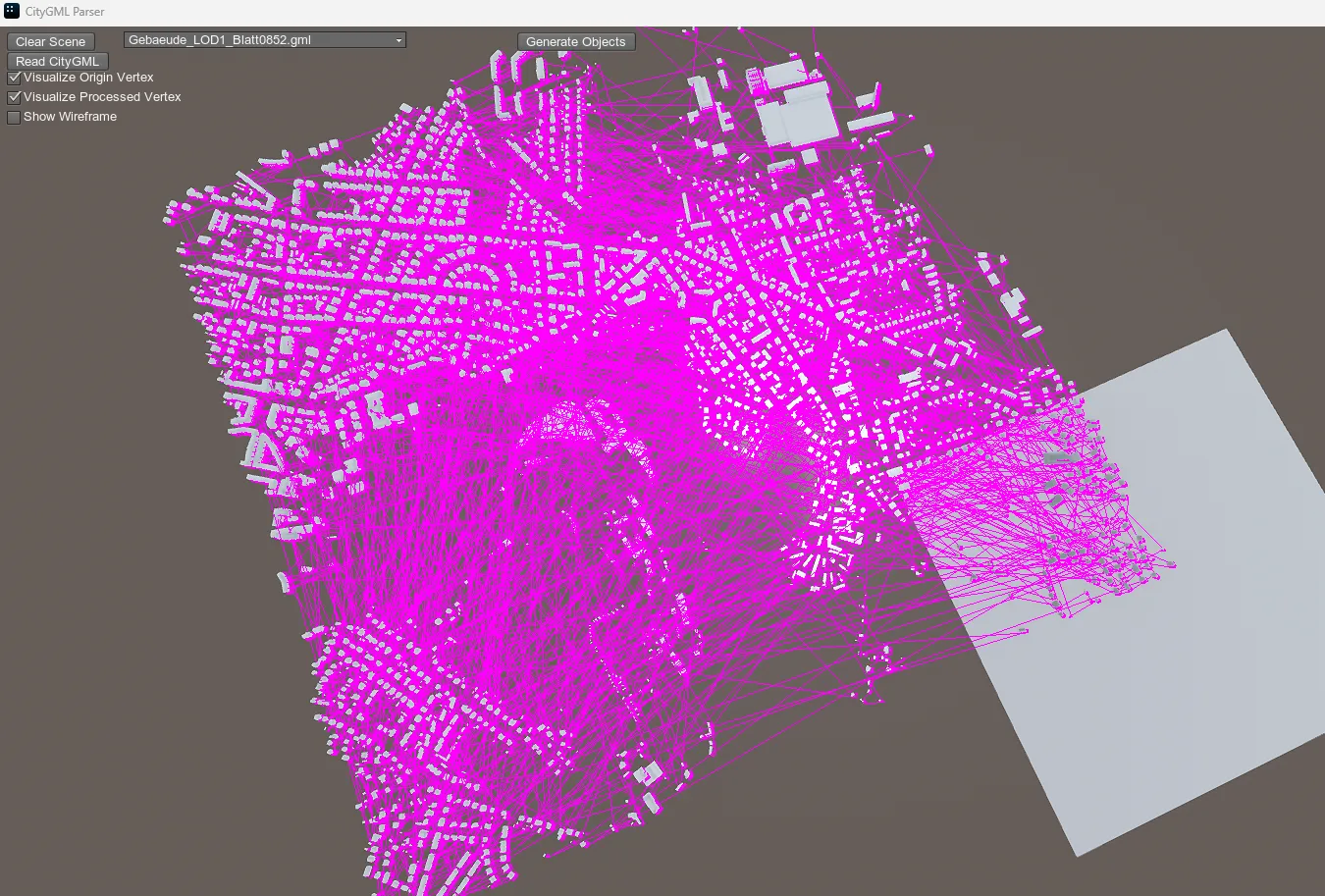
1. Parse City GML format into Unigine engine.
2. CityGML5 multi-level detail model (LOD).
File Opening Mode
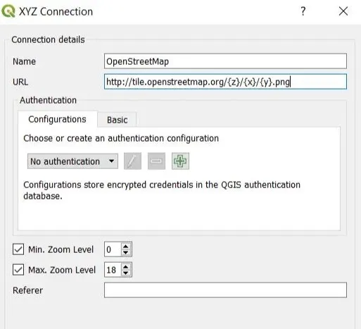
- CityGML 3D scene viewing in QGIS.
Related GIS files
References
- https://www.ogc.org/standards/citygml/
- https://en.wikipedia.org/wiki/CityGML
- https://doc.arcgis.com/en/3d/workflows/content/citygml.htm