
 Service


Plate Carrée (Simple Equidistant Rectangular Projection)
Plate Carrée (Simple Equidistant Rectangular Projection) is one of the most basic cylindrical projections. It directly maps the Earth's longitude and latitude at equal intervals onto a planar rectangular coordinate system—that is, longitude linearly corresponds to the horizontal axis and latitude linearly corresponds to the vertical axis—forming a rectangular grid with a 2:1 aspect ratio. This projection is extremely simple to compute, but area and shape distortion are very severe at high latitudes. Historically, it was therefore mainly used for early world map production and, in modern times, for panoramic textures and raster geographic data storage.
2026-09-24 16:47:57
Transverse Cylindrical Equal Area Projection
Transverse Cylindrical Equal Area Projection is a type of map projection that uses a transversely oriented cylindrical surface as the projection surface, projecting the graticule of the Earth's ellipsoid onto the cylindrical surface under equal-area conditions and then unrolling it into a plane. Its cylinder axis is perpendicular to the Earth's axis of rotation, and the cylindrical surface is typically made tangent to a specific meridian of the Earth. This tangent central meridian appears as a straight line after projection and maintains equal-area, distortion-free characteristics. The Equator is a straight line perpendicular to the central meridian, and all other meridians and parallels are symmetrically distributed curves. This type of projection strictly ensures that the area ratio of regions before and after projection remains exactly consistent, producing no area distortion. It is often used in thematic mapping scenarios that require precise statistical analysis of regional areas.
2026-09-24 16:44:18
Lambert Azimuthal Equal Area (Modified)
Lambert Azimuthal Equal Area (Modified) is an equal-area azimuthal projection proposed by the German mathematician Johann Heinrich Lambert in 1772. Its core characteristic is maintaining a strictly proportional relationship between the area of any region on the map and the actual area on the Earth's surface. At the same time, shapes and angles are significantly distorted, with the effect becoming more pronounced in regions farther from the projection center. The term "Modified" does not refer to a separate projection type, but rather to parameter adjustments made to the standard spherical model in practical applications. For example, using the WGS84 ellipsoid instead of a sphere, setting the projection center to a specific region such as China or Europe, or using auxiliary sphere parameters to optimize regional area fidelity. This makes it suitable for national surveying, environmental statistics, and polar science mapping. At the projection center, there is no distortion and directions are accurate, with a circular boundary at the periphery. It is mainly used to display global or hemispheric-scale distribution data, such as species distribution, climate patterns, and geological structure analysis.
2026-09-24 16:36:52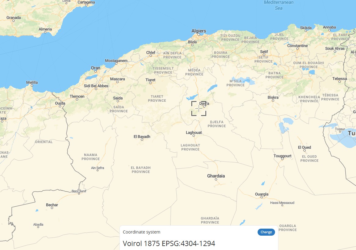
Voirol 1875 (EPSG:4304)
Voirol 1875 (EPSG:4304) is a historical 2D geographic coordinate system used in the maritime and land areas of northern Algeria above 32°N latitude. It was established by the French IGN Paris and uses the Clarke 1880 (IGN) reference ellipsoid and the Greenwich prime meridian. Units are in degrees, with coordinate axes ordered as latitude (northward) and longitude (eastward). It differs from the Voirol 1879 geodetic datum by approximately 9 meters, and the two were sometimes used interchangeably in the early oil industry. It has now been fully replaced by the Nord Sahara 1959 coordinate system and can be transformed to WGS84 (EPSG:4326) using the transformation methods defined in EPSG.
2026-09-24 16:30:42
REGCAN95 (EPSG:4081)
REGCAN95 (EPSG:4081) is the official geodetic datum for the Canary Islands, Spain. Its official name is Red Geodesica de Canarias 1995. It uses the GRS 1980 reference ellipsoid and the Greenwich meridian as its prime meridian. It is a 2D geographic coordinate system, with coordinate units in degrees and coordinate axis order of geodetic latitude (northward) followed by geodetic longitude (eastward). Its coverage extends over the land territory and surrounding maritime areas of the Canary Islands, and it replaces the older Pico de las Nieves 1984 (PN84) datum. It is currently widely used in surveying and geographic information-related work as the horizontal component of the region's 3D coordinate system.
2026-09-24 16:24:16
MAGNA-SIRGAS (EPSG:4686)
MAGNA-SIRGAS (EPSG:4686) is the latest geocentric geographic coordinate reference system officially adopted by Colombia. It is based on the GRS 1980 ellipsoid and referenced to the Greenwich meridian. It replaced the older Bogotá 1975 datum introduced in 1941, and uses longitude and latitude (in degrees) as coordinate units. It covers the entire territory of Colombia, including its associated islands and maritime areas, such as San Andrés, Malpelo, Roncador, Serrana, and Serranilla. This datum is the legal standard for surveying, GIS applications, and GNSS positioning in the country. While it is highly compatible with WGS84, it is not completely identical. Since 2018, it has been gradually replaced by the updated version MAGNA-SIRGAS 2018 (EPSG:20046).
2026-09-24 16:18:54
DIMAP (DIMAP (Metadata format for SPOT / Pleiades remote sensing imagery))
DIMAP stands for Digital Image Map. It is an open remote sensing image distribution data format specification jointly introduced by the French company Spot Image, Satellus, and the French Space Agency CNES. The early version 1.1 was primarily used for SPOT 5 satellite data distribution. Subsequently, the iterated DIMAP v2 version was adapted for high-resolution satellites such as Pléiades. It can integrate GeoTIFF or JPEG2000 image files and comes with rich metadata including satellite orbit information, imaging parameters, Rational Polynomial Coefficients (RPC), and coordinate systems. It supports high-precision image geometric correction with few ground control points and can be directly read and parsed in mainstream remote sensing processing software such as ENVI and GDAL, greatly reducing the operational threshold for remote sensing image geometric processing.
2026-09-24 16:08:53
SAFE (Sentinel Satellite Data Format)
SAFE (Sentinel Satellite Data Format) is a European standard archive format specifically designed by the European Space Agency (ESA) for the Sentinel series of satellites. It is essentially a directory folder encapsulating complete remote sensing data. It uses the XML-format manifest.safe as its core metadata entry point and internally integrates binary image data, preview images, KML geographic overlay layers, and various other file types. It offers excellent extensibility and can uniformly carry satellite products across the entire Sentinel series at different levels and in different modes. It is the universal standard format for ESA's Earth observation data archiving and distribution.
2026-09-24 16:01:01
OpenMapSearch API
OpenMapSearch API is not a single official service, but rather a collective term for map search interfaces implemented based on open standards (such as OpenLS and OpenStreetMap) or open-source frameworks. Its core function is to return spatial information—such as geographic coordinates and detailed location information—through text queries (addresses, POI names, etc.). It is typically provided as a RESTful HTTP interface and supports JSON/XML response formats. It is widely used to integrate location search functionality into web and mobile applications.
2026-09-23 20:03:01
Nominatim API
Nominatim API is an open-source geocoding and reverse geocoding service officially provided by OpenStreetMap. It supports forward geocoding—converting human-readable addresses (e.g., "Xihu District, Hangzhou, Zhejiang, China") into precise latitude/longitude coordinates—as well as reverse geocoding, which converts latitude/longitude coordinates (e.g., 30.2642, 120.1667) back into structured address information. All data relies on OpenStreetMap map information contributed by volunteers worldwide. It supports both free-form text searches and structured parameter filtering, and is widely used in fields such as map applications, location search, and data analysis. It is also available for free through the official public interface, but users must comply with the usage policy of no more than one request per second.
2026-09-23 19:57:31