
 Service


Hammer–Aitoff variant
Hammer–Aitoff variant is an improved version of the Lambert azimuthal equal-area projection. The Hammer projection is an equal-area projection with an elliptical graticule. It is also referred to as the Hammer–Aitoff projection. This projection is suitable for small-scale mapping.
2025-11-27 15:46:29
Aitoff Projection
Aitoff projection is a specialized map projection method first proposed by the German mathematician David A. Aitoff in 1889. As a compromise projection, it aims to balance distortions in angle, area, and distance, making it suitable for global overview maps. The Aitoff projection is an improvement upon the azimuthal equidistant projection. By horizontally stretching the original hemispherical projection to twice its width, it forms an elliptical map where the width is double the height. This projection is particularly well-suited for displaying regions centered on specific points, such as polar areas or cities, while providing a relatively balanced view of the world.
2025-11-27 15:42:04
New Zealand Map Grid Projection
New Zealand Map Grid Projection is a conformal map projection technology specifically designed for large-scale mapping of New Zealand. It employs the complex Cauchy-Riemann equations for projection calculations, with its central point set at 173° East longitude and 41° South latitude. It is important to note that this projection method is only suitable for large-scale mapping within New Zealand and may not be applicable for mapping other regions.
2025-11-24 16:30:22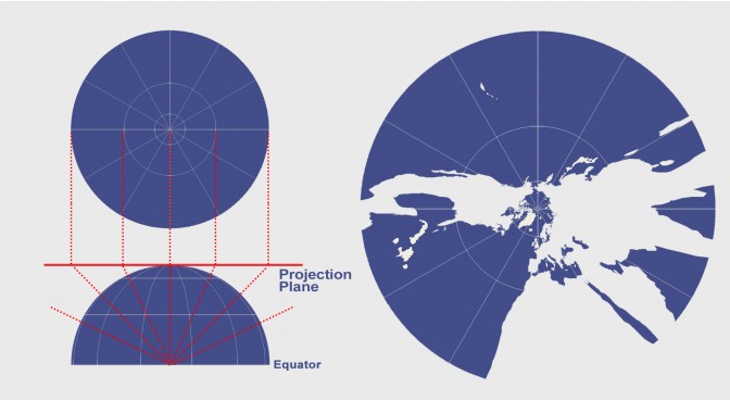
Gnomonic Projection
Gnomonic Projection is a perspective azimuthal projection that uses the center of the sphere as the light source. It projects great circles on the spherical surface (such as meridians and the equator) as straight lines, making it commonly used in navigation, astronomy, and seismic analysis. Its key characteristic is the absence of distortion at the projection center, but extreme distortion occurs at the edges. While suitable for mapping great-circle routes or analyzing linear paths, it does not preserve area or angular relationships.
2025-11-24 16:25:01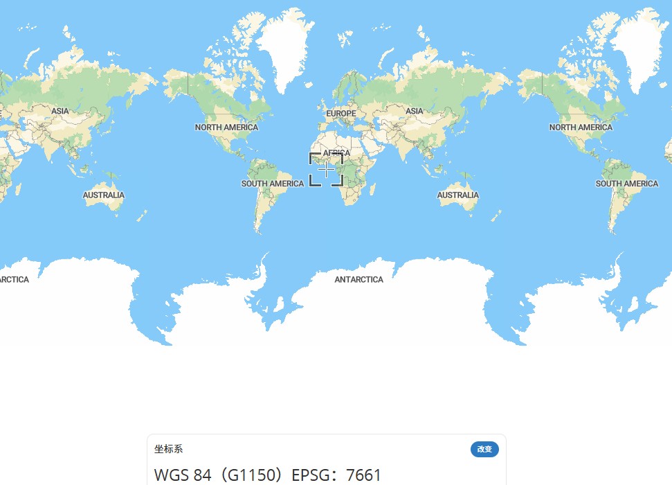
Compound CRS
A Compound CRS achieves unified representation of multi-dimensional spatial data by combining multiple coordinate reference systems (CRS). For example, it integrates a planar coordinate system (e.g., EPSG:7661) with an elevation system (e.g., EPSG:3855) to form a complete "planar + elevation" spatial description. Its core features include ensuring consistency between horizontal and vertical coordinate systems through associated parameters (such as ellipsoids and datums), making it suitable for fields requiring simultaneous expression of planar positions and elevations, such as terrain modeling and 3D GIS analysis. Technically, a Compound CRS typically comprises a horizontal CRS and a vertical CRS, unified through nested or associated parameters.
2025-11-24 16:19:55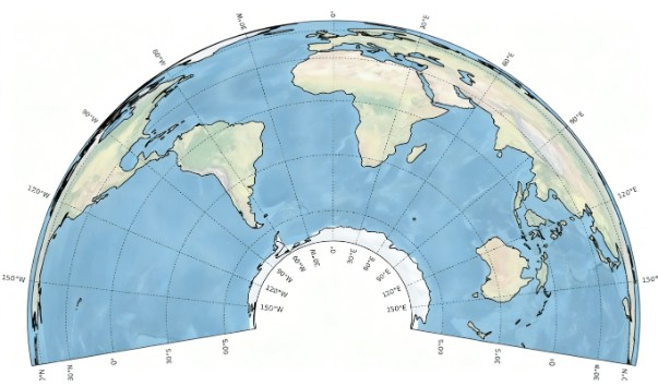
Albers Equal-area Conic Projection
Albers equal-area conic projection is an equal-area conic projection that utilizes two standard parallels. Compared to projections with only one standard parallel, this approach helps reduce distortion to some extent. It is best suited for mapping large continental areas extending predominantly in an east-west direction in the mid-latitudes and is commonly used for maps of the contiguous United States, Europe, and Australia.
2025-11-24 16:12:02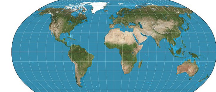
Robinson Projection
Robinson projection is a widely used map projection method developed since the 1960s, designed to represent the entire world on a single map. It seeks a practical compromise for displaying the whole Earth on a flat surface. Introduced in 1963 by Dr. Arthur H. Robinson, this projection features straight latitude lines and evenly spaced meridians, classifying it as a pseudocylindrical projection. While the central meridian is straight, all other meridians are curved. Robinson defined this projection by constructing a lookup table of Cartesian coordinates through specific interpolation of latitudes and longitudes, rather than using mathematical formulas.
2025-11-24 16:09:04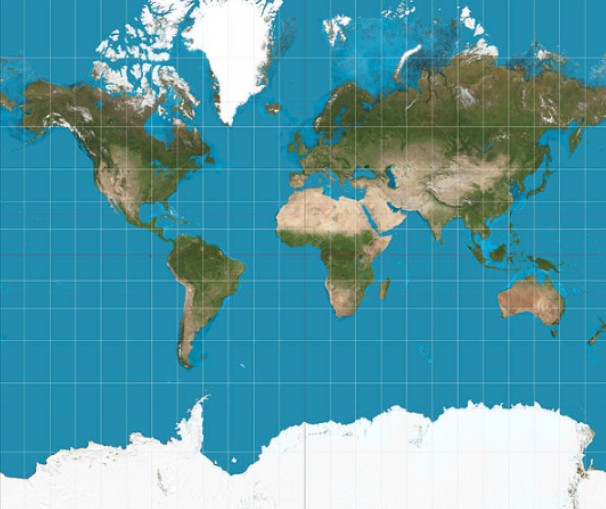
Mercator Projection
Mercator projection is a conformal tangent cylindrical projection devised by the Flemish cartographer Gerardus Mercator in 1569. It conceptually projects the Earth's surface onto a cylinder tangent at the equator, with a light source at the Earth's center casting surface features onto the cylinder. When unrolled, this creates a world map with the standard parallel at zero degrees (the equator).
2025-11-24 16:01:13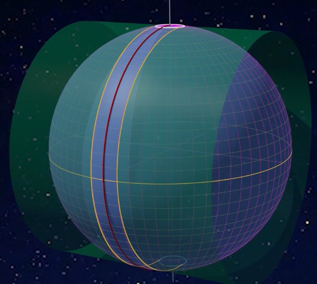
UTM Zone (Universal Transverse Mercator Coordinate System)
UTM Zone (Universal Transverse Mercator Coordinate System) is a coordinate system that converts latitude and longitude coordinates on the Earth's surface into a planar Cartesian coordinate system. It is widely used in map creation, engineering surveying, and military applications. Its core principle involves reducing distortion through zonal projection and achieving high-precision positioning through standardized coordinate representation.
2025-11-24 15:52:38
Esri GeoEvent Server
Esri GeoEvent Server is an enterprise-level software provided by Esri, designed for real-time processing, analysis, and dissemination of event-based geospatial data streams. It can connect to multiple real-time data sources, perform real-time analysis on event data through filters and processors, and deliver processed results to client applications, feature services, dashboards, or other destinations. This technology is commonly used in smart cities, traffic monitoring, and other scenarios requiring real-time responsiveness, helping users quickly adapt to dynamic changes.
2025-11-24 15:46:07