 Service

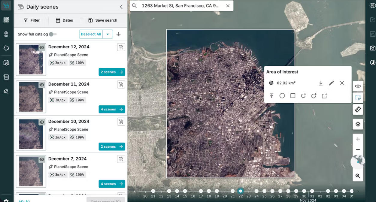
Planet Labs API
The Planet Labs API is an API provided by the US-based company Planet Labs for delivering Earth observation satellite data. It is characterized by its ability to programmatically search, retrieve, and analyze satellite imagery captured by a large number of small Earth observation satellites (known as the "Dove" constellation), offering high-frequency and high-temporal-resolution data. A key strength lies in its "daily revisit" capability, enabling near-real-time monitoring of surface changes—a significant departure from traditional satellite data services.
2026-01-23 13:45:39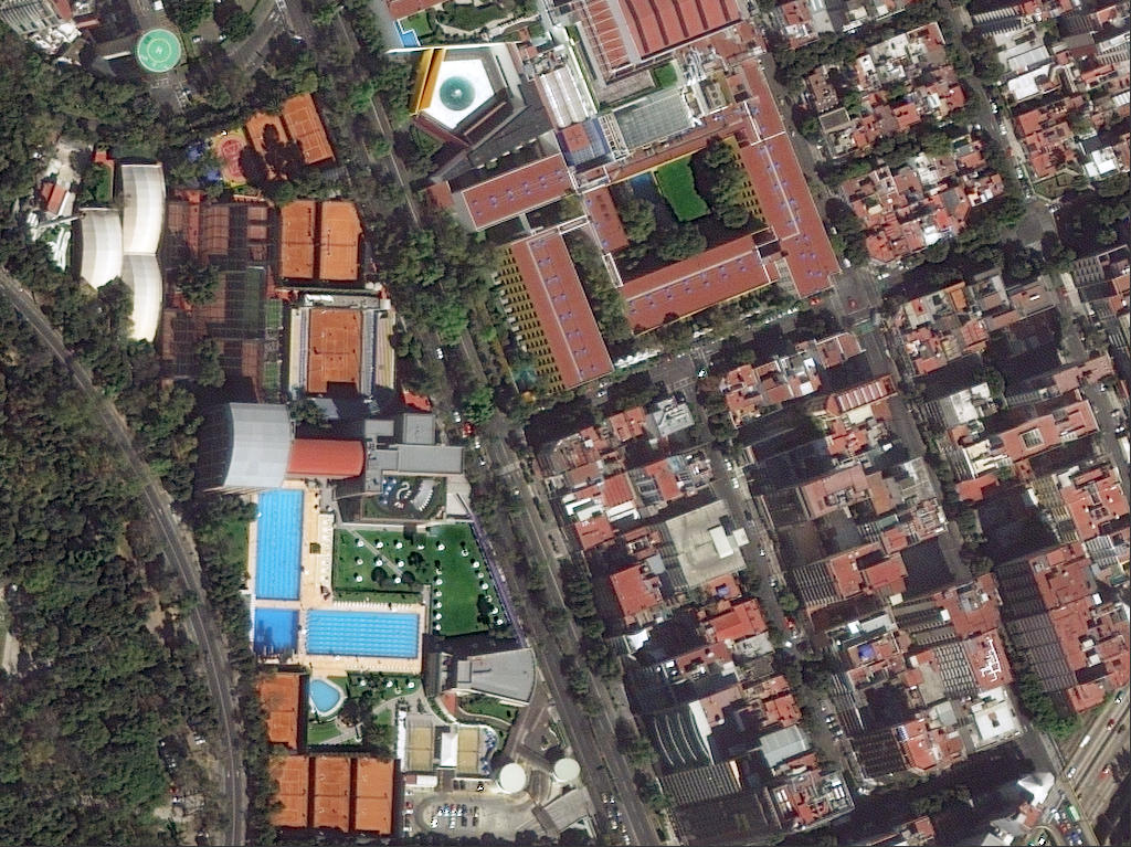
DigitalGlobe / Maxar Imagery API
DigitalGlobe / Maxar Imagery API is a commercial satellite imagery delivery service and set of APIs provided by Maxar Technologies (formerly DigitalGlobe) in the United States. It is characterized by its ability to deliver sub-meter resolution optical satellite imagery, captured by high-performance Earth observation satellites such as WorldView and GeoEye, through an online API. Users can flexibly search, visualize, and download both the latest and archived imagery, making it a key foundational service for geospatial analysis, decision support, and both commercial and public applications.
2026-01-23 13:38:25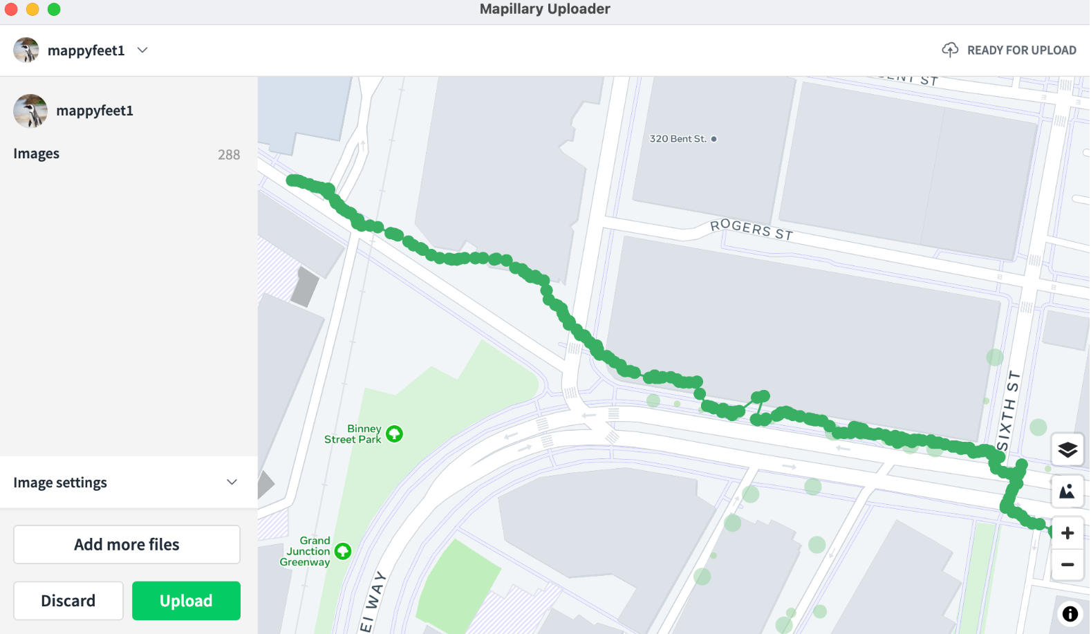
Mapillary Map Traces / GPX Service
The Mapillary Map Traces / GPX service is an interface for providing trajectory data accompanying street-level imagery collection, offered by Mapillary. It enables the publication and retrieval of movement paths (traces) corresponding to street-level images captured and uploaded by users as geospatial data. Primarily delivered in standard formats such as GPX, it provides user movement trajectories—from walking, cycling, or driving—as time‑series coordinate data, allowing spatially‑linked analysis and visualization alongside street‑level imagery. These trace data are highly compatible with open‑map ecosystems like OpenStreetMap (OSM) and serve as an important supplementary data source for real‑world road and route information.
2026-01-23 13:33:37
PLY (Polygon File Format / Stanford Triangle Format)
LY (Polygon File Format / Stanford Triangle Format) is a file format for three-dimensional data primarily used in 3D scanning and computer graphics. Originally developed at Stanford University, it is characterized by its ability to flexibly describe not only shape information such as point clouds and polygon meshes but also attributes like color, normal vectors, and transparency. With a simple yet highly extensible structure, PLY is widely utilized across research and industrial applications, playing a key role in areas such as 3D modeling, visualization, reverse engineering, and digital preservation of cultural heritage.
2026-01-23 13:25:36
XYZ Format
The XYZ format is one of the most fundamental and widely used point data formats for describing three‑dimensional positional information using X, Y, Z coordinate values. It is typically stored as a text (ASCII) file, with each line representing a single point containing planar coordinates (X, Y) and a height or depth value (Z). Thanks to its simple structure, the XYZ format is utilized across a broad range of fields, including topographic surveying, point‑cloud processing, 3D modeling, GIS, CAD, and remote sensing.
2026-01-22 18:54:59
DEM (Digital Elevation Model Format)
DEM (Digital Elevation Model) is a universal terrain data format and concept that represents ground surface elevation in a grid-based (raster) numerical form. Each grid cell stores a corresponding elevation value, enabling quantitative analysis of terrain undulation and shape. As a vendor-neutral general-purpose format, DEM is widely used and regarded as a fundamental and essential spatial dataset across various fields, including terrain analysis, cartography, simulation, disaster prevention, and environmental analysis.
2026-01-22 18:48:32
TER (Terragen Terrain File)
TER (Terragen Terrain File) is a proprietary terrain data file format used by the natural terrain generation software Terragen. Primarily designed for storing elevation information (heightmaps), it aims to represent realistic landforms such as mountains, hills, and valleys with high precision. While the TER format has been widely used in terrain modeling and the CG/VFX fields for its emphasis on visual realism, it is often treated as a supplementary or conversion format in the GIS domain.
2026-01-22 16:39:40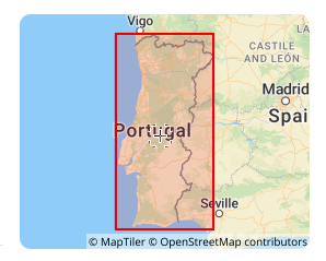
Lisbon 1890 (EPSG:4803)
Lisbon 1890 (EPSG:4803) is a regional non-geocentric datum established by Portugal at the end of the 19th century. It primarily provided a unified coordinate framework for the country's early terrestrial surveying and topographic mapping (for example, when combined with the Bonne projection to form EPSG:2963). As a national standard from a specific historical period, it has been completely superseded by modern geocentric datums (e.g., ETRS89). Its current value is limited solely to processing and converting legacy Portuguese data such as historical maps and cadastral archives from the late 19th to mid-20th century, which, after professional conversion, can be used for digital archiving and historical geographic analysis.
2025-12-29 16:45:37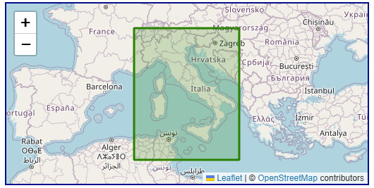
Roma40 (Rome 1940, EPSG:4806)
Roma40 (Rome 1940, EPSG:4806) is a regional, historical geodetic datum designed specifically for Italy and its surrounding regions (such as Sicily and Sardinia), and belongs to the geocentric coordinate system. Its core purpose was to provide a benchmark for official Italian surveying from the 1940s to the 1990s.
2025-12-29 16:38:56
ED87 (European Datum 1987, EPSG:4231)
ED87 (European Datum 1987, EPSG:4231) is a regional geodetic datum established in 1987 specifically for Europe, primarily Western Europe. It is a traditional geodetic datum designed to align the coordinate framework as closely as possible with the European geoid at the time and served as a key intermediate achievement in the modernization of European geodesy. Its primary application is in processing historical surveying data, topographic maps, and engineering drawings from Western Europe predating the 1990s. However, as a transitional datum based on terrestrial triangulation, its accuracy and global compatibility are now insufficient. Today, it is mainly used for scenarios such as historical data integration, digital archiving, and specialized research after being transformed into modern geocentric coordinate systems like WGS84 or ETRS89.
2025-12-29 16:30:44