Service

Albers Equal-area Conic Projection
Nov 24,2025
GISBox is a one-stop 3D GIS data editing, conversion and publishing platform that supports editing in multiple GIS formats such as OSGB/GEOTIFF/RVT, converting to 3DTiles/Terrain and publishing.
Introduction
Albers equal-area conic projection is an equal-area conic projection that utilizes two standard parallels. Compared to projections with only one standard parallel, this approach helps reduce distortion to some extent. It is best suited for mapping large continental areas extending predominantly in an east-west direction in the mid-latitudes and is commonly used for maps of the contiguous United States, Europe, and Australia.
Coordinate System Composition
- Central Meridian: Typically set to 105° East, serving as the central reference longitude for the projection.
- Standard Parallels: Two specified latitudes (e.g., 25°N and 47°N) ensure equal-area representation without length distortion along these parallels.
- False Easting and False Northing: Both set to 0.000000 to adjust the coordinate origin position.
- Latitude of Origin: Usually defined as 0°, serving as the latitude reference for the projection.
- Linear Unit: Meters are used as the unit of measurement.
Pros
- True Areal Proportions: The projection strictly preserves area accuracy, making it ideal for thematic maps such as those illustrating geography or population density where precise area representation is critical.
- Minimal Distortion in Mid-Latitudes: By utilizing two standard parallels (e.g., 25°N and 47°N), distortion is minimized in regions near these latitudes, with negligible length and area deformation.
- Broad Application: Widely adopted for small to medium-scale maps in China (e.g., 1:250,000 administrative or population distribution maps) and for national mapping in the United States.
Cons
- Shape Distortion: Significant shape distortion occurs at high latitudes, particularly in areas far from the standard parallels.
- High Distortion in Polar and Equatorial Regions: Unsuitable for large-scale mapping of polar or equatorial regions.
- Non-Conformality: Angles and directions are not preserved, making it inappropriate for applications requiring precise directional accuracy.
Application Scenario
The Albers Equal-Area Conic Projection is a map projection method that maintains true areal proportions, making it particularly suitable for large-scale thematic mapping of mid-latitude regions. It is commonly used for creating administrative division maps, population distribution maps, and relief maps. For example, China's relief maps adopt this projection with standard parallels at 25°N and 45°N. Additionally, small to medium-scale maps in China (e.g., 1:250,000 or smaller), such as the national 1:250,000 water resources spatial database, widely employ this projection with parameters including a central meridian at 110°E and standard parallels at 25°N and 47°N. By using two secant standard parallels, the projection ensures relatively uniform distortion, especially for continental landmasses extending in an east-west direction.
Example
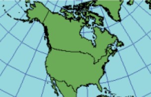
1. Albers projection.
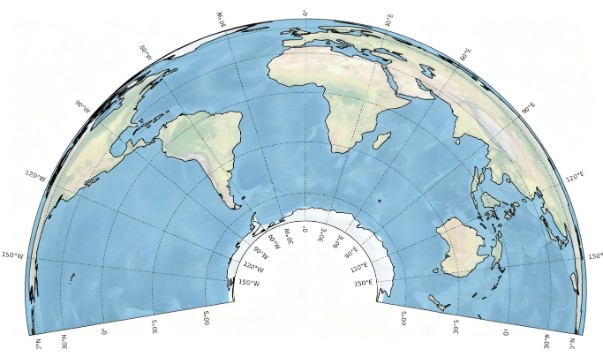
2. Albers equal-area conic projection.