Service

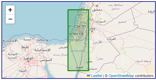
Israel TM Grid (Israeli National Grid | EPSG:2039)
Jan 23,2026
GISBox is a one-stop 3D GIS data editing, conversion and publishing platform that supports editing in multiple GIS formats such as OSGB/GEOTIFF/RVT, converting to 3DTiles/Terrain and publishing.
Introduction
Israel TM Grid (Israeli National Grid | EPSG:2039) is the official national projected coordinate system adopted by Israel, primarily used for surveying, mapping, and engineering construction within the country. This coordinate system is based on the Israeli national surveying system and employs a Transverse Mercator projection to facilitate precise measurements and map compilation in Israel and its surrounding regions. Although global positioning systems (such as WGS84) have gained widespread use, the Israel TM Grid remains highly valuable for local engineering, land management, and historical geospatial data applications.
Coordinate System Composition
Israel TM Grid (EPSG:2039) is a Transverse Mercator projection system based on the GCS_Israeli_1963 geographic coordinate system, which uses the Clarke 1880 ellipsoid. Its central meridian is set at 35°12'15" East, with a scale factor of 1.0000067, and coordinates are expressed in meters. This system covers the entire territory of Israel and parts of the Palestinian regions, making it suitable for medium- to large-scale mapping and engineering surveying.
Pros
- National Survey Standardization: Provides a unified coordinate framework for the entire country, supporting national-level surveying, land management, and infrastructure planning.
- High Local Accuracy: Optimized for Israel’s geographical characteristics, achieving millimeter to centimeter-level measurement accuracy within the national territory.
- Engineering-Friendly: Uses metric Cartesian coordinates, facilitating direct measurements in construction projects, cadastral surveys, and topographic mapping.
- Historical Data Continuity: Maintains compatibility with traditional Israeli surveying systems, enabling accurate interpretation and conversion of historical geographic data.
Cons
- Regional Limitations: Applicable only to Israel and its immediate surroundings, requiring complex coordinate transformations for cross-border applications.
- Non-Geocentric Reference: Based on a regional ellipsoid rather than a global geocentric system, resulting in systematic deviations from modern systems like WGS84.
- Limited International Interoperability: Faces compatibility challenges with neighboring coordinate systems and international standards, necessitating specialized transformation parameters.
- Technological Obsolescence: Gradually being replaced by modern Israeli coordinate systems based on the ITRF framework (such as ITM), with reduced adoption in new projects.
Application Scenario
The Israel TM Grid is primarily used for processing and modernizing historical surveying data within Israel. It serves as the foundational reference for interpreting pre-1990s topographic maps, cadastral records, military maps, and engineering drawings in Israel. This coordinate system supports professional applications such as historical land ownership verification, urban development evolution studies, infrastructure heritage management, and archaeological site localization. Additionally, it retains specialized value in national defense, border management, and regional planning, providing a crucial coordinate bridge for the vertical integration of Israel’s territorial spatial information.
Example
1. Israel TM Grid (EPSG:2039) .