Service

ED87 (European Datum 1987, EPSG:4231)
Dec 29,2025
GISBox is a one-stop 3D GIS data editing, conversion and publishing platform that supports editing in multiple GIS formats such as OSGB/GEOTIFF/RVT, converting to 3DTiles/Terrain and publishing.
Introduction
ED87 (European Datum 1987, EPSG:4231) is a regional geodetic datum established in 1987 specifically for Europe, primarily Western Europe. It is a traditional geodetic datum designed to align the coordinate framework as closely as possible with the European geoid at the time and served as a key intermediate achievement in the modernization of European geodesy. Its primary application is in processing historical surveying data, topographic maps, and engineering drawings from Western Europe predating the 1990s. However, as a transitional datum based on terrestrial triangulation, its accuracy and global compatibility are now insufficient. Today, it is mainly used for scenarios such as historical data integration, digital archiving, and specialized research after being transformed into modern geocentric coordinate systems like WGS84 or ETRS89.
Coordinate System Composition
ED87 (EPSG:4231) is a regional geodetic datum. Its core construction is based on a regional origin, designed to align the coordinate framework optimally with the European geoid. It is defined by three key elements: the physical framework of the European Triangulation Network, the mathematical model of the International 1924 Reference Ellipsoid, and a regional origin and orientation specifically for Europe.
Pros
- High Regional Accuracy for Its Time: Before satellite surveying became widespread, ED87, based on the European Retriangulation Network, achieved the highest possible accuracy within Europe under the technological conditions of its era, meeting regional surveying and mapping needs in the late 20th century.
- Achieved Regional Unification: It improved upon earlier disparate datums like ED50, establishing a relatively unified coordinate reference across Europe, which actively promoted the exchange and integration of geographic data within the continent.
- Bridged Transitional Eras: As an important transitional step from traditional ground-based surveying to satellite geodesy, ED87 laid the groundwork for later, more precise, and modern European datums like ETRS89.
Cons
- Technologically Outdated: As a non-geocentric datum based on terrestrial triangulation, its origin does not coincide with the Earth's center of mass, resulting in systematic deviations from the geocentric coordinate systems (e.g., WGS84) used by modern GNSS (like GPS), leading to poor compatibility.
- Limited Coverage: It is a strictly regional datum, applicable only to Europe. Using it in other parts of the world would introduce significant errors, lacking global applicability.
- Superseded by Modern Standards: With ETRS89 (highly compatible with WGS84) becoming the official European standard, ED87 has been phased out in practical production, scientific research, and commercial applications and is no longer a current, valid datum.
- Complex Data Conversion: Converting historical ED87 data to modern coordinate systems requires specific transformation parameters. The process is more complex than conversions between geocentric systems and may incur a loss of accuracy.
Application Scenario
The application scenarios of ED87 (EPSG:4231) are highly concentrated on processing geographic data heritage from a specific period. Its core purpose is to accurately interpret and convert coordinate information from paper-based topographic maps, cadastral records, or engineering drawings of Western Europe produced during the 1980s to 1990s based on the European Triangulation Network. This is done for objectives such as digital archiving, historical research, or legal verification. After converting to modern coordinate systems like ETRS89 or WGS84, these historical spatial data are integrated into current GIS systems.
Example
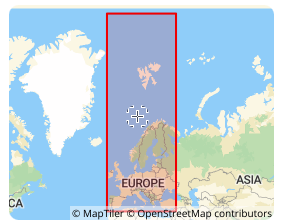
1. The covered area of the coordinate reference system according to the EPSG database.