Service

Roma40 (Rome 1940, EPSG:4806)
Dec 29,2025
GISBox is a one-stop 3D GIS data editing, conversion and publishing platform that supports editing in multiple GIS formats such as OSGB/GEOTIFF/RVT, converting to 3DTiles/Terrain and publishing.
Introduction
Roma40 (Rome 1940, EPSG:4806) is a regional, historical geodetic datum designed specifically for Italy and its surrounding regions (such as Sicily and Sardinia), and belongs to the geocentric coordinate system. Its core purpose was to provide a benchmark for official Italian surveying from the 1940s to the 1990s.
Coordinate System Composition
Roma40's structure clearly reflects its characteristics as a regional, traditional benchmark:
- Geometric framework: Based on the traditional triangulation network of Italy.
- Mathematical model: Adopts the International 1924 ellipsoid.
- "Center of geoid": The center of the ellipsoid is located to best fit the geoid of the Apennine Peninsula and surrounding areas, rather than the Earth's center of mass.
- Projection and zoning: In Italy, it is usually used in conjunction with the transverse Mercator projection and divided into multiple projection zones (e.g., Italy zone 1, zone 2).
Pros
- High Regional Accuracy: As a non-geocentric datum established based on Italy's domestic triangulation network, its ellipsoid origin was optimized to achieve extremely high fitting accuracy within the Italian Peninsula and surrounding areas. This met Italy's high-precision surveying needs for decades prior to the satellite era.
- Achieved National Unification: Historically, it unified the geodetic datum across Italy (including its major islands), ending potential regional standard confusion. This was crucial for national cartography, infrastructure development, and land management.
- Supported Long-Term Development: As Italy's official datum for approximately half a century, it steadily supported the country's economic development, urban planning, and geographic information accumulation, making an irreplaceable historical contribution.
Cons
- Technologically Outdated: Its non-geocentric nature results in fundamental, systematic deviations on the order of hundreds of meters compared to modern global satellite-based coordinate systems (e.g., WGS84, ETRF89), making it incompatible with GNSS (e.g., GPS) data.
- Extremely Limited Coverage: It is a strictly national datum designed solely for Italian territory and holds no application value outside this scope.
- Officially Deprecated: The Italian authorities officially adopted ETRF89 as the new national standard starting in the 1990s. Roma40 has been explicitly superseded and discontinued in both legal and practical production contexts.
- Complex and Non-Standardized Transformation: Converting to modern coordinate systems lacks a single global standard parameter. Transformation accuracy is highly dependent on regional transformation parameters or grid models, making the process error-prone if not handled correctly.
Application Scenario
The core application of Roma40 (EPSG:4806) is to process the historical geographical data heritage produced by Italy in the mid-to-late 20th century (approximately the 1940s to the 1990s) based on its national triangulation network. Specifically, this includes the accurate interpretation, digitization, and archiving of coordinates from paper topographic maps, cadastral archives, engineering drawings, and early GIS databases from that period. After completing the accurate conversion to modern geocentric coordinate systems (such as ETRF89/WGS84), this data can be integrated into the current system for specific fields such as legal boundary verification, historical geographical research, urban development analysis, and cultural heritage protection.
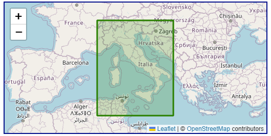
Example
1. The covered area of the coordinate reference system according to the EPSG database.