Service

DigitalGlobe / Maxar Imagery API
Jan 23,2026
GISBox is a one-stop 3D GIS data editing, conversion and publishing platform that supports editing in multiple GIS formats such as OSGB/GEOTIFF/RVT, converting to 3DTiles/Terrain and publishing.
Introduction
DigitalGlobe / Maxar Imagery API is a commercial satellite imagery delivery service and set of APIs provided by Maxar Technologies (formerly DigitalGlobe) in the United States. It is characterized by its ability to deliver sub-meter resolution optical satellite imagery, captured by high-performance Earth observation satellites such as WorldView and GeoEye, through an online API. Users can flexibly search, visualize, and download both the latest and archived imagery, making it a key foundational service for geospatial analysis, decision support, and both commercial and public applications.
File Structure
DigitalGlobe / Maxar Imagery API consists of multiple functional APIs and data services. The main components are as follows:
- Imagery Search API: Enables the search for available satellite imagery by specifying criteria such as acquisition date, cloud cover, resolution, viewing angle, and geographic extent. It also supports access to vast archives spanning several decades.
- Imagery Tiles API: Delivers imagery in tile format (comparable to XYZ/WMTS) for web maps and GIS clients, optimized for large-scale visualization and interactive display.
- Download API: Provides an interface for directly downloading orthorectified high-resolution satellite imagery for analysis and archiving purposes.
- Analytics-Ready Imagery (ARI): Offers radiometrically and geometrically corrected data optimized for AI/machine learning and time-series analysis.
- Authentication and Contract Management: Implements authentication based on subscription contracts, offering flexible billing models according to usage volume, area, and resolution.
Pros
- Very High Spatial Resolution: Provides commercial-grade resolution of up to 30 cm with the WorldView satellite constellation, enabling detailed identification of buildings, roads, and infrastructure.
- Extensive Global Coverage and Rich Archive: Offers global imaging capabilities and access to long-term historical imagery, making it suitable for change detection and time-series analysis.
- High Integrability through APIs: Easily integrates with GIS, web applications, and cloud analytics platforms via REST APIs, supporting automated workflow construction.
- Enterprise and Government-Grade Reliability: Widely adopted by defense, government, and international organizations, ensuring high data quality, availability, and support.
Cons
- High Cost: As a high-resolution, commercial-only data source, usage costs are higher compared to open data (e.g., Sentinel, Landsat), which can be a barrier for small-scale projects.
- Stringent Usage and Licensing Restrictions: Strict license limitations apply to redistribution, public disclosure, and secondary use, requiring careful review of contract terms based on intended applications.
- Requires Expertise: Optimizing search criteria, understanding radiometric characteristics, and preprocessing for analysis demand specialized knowledge in remote sensing and GIS.
- Limited Real-Time Capability: While near-real-time updates are possible, timeliness constraints exist compared to drone or aerial imagery.
Application Scenario
The Mapillary Map Traces / GPX service is used for verifying and updating street networks, understanding urban DigitalGlobe / Maxar Imagery API is widely used in specialized fields that require highly accurate and reliable ground information. In urban planning and infrastructure management, it supports monitoring of construction progress and land-use changes. In disaster prevention and crisis management, it aids in damage assessment before and after natural disasters and provides rapid situational awareness. It also plays a critical role in defense and security, border surveillance, resource exploration in energy and mining, and risk assessment in the insurance industry—where accuracy and objectivity are essential for decision support. Furthermore, it serves as an advanced geospatial analysis platform for automated object detection and change analysis when combined with AI and machine learning.
Example
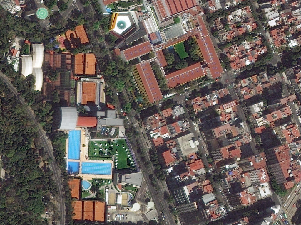
1. Example of 50 cm imagery tiles accessible via DigitalGlobe Maps API service.
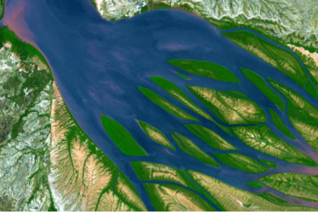
2. Maxar DigitalGlobe – Overview.
File Opening Mode
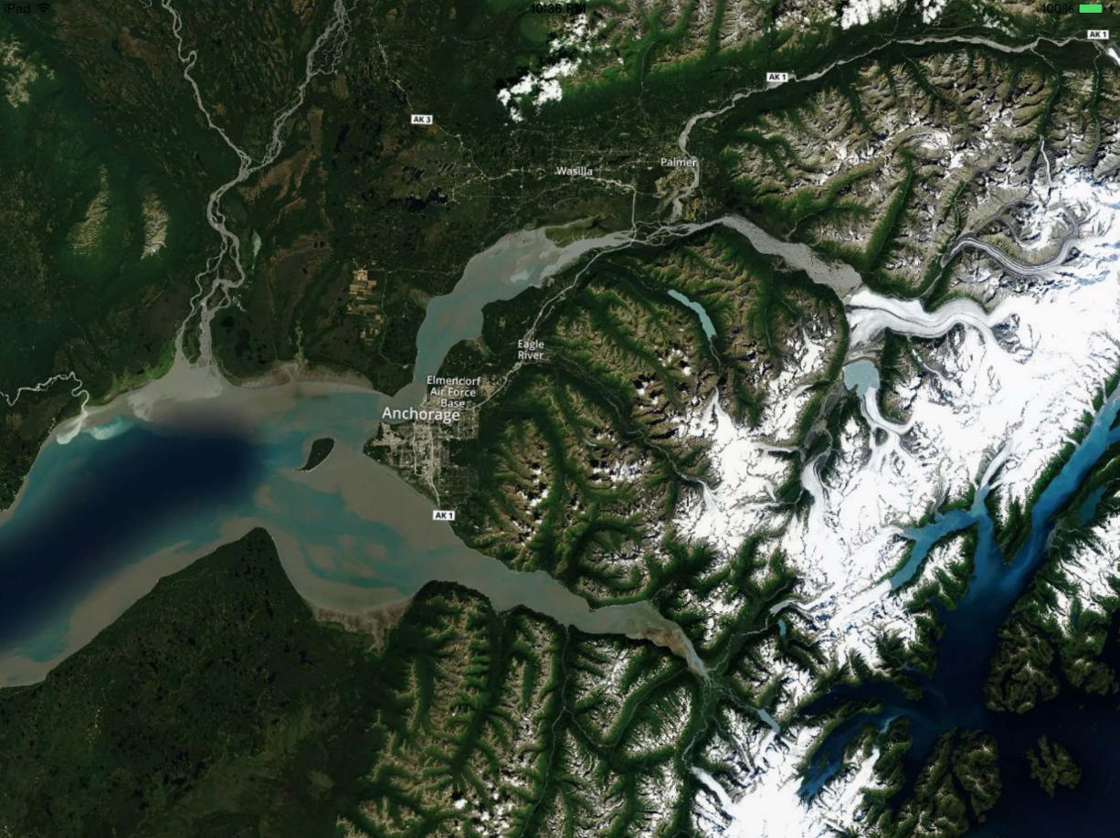
1. Recent imagery layer of Anchorage, Alaska, showing roads.