Service

Eckert IV
Dec 29,2025
GISBox is a one-stop 3D GIS data editing, conversion and publishing platform that supports editing in multiple GIS formats such as OSGB/GEOTIFF/RVT, converting to 3DTiles/Terrain and publishing.
Introduction
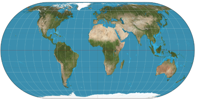
Eckert IV (Eckert's Fourth Projection) is an equal-area map projection proposed in 1906 by German mathematician Max Eckert. Designed for representing the entire Earth on a world map, it accurately preserves area while distributing shape distortions relatively evenly. It is commonly used in GIS and thematic mapping for visually representing statistical data and distribution information. It is implemented by ESRI as ESRI:54012.
Coordinate System Composition
Eckert IV is a projection method itself and not a file format, but it is defined and structured in GIS software through the following elements:
- Projection Type: Pseudocylindrical Equal-Area Projection. All parallels are drawn as horizontal straight lines, with only the central meridian appearing as a straight line.
- Central Meridian: Typically set at 0° longitude but can be adjusted to any longitude as needed.
- Shape of Parallels and Meridians: Parallels are evenly spaced straight lines, while meridians are drawn as curves, compressing more horizontally at higher latitudes.
- Area Preservation Property: Any area on the Earth's surface maintains its correct proportional area on the map.
- Coordinate Reference System Definition: Defined by ESRI as ESRI:54012, with projection transformations based on geographic coordinate systems such as WGS84.
Pros
- Accurate Area Representation: As an equal-area projection, it enables precise comparisons of the areas of continents, countries, and oceans, making it suitable for statistical and thematic maps.
- Visual Balance for World Maps: Distortions are not concentrated in specific regions, resulting in a relatively balanced overall shape.
- Suppresses Excessive Distortion in High-Latitude Regions: Compared to the Mercator projection, area exaggeration around Greenland and Antarctica is significantly reduced.
- Standard Support in GIS Software: Compatible with major GIS platforms like ArcGIS and QGIS, making it ideal for displaying global-scale data.
Cons
- Inevitable Shape Distortions: Prioritizing area preservation leads to horizontal distortion of land shapes, particularly at low and mid-latitudes.
- Inaccurate Angles and Distances: Unsuitable for nautical charts, surveying, or distance measurement purposes.
- Not Ideal for Regional Maps: Designed for global representation, it is less suitable for detailed maps at the country or city level.
- Requires Familiarity for Intuitive Recognition: Its shape may appear unfamiliar compared to common cylindrical or equidistant projections.
Application Scenario
The Eckert IV projection is well-suited for geographic analysis and thematic mapping where accurate area comparisons on a global scale are essential. For example, it can precisely represent area differences between regions when visualizing global statistical data such as population distribution, forest area, land use, climate zones, or environmental impact. Additionally, it is often adopted in educational maps, reports, and materials from international organizations as a world map that emphasizes visual fairness, and it serves as an effective base map for presenting the overall picture of GIS analysis results.
Example
1. A map projection using Eckert's equal-area projection (Fourth Projection) centered on Greenwich.
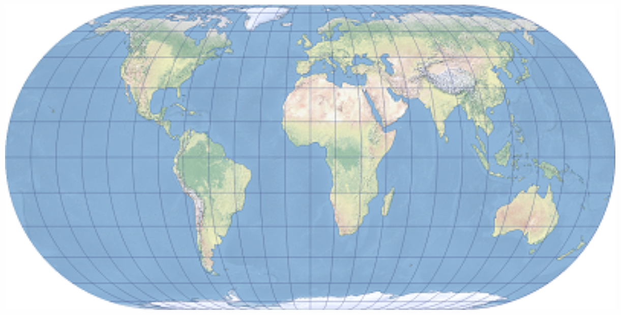
2. Eckert's equal-area projection.