Service

Compound CRS
Nov 24,2025
GISBox is a one-stop 3D GIS data editing, conversion and publishing platform that supports editing in multiple GIS formats such as OSGB/GEOTIFF/RVT, converting to 3DTiles/Terrain and publishing.
Introduction
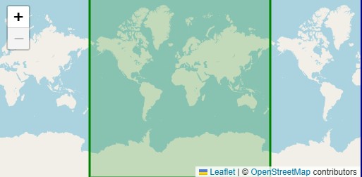
A Compound CRS achieves unified representation of multi-dimensional spatial data by combining multiple coordinate reference systems (CRS). For example, it integrates a planar coordinate system (e.g., EPSG:7661) with an elevation system (e.g., EPSG:3855) to form a complete "planar + elevation" spatial description. Its core features include ensuring consistency between horizontal and vertical coordinate systems through associated parameters (such as ellipsoids and datums), making it suitable for fields requiring simultaneous expression of planar positions and elevations, such as terrain modeling and 3D GIS analysis. Technically, a Compound CRS typically comprises a horizontal CRS and a vertical CRS, unified through nested or associated parameters.
Coordinate System Composition
- Global Coordinate System: Establishes the geometric model, determining the position and orientation of components in space. It typically aligns with the coordinate system used when importing CAD models.
- Ply Coordinate System: A type of local coordinate system used to define the orientation of laminate plies, specifying the fiber direction of the 0° ply.
- Material Coordinate System: Associated with material properties, this system describes material constitutive relationships or fiber directions.
- Section Coordinate System: A local coordinate system for specific cross-sectional analyses, commonly used in structural mechanics for stress or strain calculations.
Pros
- Unified Multi-Dimensional Data Representation: By combining horizontal (e.g., planar) and vertical (e.g., elevation) coordinate systems, it enables comprehensive spatial data descriptions, suitable for complex scenarios like terrain modeling and flood simulation.
- Accurate Simulation of Material Behavior: In composite material analysis, distinguishing between global, ply, and other coordinate systems allows precise definition of anisotropic material properties and directions, enhancing simulation accuracy.
- High Flexibility: Supports dynamic adjustments (e.g., automatic path synchronization when workpiece coordinates are updated), facilitating applications involving external axis movements or conveyor guides.
Cons
- High Complexity: Requires precise parameter settings for subsystems (e.g., ellipsoids, datums), increasing modeling difficulty and computational costs.
- Economic Burden: High raw material and processing costs for composites further amplify the financial pressure of analysis.
- Compatibility Challenges: Complex conversions between local coordinate systems (e.g., parametric systems) and global geocentric systems (e.g., GPS) may impact data integration accuracy.
Application Scenario
The Compound CRS enables unified representation of multi-dimensional spatial data by combining horizontal (e.g., planar) and vertical (e.g., elevation) coordinate systems. It is widely used in terrain modeling, flood simulation, and 3D GIS analysis. In engineering, it facilitates precise simulation of anisotropic behaviors in composite materials, such as failure mode analysis of laminates, while supporting dynamic adjustments for applications like external axis movements or conveyor guides. In scientific research, Compound CRS plays a key role in data fusion for smart city maps, traffic flow optimization, and describing object motion trajectories in physics and computer graphics. Its core strength lies in integrating spatial information across dimensions, though careful attention is needed to address parameter complexity and computational costs.
Example
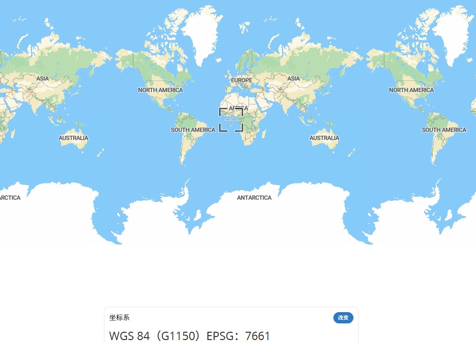
1. WGS84(G1150) EPSG:7661.
2. Antarctica-Pennell Coast Region-EPSG: 3855.