 Service

OpenAerialMap API
Jan 23,2026
GISBox is a one-stop 3D GIS data editing, conversion and publishing platform that supports editing in multiple GIS formats such as OSGB/GEOTIFF/RVT, converting to 3DTiles/Terrain and publishing.
Introduction
OpenAerialMap API is a public API service for sharing and accessing aerial and drone imagery (aerial photographs and orthoimagery) operated under the principles of open source. It is primarily led by communities such as the Humanitarian OpenStreetMap Team (HOT) and provides access to metadata and actual imagery data worldwide for purposes including disaster response, humanitarian aid, research, and public use. Through the API, users can search and retrieve aerial imagery based on criteria such as geographic area, acquisition date, resolution, and license terms, promoting the reuse and transparency of geospatial data.
File Structure
The OpenAerialMap API adopts a decentralized architecture that does not centrally host the imagery itself, but instead primarily provides a "metadata catalog" and "links to delivery sources."
- Metadata Catalog: Manages standardized metadata for each aerial image, including coverage area (bounding box), acquisition date and time, spatial resolution, sensor type, provider, and usage license.
- Search & Filter API: Allows searches based on geographic extent, time, resolution, cloud cover, platform (aircraft, drone, or supplementary satellite), and returns results in GeoJSON format.
- Data Reference Links: Actual imagery data is stored across cloud storage or external delivery services (e.g., S3, tile servers), with the API providing URLs for accessing them.
- Standard Format Compatibility: Ensures compatibility with widely used GIS and web‑map formats such as orthoimagery (GeoTIFF) and tile services (XYZ/TMS).
Pros
- High Transparency as Open Data: Offers aerial imagery metadata freely accessible to anyone, with clear license terms that make it easy to determine whether reuse or redistribution is permitted.
- Strong Alignment with Disaster Response and Humanitarian Aid: Enables quick search and retrieval of up‑to‑date aerial imagery released soon after disasters, supporting damage assessment, aid planning, and on‑ground mapping activities.
- Flexible API‑Based Integration: Its RESTful API facilitates easy integration into GIS, web maps, analysis pipelines, and data workflows, making it suitable for automation and large‑scale processing.
- Scalable Decentralized Design: By not centrally hosting the actual data, it allows continuous addition of new providers and regional data, supporting global expansion.
Cons
- Inconsistent Data Quality: Since data is aggregated from multiple providers, variations exist in resolution, geometric accuracy, acquisition conditions, and quality assurance levels.
- Limited Coverage: The data does not uniformly cover the entire globe and tends to concentrate in disaster‑prone regions or areas with active humanitarian activities.
- Dependence on Data Source Availability: Since the API only provides links, performance can be affected by the availability and network speed of external storage services.
- Potential Constraints for Commercial Use: Licenses vary by dataset, and some may restrict commercial use or redistribution, requiring careful review before use.
Application Scenario
The OpenAerialMap API is used in disaster response and humanitarian aid for damage assessment and situational awareness, as well as in supporting OpenStreetMap (OSM) editing, urban change monitoring, environmental surveys, academic research, and educational purposes. Its strength lies in its ability to quickly integrate the latest aerial imagery into existing GIS or web maps, especially in scenarios where speed and openness are critical. It is also suitable for automating tasks such as periodic image collection, comparative analysis, and visualization when embedded into custom analysis platforms or data pipelines.
Example
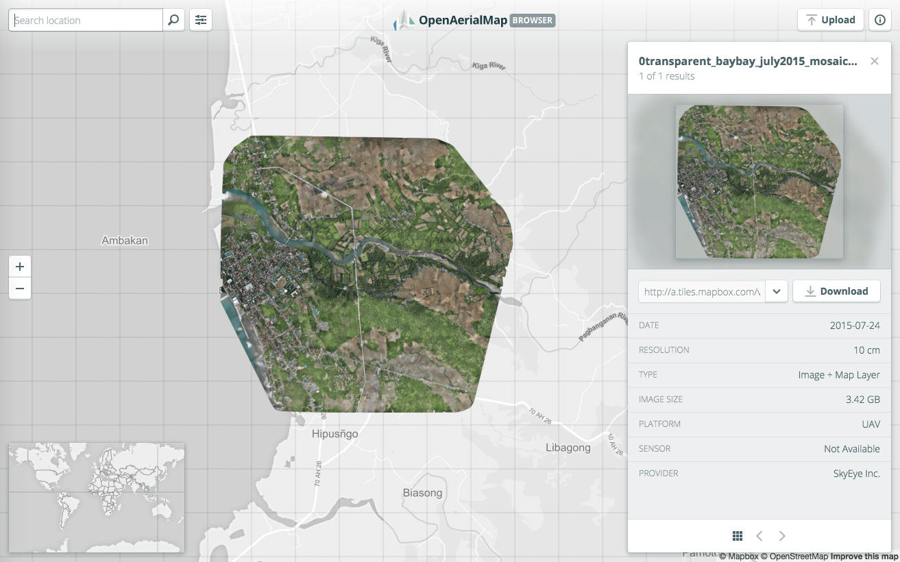
1. Search, share, and publish imagery on OpenAerialMap.
File Opening Mode
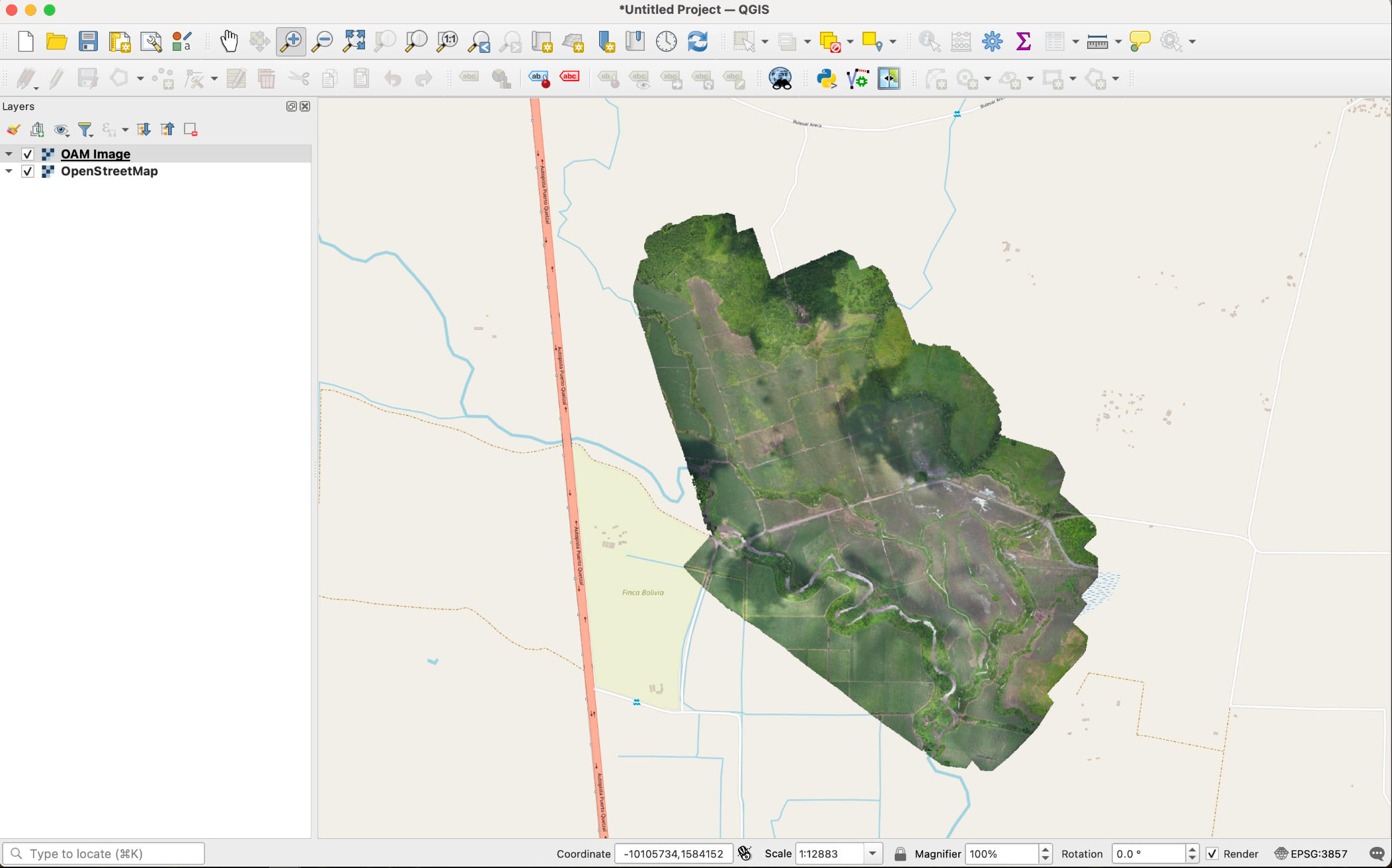
1. Open files downloaded from OpenAerialMap in QGIS.
Related GIS Services
References
- https://docs.openaerialmap.org/browser/user-guide/
- https://developmentseed.org/projects/openaerialmap/