 Service

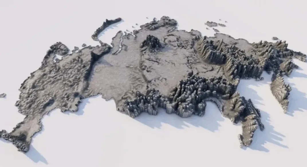
SXF (Russian State Surveying Format)
SXF (Russian State Surveying Format) is a proprietary format used by the Russian Federation to store and process geospatial data. It is primarily used in national surveying and mapping projects, such as topographic maps and cadastral surveys. This format supports structured storage of both vector and raster data, including coordinate systems and attribute tables, and complies with Russian national surveying and mapping standards. Designed to balance data accuracy and localization requirements, it is commonly used by government surveying and mapping agencies and related professional software.
2025-10-31 14:48:40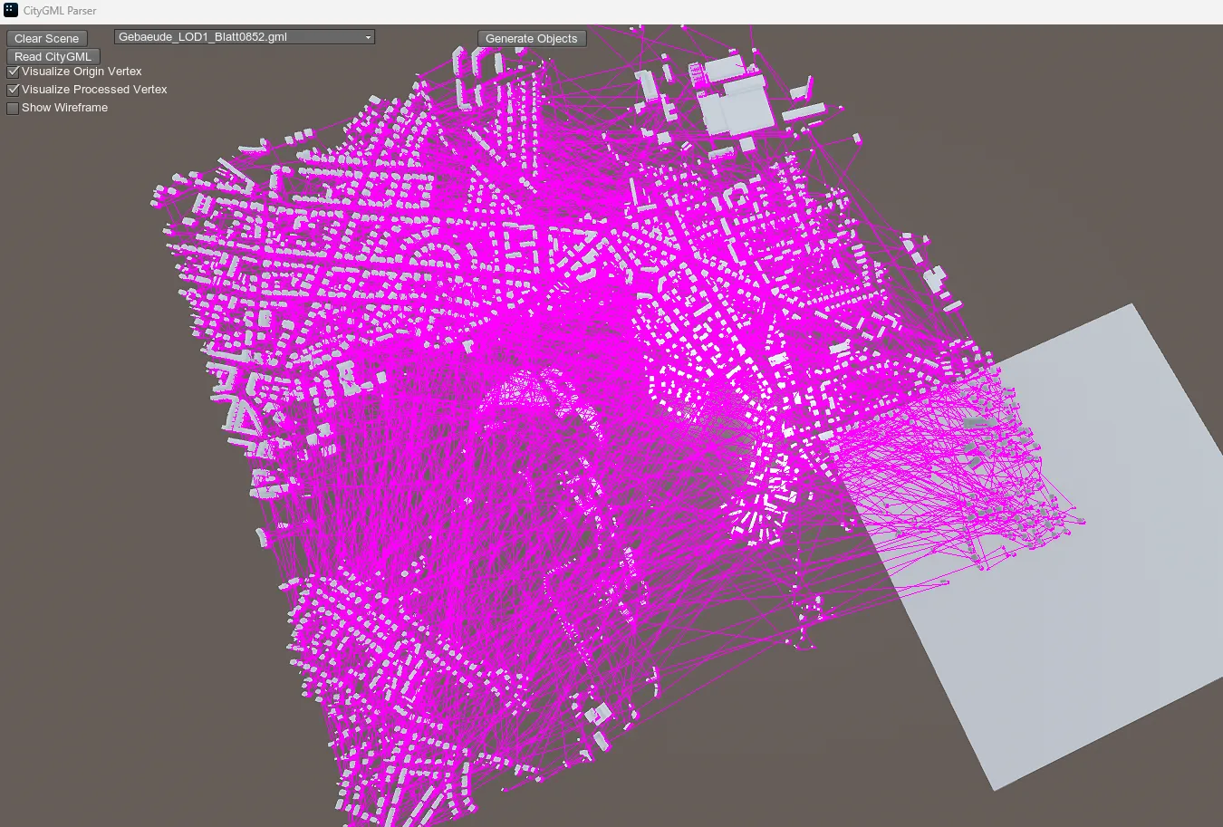
CityGML (City Geography Markup Language)
CityGML, an international standard for the exchange of 3D city model data developed by the Open Geospatial Consortium (OGC), uses XML encoding to uniformly describe the geometric, topological, semantic, and appearance attributes of urban elements.
2025-10-31 13:52:47
VRML (Virtual Reality Modeling Language)
VRML is the abbreviation of Virtual Reality Modeling Language. It was created mainly to solve the problem of realizing 3D animation effects and user interaction based on 3D objects in web pages. VRML files are usually used to describe 3D virtual environments, containing information such as vertices, edges, and colors of polygons. Using VRML, developers can create interactive 3D scenes that can be displayed on web pages. VRML files use the extension .wrl (world file) and are stored in text format, which has good readability and is easy to edit manually.
2025-09-16 19:31:28
GRIB (GRIDded Binary)
GRIB (GRIDded Binary) is a standard file format for storing and transmitting meteorological data, designed by the World Meteorological Organization (WMO). It is mainly used to describe rasterized meteorological data, such as temperature, humidity, wind speed, precipitation, etc. GRIB files store data in binary form, which is efficient and has a high compression rate, so it has become one of the main data formats in the meteorological field.
2025-09-16 19:22:05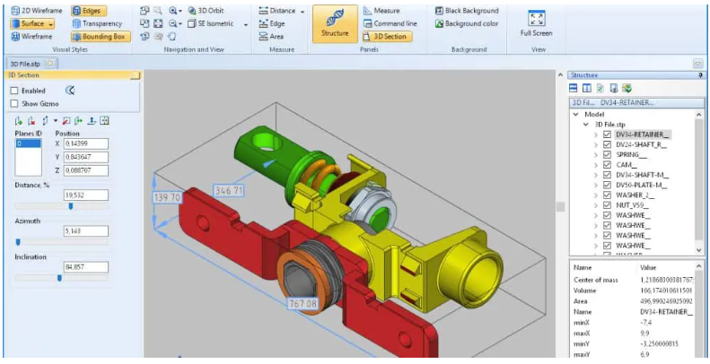
STEP (Product Model Data)
The full name of STEP is Standard for the Exchange of Product Model Data. It is an international standard 3D CAD data exchange format. The standard number is IS10303. STEP file is an internationally used 3D model data exchange format. The extension is usually step or .stp. It can share data between different CAD software, which is very convenient.
2025-09-16 14:48:20
RVM (AVEVA Review Model)
RVM is a 3D model data storage format developed by the British company AVEVA for the Plant Design Management System (PDMS). It is mainly used to store 3D model information such as pipelines, equipment, and structures of factory facilities (such as petrochemical plants and power stations). It supports both text (TextRVM) and binary (BinaryRVM) formats, the latter of which is more common and has higher storage efficiency.
2025-09-16 14:48:19
SketchUp
SketchUp is a 3D modeling software developed by Trimble, with the core concept of “making 3D modeling as natural as sketching with a pencil”. It significantly lowers the threshold of 3D design through a minimalist interface and intuitive push-pull modeling tools (such as drawing lines to create surfaces and extruding to create bodies), and is suitable for quickly building solution prototypes in the fields of architecture, interior design, and landscape. Its unique advantage lies in the balance between professionalism and ease of use. 80% of users can master basic operations within 3 hours.
2025-09-16 14:48:19
PDS Design Review
PDS (Plant Design System) Design Review is a solution for performing design reviews using 3D models, primarily in plant design and large facility construction projects. It visually verifies design components such as piping, equipment, and structures through interactive 3D visualization, enabling interference checks and early detection of design errors.
2025-09-16 14:48:18
MicroStation
MicroStation is a high-performance CAD (Computer Aided Design) software developed by Bentley Systems in the United States. It is widely used for design, modeling, and drawing creation in the fields of infrastructure, civil engineering, architecture, energy, and transportation, and supports both 2D and 3D drawing and visualization. MicroStation has a strong track record, especially in government agencies and large-scale infrastructure development projects, and is well-known as a professional tool with precision design and high compatibility.
2025-09-16 14:48:17