 Service

Inventor
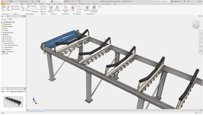
Autodesk Inventor is a 3D mechanical CAD (Computer-Aided Design) software developed and provided by Autodesk, and is mainly used in the fields of manufacturing and machine design. It is equipped with a wide range of functions such as assembly design, drawing creation, simulation, piping and cable design, sheet metal modeling, and welding design, centered on parametric modeling, and can digitize and streamline a series of processes from the design of complex machine parts to prototyping and manufacturing. Along with SolidWorks, it is one of the professional 3D CAD software widely used around the world.
2025-09-16 14:48:17
Parasolid
Parasolid is a core technology of Siemens for accurate geometric modeling that is widely used in the fields of 3D computer-aided design (CAD), computer-aided engineering (CAE) and computer-aided manufacturing (CAM). It also plays an important role in GIS (Geographic Information System) processing of complex spatial data scenes involving high-precision 3D terrain, building models, etc. It stores and exchanges accurate geometric information of 3D models in a neutral file format, providing strong support for data interaction between different software.
2025-09-16 14:48:16
IGES (Initial Graphics Exchange Specification)
**IGES (Initial Graphics Exchange Specification) **is an intermediate file format for exchanging geometric data such as drawings and 3D models between CAD (Computer-Aided Design) systems. It was established by the American National Standards Institute (ANSI) in 1980 with the aim of ensuring compatibility between different CAD software. It has been widely used as a standard format for sharing and reusing design data of parts and structures between vendors, especially in the manufacturing and mechanical design industries.
2025-09-16 14:48:16

JTOpen
JTOpen is not a GIS software in the traditional sense. It is a set of open source class libraries for interacting with IBM i (formerly OS/400) systems in the Java language environment. However, it can play an important role in GIS application scenarios involving the association of geospatial data with IBM i systems.
2025-09-16 14:48:15

IFC (Industry Foundation Classes)
IFC (Industry Foundation Classes) is an open BIM (Building Information Modeling) file format widely used in the construction industry. The IFC format was developed by buildingSMART, an international building standards organization, to promote data sharing and collaboration between different software tools in the construction industry. It is an open standard for describing all relevant data and information in construction and building engineering projects, such as buildings, equipment, structures, materials, etc. This allows information in the building design, engineering and construction process to flow seamlessly between different software.
2025-09-16 14:48:15
Autodesk Maya
Autodesk Maya is a professional-grade 3D computer graphics software developed and provided by Autodesk. It is widely used in industries such as film, animation, games, commercials, and architectural visualization, and is suitable for scenes that require high-level 3D modeling, animation, rendering, and simulation.
2025-09-16 14:48:14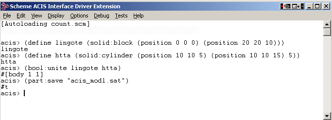
ACIS SAT
ACIS SAT (Standard ACIS Text) is a 3D geometric information format mainly used for processing 3D city models and geospatial data. ACIS is a solid modeling kernel developed by Spatial (now Dassault Systèmes) in the United States, and SAT is the most commonly used text format file saving method in ACIS.
2025-09-16 14:48:14
Autodesk Navisworks
Autodesk Navisworks is a BIM integrated review software developed by Autodesk. It features the ability to integrate, validate, and simulate multiple 3D models (Revit, AutoCAD, Civil 3D, etc.) and is suitable for fields such as architecture, civil engineering, and plant design.
2025-09-16 14:48:13