
 Service

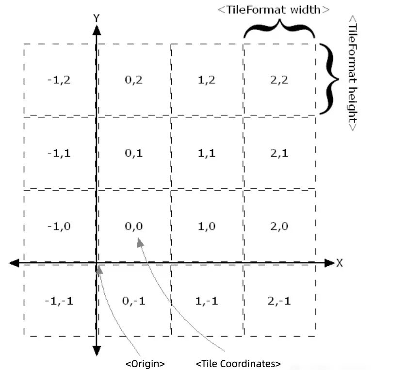
Web Map Tile Service (WMTS)
Web Map Tile Service (WMTS), also known as Web Map Tile Service, is a solution that uses pre-generated tiles to provide electronic map services. The WMTS standard defines some operations that allow users to access tile maps. WMTS provides a standardized solution for publishing digital map services using a predefined tile method, making up for the inability of WMS (Web Map Service) to provide tiled maps. The purpose of the WMTS service is to provide services for tile maps.
2025-09-16 14:47:12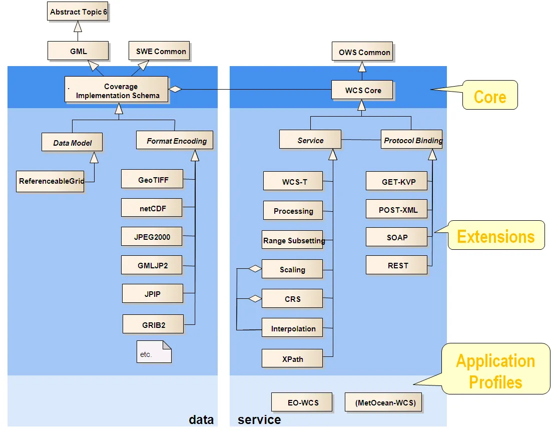
Web Coverage Service (WCS)
**Web Coverage Service (WCS) **is a geographic information service protocol based on the Open Geospatial Consortium (OGC) standard. It is designed to provide raster data (Coverage Data), allowing users to access and obtain geospatial coverage data through the Internet. Coverage data contains physical quantities or phenomena related to space, such as temperature, rainfall, altitude, etc. These data are usually stored in the form of regular grids or irregular grids, and are widely used in environmental monitoring, meteorological analysis, remote sensing data sharing and other fields.
2025-09-16 14:47:12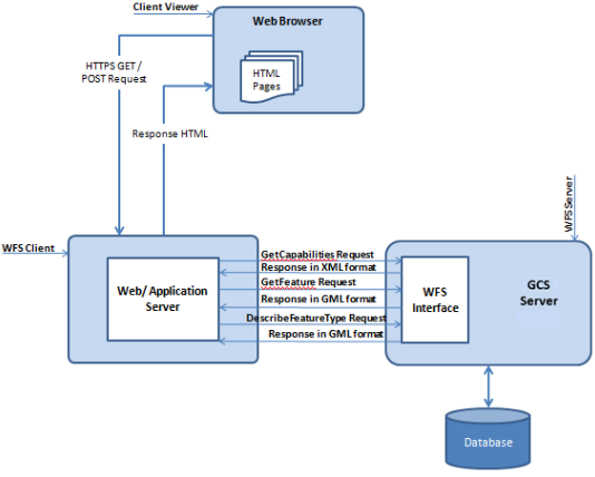
Web Feature Service(WFS)
Web Feature Service (WFS) is a service for online sharing and interoperability of geographic feature data in a network environment. It is based on a distributed computing platform that supports the Hypertext Transfer Protocol (HTTP) and provides functions such as query, acquisition, creation, locking, update, and deletion of geographic features and their attribute data. WFS uses Geography Markup Language (GML) to describe geographic feature data and defines a variety of operations to implement these functions, including GetCapabilities, DescribeFeatureType, GetFeature, LockFeature (LockFeature, which may not be included in some implementations), and Transaction.
2025-09-16 14:47:11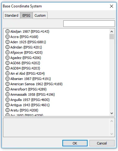
Amersfoort (EPSG:4289)
**Amersfoort (EPSG:4289) **is a widely used geographic coordinate system in the Netherlands, using Bessel 1841 as the base ellipsoid, with the geodetic base point at Amersfoort. This coordinate system has long played an important role in land surveying, mapping, and infrastructure development in the Netherlands. EPSG:4289 uses geographic coordinates (latitude and longitude), making it suitable for expressing wide-area location information on the Earth’s surface.
2025-09-16 14:47:11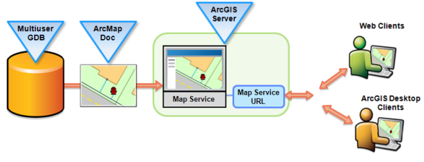
Web Map Service (WMS)
Web Map Service (WMS) is a standard protocol defined by the Open Geospatial Consortium (OGC) for requesting and displaying geospatial map images over the Internet. These images are generated from geographic data and are usually displayed in raster formats (such as PNG, JPEG). The core function of WMS is to provide users with visualization of geographic data through standardized HTTP requests without directly delivering the data itself.
2025-09-16 14:47:11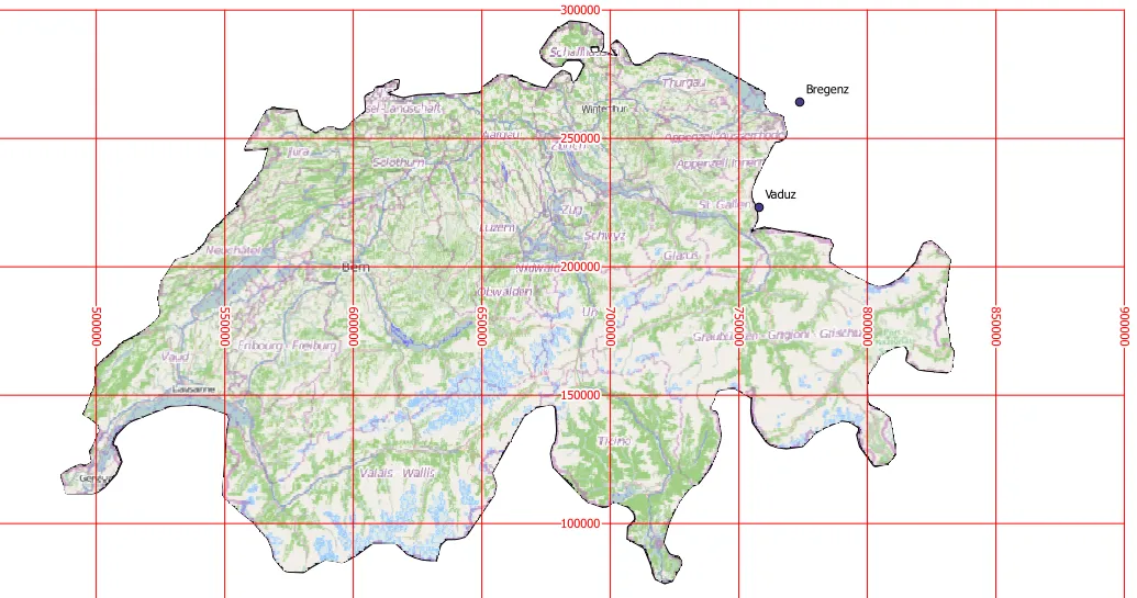
CH1903 (Swiss Coordinate System 1903 | EPSG:4149)
CH1903 is the widely used national coordinate system of Switzerland, based on the geodetic datum established in 1903. It is a projection coordinate system covering the whole of Switzerland, developed to enable precise geospatial information management and mapping of a country with mountainous terrain. The reference ellipsoid used is Bessel 1841, and the projection method is the Oblique Mercator Projection. This coordinate system has long been used by the Swiss National Cartographic Office (Swisstopo) and has become a standard in many fields such as topographic mapping, surveying, civil engineering and infrastructure planning. In recent years, Switzerland has gradually transitioned to the higher-precision CH1903+ (EPSG:2056) coordinate system, but a large amount of historical data is still stored based on CH1903.
2025-09-16 14:47:11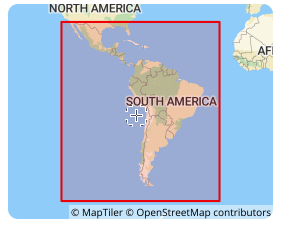
SIRGAS 2000 (South American Datum | EPSG:4674)
**SIRGAS 2000 **is a geocentric reference frame for Central and South America, which aims to define and implement a unified reference frame for Central and South America that is consistent with ITRF. Its ellipsoid adopts GRS 1980, with a major semi-axis of 6378137 meters, an oblateness of 298.257222101, the Greenwich meridian as the prime meridian, and the angle unit is degree. SIRGAS 2000 was established in 2000, consistent with the ITRF2000 framework, with a reference epoch of 2000.0. It is a regional encryption of ITRS in South America, achieved through a network of about 200 continuously operating stations (SIRGAS-CON) throughout Latin America and the Caribbean.
2025-09-16 14:47:10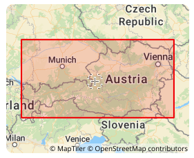
MGI (Militar-Geographische Institut | EPSG:4312)
MGI coordinate system was established by the Austrian Military Geographical Institute. It is a local coordinate system based on the Bessel ellipsoid and is mainly used for geographic information representation and spatial positioning in Austria. It uses the Transverse Mercator projection, with the central meridian at 13°20′ east longitude, the latitude of the projection origin at 0°, the easting offset of 1,500,000 meters, and the northing offset of 0 meters. It is a variant of the Gauss-Krüger projection and is widely used in Austria in many fields such as topographic mapping, land management, urban planning, and transportation planning, providing an accurate spatial reference frame for these fields.
2025-09-16 14:47:10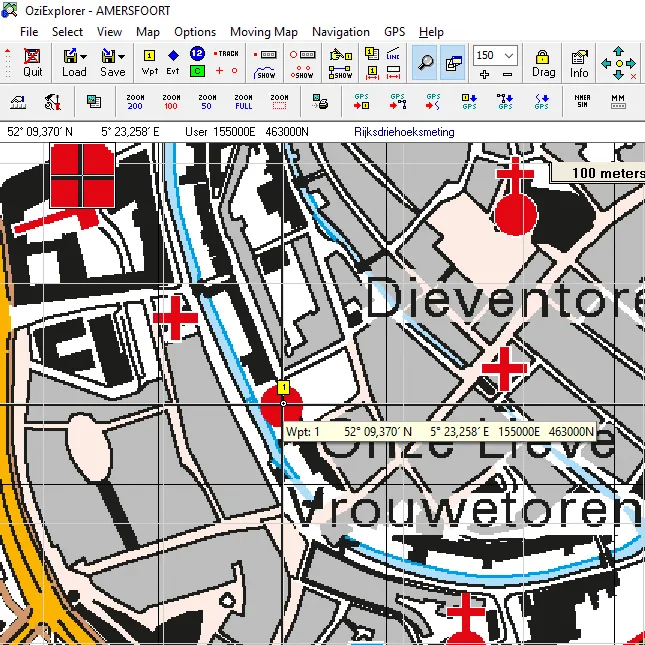
RD New (Rijksdriehoeksmeting New | EPSG:28992)
RD New (Rijksdriehoeksmeting New) is the national reference coordinate system of the Netherlands and the standard projection coordinate system for geographic information measurement and map production. The coordinate system is based on the Transverse Mercator Projection, with Amersfoort as the origin. It is widely known as EPSG code 28992. The system is designed to manage spatial data throughout the Netherlands with high accuracy and is currently widely used in public and private fields such as land management, urban planning, infrastructure design, and disaster response.
2025-09-16 14:47:10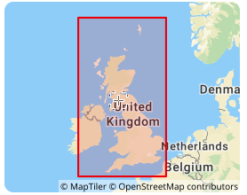
OSGB36 (Ordnance Survey Great Britain 1936 | EPSG:4277)
OSGB36 is the UK national coordinate system, the full name is Ordnance Survey Great Britain 1936, and its EPSG code is 4277. This coordinate system is based on the Airy 1830 ellipsoid and was developed by the Ordnance Survey of the United Kingdom. It is the national datum for topographic surveying in the United Kingdom. In the fields of geographic information systems (GIS), cartography, and engineering surveying in the United Kingdom, OSGB36 has been widely used, providing a unified reference framework for geospatial data in the United Kingdom, allowing geographic data from different sources to be integrated and analyzed in the same coordinate system.
2025-09-16 14:47:10