Google Maps Platform
Google Maps Platform is one of the most widely used map services in the world, providing detailed map data, navigation, real-time traffic information, Street View imagery, and more. It is a cloud-based map service provided by Google, and through a wide range of APIs and SDKs, developers can integrate map display, route guidance, spot search, and other functions into their own applications. It is used in a wide range of industries, including logistics, retail, and mobility.
2025-11-05 14:20:33Routing API
Reverse Geocoding API is a technical interface that converts longitude and latitude coordinates into human-readable addresses. It automatically returns the corresponding structured address information (such as "Tiananmen Square, Dongcheng District, Beijing") by inputting GPS coordinates (such as 116.404,39.915), and supports the attachment of surrounding POI (points of interest) data. This service is widely used in map navigation, logistics tracking, location analysis and other scenarios, and is one of the core components of LBS (location-based services).
2025-11-05 14:19:20Reverse Geocoding API
Reverse Geocoding API is a technical interface that converts longitude and latitude coordinates into human-readable addresses. It automatically returns the corresponding structured address information (such as "Tiananmen Square, Dongcheng District, Beijing") by inputting GPS coordinates (such as 116.404,39.915), and supports the attachment of surrounding POI (points of interest) data. This service is widely used in map navigation, logistics tracking, location analysis and other scenarios, and is one of the core components of LBS (location-based services).
2025-11-05 14:17:26LandsatLook Viewer API - USGS Landsat Satellite Imagery Service
USGS Landsat Look Viewer API is an online tool provided by the United States Geological Survey (USGS) that allows users to browse and download Landsat satellite images since 1972, supporting multiple data types and advanced query functions. LandsatLook Viewer API aims to provide Geographic Information System (GIS) users with an efficient and convenient way to obtain and analyze Landsat images, and is an important tool for remote sensing research and environmental monitoring. Users can obtain more detailed instructions and development support by reading the official documentation.
2025-11-05 14:12:20Web Feature Service(WFS)
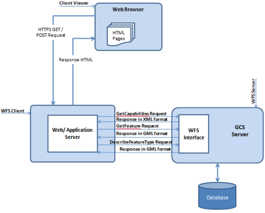
Web Feature Service (WFS) is a service for online sharing and interoperability of geographic feature data in a network environment. It is based on a distributed computing platform that supports the Hypertext Transfer Protocol (HTTP) and provides functions such as query, acquisition, creation, locking, update, and deletion of geographic features and their attribute data. WFS uses Geography Markup Language (GML) to describe geographic feature data and defines a variety of operations to implement these functions, including GetCapabilities, DescribeFeatureType, GetFeature, LockFeature (LockFeature, which may not be included in some implementations), and Transaction.
2025-09-16 14:47:11OGC API - Coverages
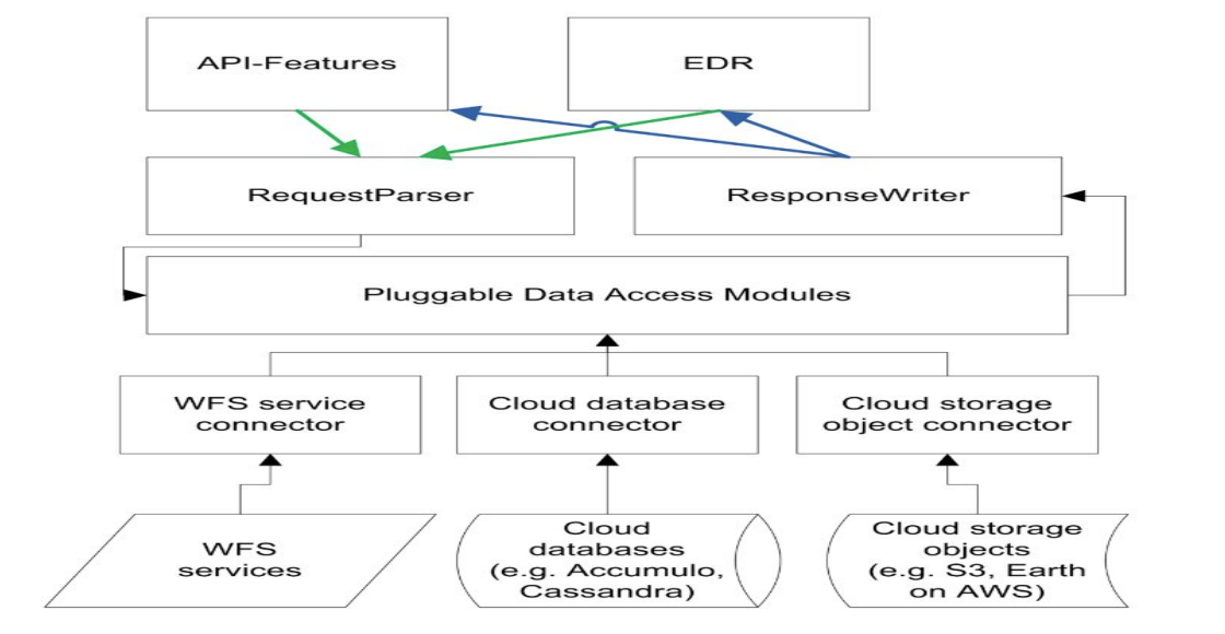
OGC API - Coverages is a geospatial data service specification developed by the Open Geospatial Consortium (OGC), which aims to provide a standardized interface for continuous coverage data such as raster data and spatiotemporal grids. It defines how to access, query and process coverage data through a RESTful API, supports data types such as raster data band information and raster pixels, and is widely used in remote sensing, meteorology, oceanography and other fields.
2025-09-16 14:47:14CityGML (City Geography Markup Language)
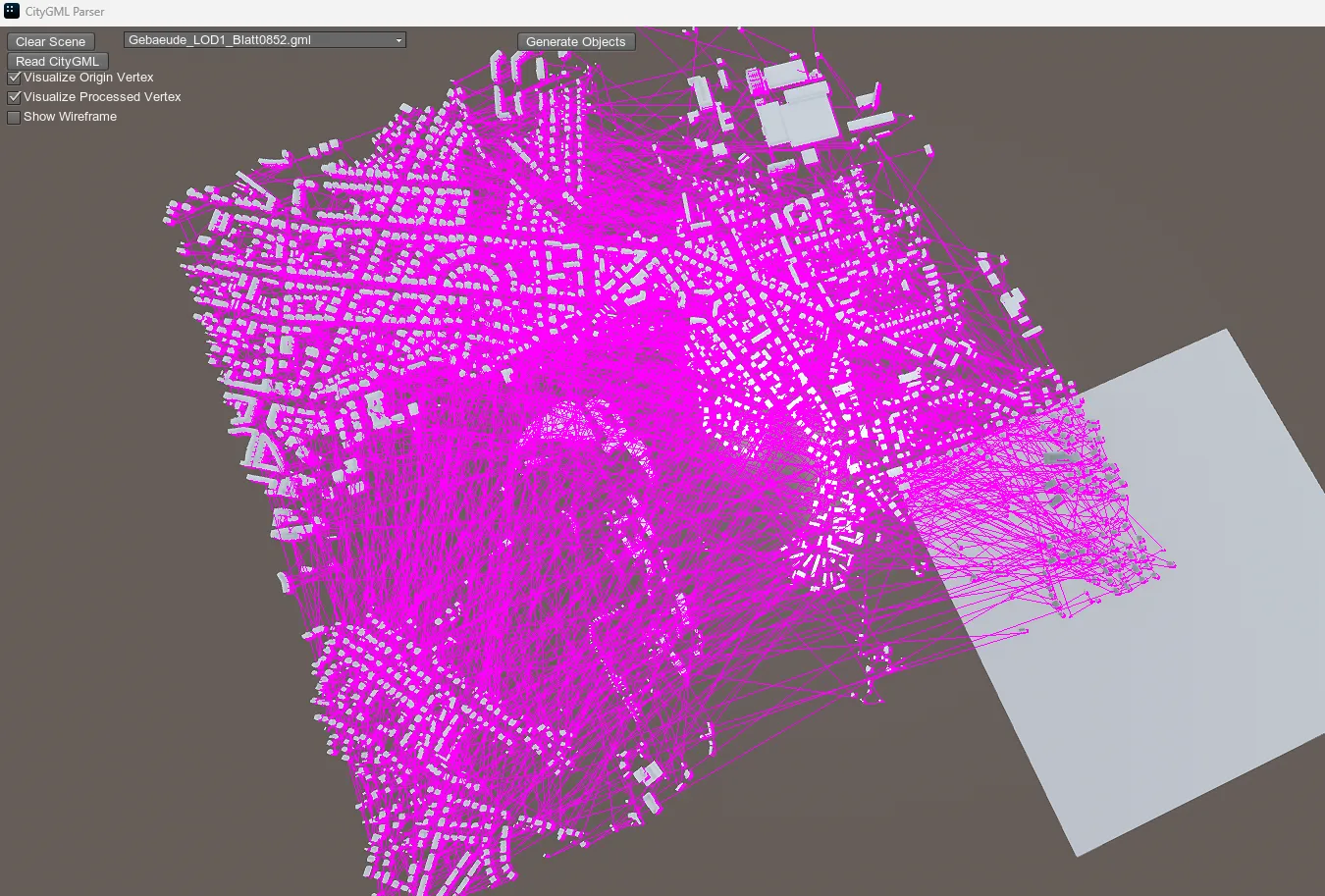
CityGML, an international standard for the exchange of 3D city model data developed by the Open Geospatial Consortium (OGC), uses XML encoding to uniformly describe the geometric, topological, semantic, and appearance attributes of urban elements.
2025-10-31 13:52:47SXF (Russian State Surveying Format)
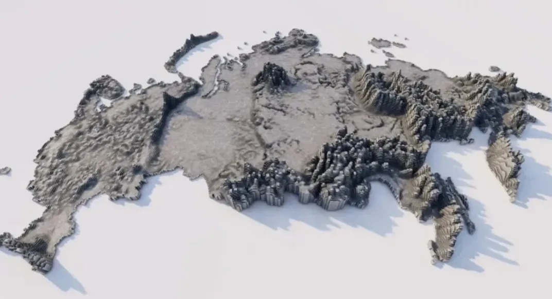
SXF (Russian State Surveying Format) is a proprietary format used by the Russian Federation to store and process geospatial data. It is primarily used in national surveying and mapping projects, such as topographic maps and cadastral surveys. This format supports structured storage of both vector and raster data, including coordinate systems and attribute tables, and complies with Russian national surveying and mapping standards. Designed to balance data accuracy and localization requirements, it is commonly used by government surveying and mapping agencies and related professional software.
2025-10-31 14:48:40
 Service

_1762323693444.png)
_1762323506153.png)
_1762323273719.png)
