 Service

Amersfoort (EPSG:4289)
**Amersfoort (EPSG:4289) **is a widely used geographic coordinate system in the Netherlands, using Bessel 1841 as the base ellipsoid, with the geodetic base point at Amersfoort. This coordinate system has long played an important role in land surveying, mapping, and infrastructure development in the Netherlands. EPSG:4289 uses geographic coordinates (latitude and longitude), making it suitable for expressing wide-area location information on the Earth’s surface.
2025-09-16 14:47:11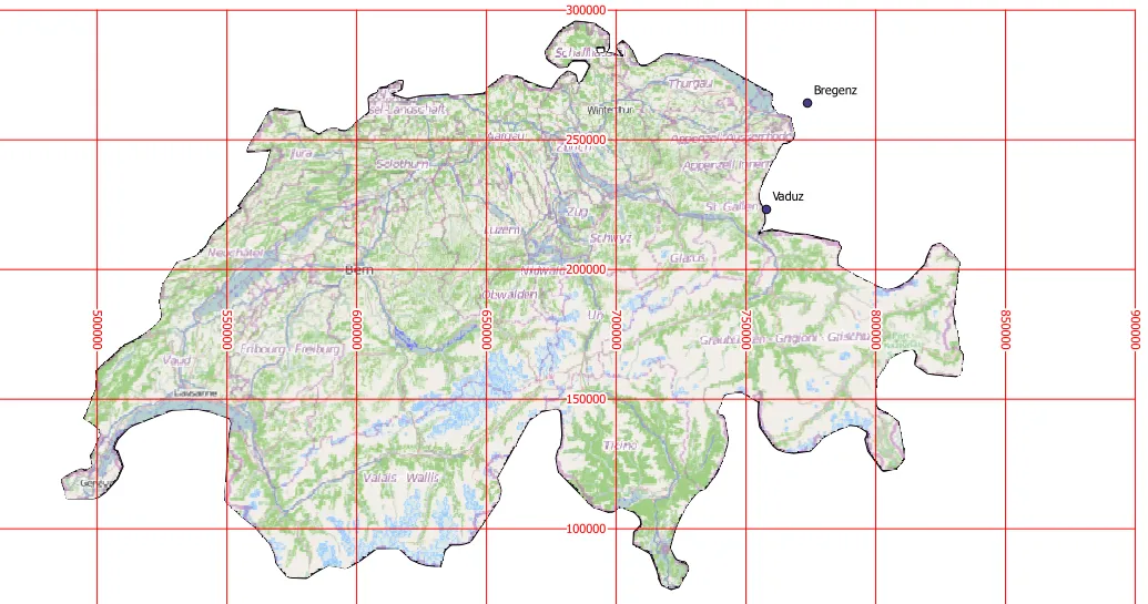
CH1903 (Swiss Coordinate System 1903 | EPSG:4149)
CH1903 is the widely used national coordinate system of Switzerland, based on the geodetic datum established in 1903. It is a projection coordinate system covering the whole of Switzerland, developed to enable precise geospatial information management and mapping of a country with mountainous terrain. The reference ellipsoid used is Bessel 1841, and the projection method is the Oblique Mercator Projection. This coordinate system has long been used by the Swiss National Cartographic Office (Swisstopo) and has become a standard in many fields such as topographic mapping, surveying, civil engineering and infrastructure planning. In recent years, Switzerland has gradually transitioned to the higher-precision CH1903+ (EPSG:2056) coordinate system, but a large amount of historical data is still stored based on CH1903.
2025-09-16 14:47:11