 Service

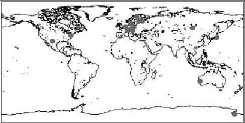
GDA2020 (Geocentric Datum of Australia 2020 | EPSG:7844)
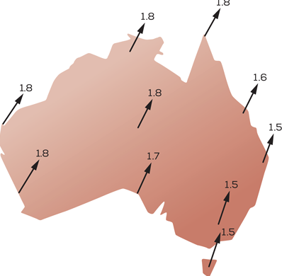
GDA2020 is the latest geocentric coordinate reference frame launched by Australia in 2020. It is consistent with ITRF2014, providing the position and long-term velocity of the base station at the reference epoch, and includes the post-seismic deformation caused by large earthquakes and the annual and semi-annual parameter models. The accuracy of GDA2020 is improved compared to ITRF2014, and can meet the needs of high-precision geolocation and measurement.
2025-09-16 14:47:08
Tokyo Datum (Tokyo 1918 | EPSG:4301)
Tokyo Datum (Tokyo 1918 | EPSG:4301) is a geodetic reference frame adopted by Japan in the early days. Its ellipsoidal parameters (such as the major semi-axis and inverse flattening) are set based on old surveying techniques, and the prime meridian passes through the original site of the Tokyo Observatory (not Greenwich). This coordinate system is mainly used for mapping and engineering surveying in Japan. After its establishment in 1918, it has long served the Japanese geographic information field. However, due to technical limitations, its accuracy and compatibility with international standards have gradually fallen behind.
2025-09-16 14:47:08
JGD2011 (Japanese Geodetic Datum 2011 | EPSG:6668)
JGD2011 is a modern geocentric coordinate reference frame established by Japan in the early 21st century to replace the old Tokyo Datum (such as Tokyo 1918). Its core is based on the GRS80 ellipsoid, with the origin aligned with the center of mass of the earth, and the coordinate axis pointing in accordance with international standards (such as the prime meridian passing through Greenwich). This framework is implemented through space geodetic technologies such as GNSS and VLBI, with an accuracy of centimeters. It can dynamically reflect plate movement and earth deformation, and is suitable for high-precision geographic positioning needs in Japan and surrounding waters, and is gradually connected with international coordinate systems (such as ITRF).
2025-09-16 14:47:08
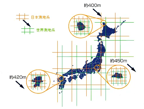
JGD2000 (Japanese Geodetic Datum 2000 | EPSG:4612)
JGD2000 is the national surveying system of Japan officially adopted by the Geospatial Information Authority of Japan in April 2002, replacing the previous “Tokyo Datum”. The main purpose of its introduction is to enhance the coordination with the global GPS coordinate system. JGD2000 is based on the geocentric coordinate system (ITRF: International Terrestrial Reference Frame) with the center of the earth as the origin, thus achieving higher-precision measurement and GIS analysis capabilities.
2025-09-16 14:47:09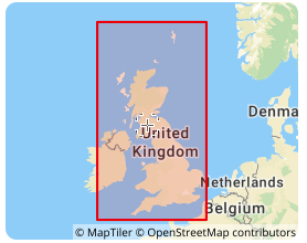
OSGB36 (Ordnance Survey Great Britain 1936 | EPSG:4277)
OSGB36 is the UK national coordinate system, the full name is Ordnance Survey Great Britain 1936, and its EPSG code is 4277. This coordinate system is based on the Airy 1830 ellipsoid and was developed by the Ordnance Survey of the United Kingdom. It is the national datum for topographic surveying in the United Kingdom. In the fields of geographic information systems (GIS), cartography, and engineering surveying in the United Kingdom, OSGB36 has been widely used, providing a unified reference framework for geospatial data in the United Kingdom, allowing geographic data from different sources to be integrated and analyzed in the same coordinate system.
2025-09-16 14:47:10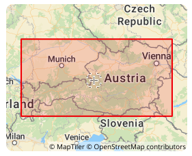
MGI (Militar-Geographische Institut | EPSG:4312)
MGI coordinate system was established by the Austrian Military Geographical Institute. It is a local coordinate system based on the Bessel ellipsoid and is mainly used for geographic information representation and spatial positioning in Austria. It uses the Transverse Mercator projection, with the central meridian at 13°20′ east longitude, the latitude of the projection origin at 0°, the easting offset of 1,500,000 meters, and the northing offset of 0 meters. It is a variant of the Gauss-Krüger projection and is widely used in Austria in many fields such as topographic mapping, land management, urban planning, and transportation planning, providing an accurate spatial reference frame for these fields.
2025-09-16 14:47:10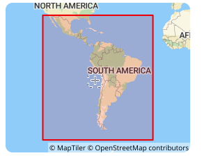
SIRGAS 2000 (South American Datum | EPSG:4674)
**SIRGAS 2000 **is a geocentric reference frame for Central and South America, which aims to define and implement a unified reference frame for Central and South America that is consistent with ITRF. Its ellipsoid adopts GRS 1980, with a major semi-axis of 6378137 meters, an oblateness of 298.257222101, the Greenwich meridian as the prime meridian, and the angle unit is degree. SIRGAS 2000 was established in 2000, consistent with the ITRF2000 framework, with a reference epoch of 2000.0. It is a regional encryption of ITRS in South America, achieved through a network of about 200 continuously operating stations (SIRGAS-CON) throughout Latin America and the Caribbean.
2025-09-16 14:47:10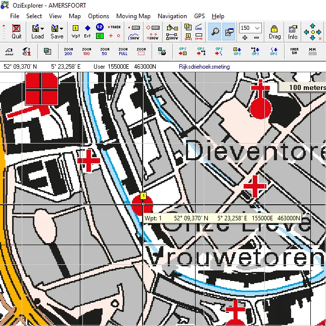
RD New (Rijksdriehoeksmeting New | EPSG:28992)
RD New (Rijksdriehoeksmeting New) is the national reference coordinate system of the Netherlands and the standard projection coordinate system for geographic information measurement and map production. The coordinate system is based on the Transverse Mercator Projection, with Amersfoort as the origin. It is widely known as EPSG code 28992. The system is designed to manage spatial data throughout the Netherlands with high accuracy and is currently widely used in public and private fields such as land management, urban planning, infrastructure design, and disaster response.
2025-09-16 14:47:10