 Service

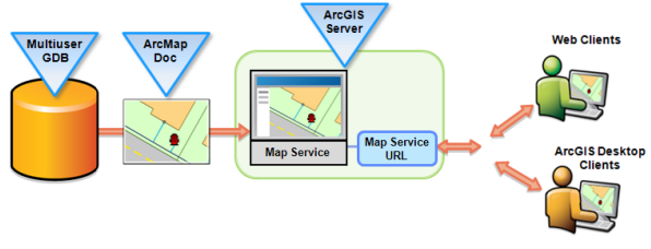
Web Map Service (WMS)
Web Map Service (WMS) is a standard protocol defined by the Open Geospatial Consortium (OGC) for requesting and displaying geospatial map images over the Internet. These images are generated from geographic data and are usually displayed in raster formats (such as PNG, JPEG). The core function of WMS is to provide users with visualization of geographic data through standardized HTTP requests without directly delivering the data itself.
2025-09-16 14:47:11