 Service

PNG (Portable Network Graphics)
PNG (Portable Network Graphics) is a commonly used image file format that is also widely used in GIS. It is a lossless compressed bitmap image format designed to replace the older GIF format. It supports 256 colors and transparency, and can be edited and saved multiple times without losing image quality. PNG files can store high-quality images with small file sizes and good image details.
2025-09-16 14:47:55
MapGIS
MapGIS is a domestic geographic information system (GIS) platform developed by China’s Zondy Cyber Group. The platform was born in the 1980s and has become one of the most widely used GIS software in China. MapGIS provides a variety of product lines such as desktop GIS, server GIS, Web GIS, and cloud GIS, which can realize the collection, management, analysis, visualization and sharing of spatial data.
2025-09-16 14:47:55
DXF (Drawing Exchange Format)
**DXF **(Drawing Exchange Format) is a CAD data exchange file format developed by Autodesk, mainly used in AutoCAD software. DXF saves graphic data in text format to facilitate data exchange between different CAD software. Its file extension is “.dxf”, which can store graphic information (lines, circles, polylines, etc.), layer information, coordinates, text, and annotations in CAD drawings.
2025-09-16 14:47:56
SDB (Spatial Database)
**SDB **(Spatial Database) is a data format used to efficiently store, manage, and parse geospatial data. It is usually one of the file geodatabase formats used in ESRI’s ArcGIS platform, and can store a large amount of geographic information in a structured manner. SDB is widely used in vector and raster data management in geographic information systems (GIS) and is suitable for large-scale spatial data processing and visualization.
2025-09-16 14:47:56
WP
**WP **files are a specific file format for managing and displaying 3D tile data and spatial information. This format is mainly used in geographic information systems (GIS) and 3D visualization platforms, and is designed to efficiently display and distribute large-scale geographic data and city models. WP files store sliced 3D models and texture information, and are suitable for managing and distributing large-scale geographic data sets. Especially in Web-based geographic information visualization and real-time rendering, WP files are widely used due to their lightweight and high-speed display characteristics.
2025-09-16 14:47:57
WT (Web Tile)
WT file is a tile data format mainly used for 3D tile maps and geographic information systems (GIS), designed for efficient display and distribution of large-scale geospatial data. This file format is the abbreviation of Web Tile and is widely used in web-based 3D visualization platforms and geospatial applications. Especially in GIS platforms such as Wings Engine, the WT format is adopted to efficiently distribute large-scale 3D city models and geospatial data.
2025-09-16 14:47:57
JPEG (Joint Photographic Experts Group)
JPEG (Joint Photographic Experts Group) is a file format widely used for digital image compression, with the extension “.jpg” or “.jpeg”. It was developed by the Joint Photographic Experts Group established in 1986 and was officially adopted as an international standard (ISO/IEC 10918-1) in 1992. JPEG mainly uses lossy compression, which can significantly reduce the size of image files with a high compression rate. Therefore, it is widely used in digital cameras, websites, social media and other fields.
2025-09-16 14:47:58
PRJ (Projection)
**PRJ **(Projection) file is one of the common file formats in Geographic Information System (GIS), which is used to store spatial reference information and coordinate system definition. PRJ is the abbreviation of Projection, which is usually used with other geographic data files (such as vector data, raster data, etc.) to determine the geographic location and coordinate system of the data.
2025-09-16 14:47:58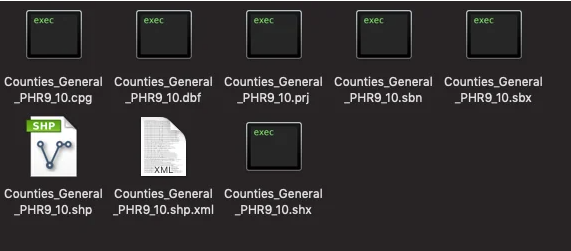
SBX (Shapefile Index)
SBX (Shapefile Index (.sbx)) is an index file used in GIS (Geographic Information System) to improve the access speed of Shapefile (vector data storage format) data. It is a common vector data format used to store geospatial data. It consists of multiple files, including .shp, .shx and .dbf files. Among them, the .shx file is the SBX file, which stores the offset and length information of each geometric object in the .shp file in binary format.
2025-09-16 14:47:58