Inventor
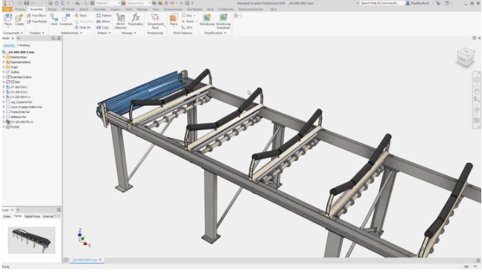
Autodesk Inventor is a 3D mechanical CAD (Computer-Aided Design) software developed and provided by Autodesk, and is mainly used in the fields of manufacturing and machine design. It is equipped with a wide range of functions such as assembly design, drawing creation, simulation, piping and cable design, sheet metal modeling, and welding design, centered on parametric modeling, and can digitize and streamline a series of processes from the design of complex machine parts to prototyping and manufacturing. Along with SolidWorks, it is one of the professional 3D CAD software widely used around the world.
2025-09-16 14:48:17TFW (TIFF World File)
TFW file (TIFF World File) is a text file used in GIS to store geographic reference information of TIFF format raster images. It defines the mapping relationship between pixel coordinates and geographic coordinates through affine transformation parameters. is a text file used in GIS to store geographic reference information of TIFF format raster images. It defines the mapping relationship between pixel coordinates and geographic coordinates through affine transformation parameters.
2025-09-16 14:48:02MAP(Map File)
MAP (Map) is a visualization tool based on geographic location information, which displays geographic location and geographic data in a graphical way. In GIS, MAP usually refers to a map file, which contains the basic data, style and metadata of the map. Map files can be created by GIS software or provided by third-party data providers. In GIS, map files can be used to better manage and organize map data and make it easier to share and integrate with other GIS software.
2025-09-16 14:47:25GPX(GPS eXchange Format)
GPX is an XML-based file format specifically designed for exchanging GPS data. It is widely used to describe location information, such as routes, tracks, and points of interest (POIs), making it easy to share and transfer data between different GPS devices and software. As an open standard, the GPX format is supported by many applications and devices, such as sports trackers, map software, and navigation systems.
2025-09-16 14:47:24OSM(Open Street Map)
OSM (Open Street Map) is an open source map dataset created and maintained by a volunteer community. Unlike traditional map data, OSM data is collected by volunteers using various data sources such as GPS devices, aerial images, topographic maps, and public satellite images. Users can use, edit, and distribute this data for free. OSM has global coverage and provides rich geographic data, including streets, buildings, rivers, lakes, mountains, public facilities, and more. At the same time, OSM also provides APIs and various tools to integrate this data into various applications.
2025-09-16 14:47:26SHX(Shapefile Index)
SHX (Shape Index) files are a file format in Geographic Information Systems (GIS), mainly used to store the location and size information of all geometric objects in Shapefile files. SHX files are part of the Shapefile file format, a popular GIS data format developed by the Environmental Systems Research Institute (ESRI) to store the geometry and attribute information of geographic locations. SHX files are usually used together with SHP files (master files storing geometry information) and DBF files (dBASE tables storing attribute data), and the three together constitute a complete Shapefile dataset.
2025-09-16 14:47:20MWS (MapWindow Session)
MWS (MapWindow Session) is a session file format used by MapWindow GIS software. MWS files contain information about geospatial data, layer settings, symbolization, and map views. It allows users to save and load GIS projects to restore the state and configuration of maps in different work sessions. MWS files can contain vector data, raster data, styles, and symbol settings, providing GIS users with a convenient way to manage and share geospatial information.
2025-09-16 14:47:44PCIDSK (PCI Geomatics Database File)
PCIDSK (PCI Geomatics Database File) is a geospatial data file format developed by PCI Geomatics of Canada, mainly used in the fields of remote sensing and geographic information systems (GIS). The format uses a database-like structure that can store vector and raster data in a single file and is known for its high compatibility with the PCI Geomatics product “Geomatica” software.
2025-09-16 14:48:04
 Service


