DigitalGlobe / Maxar Imagery API
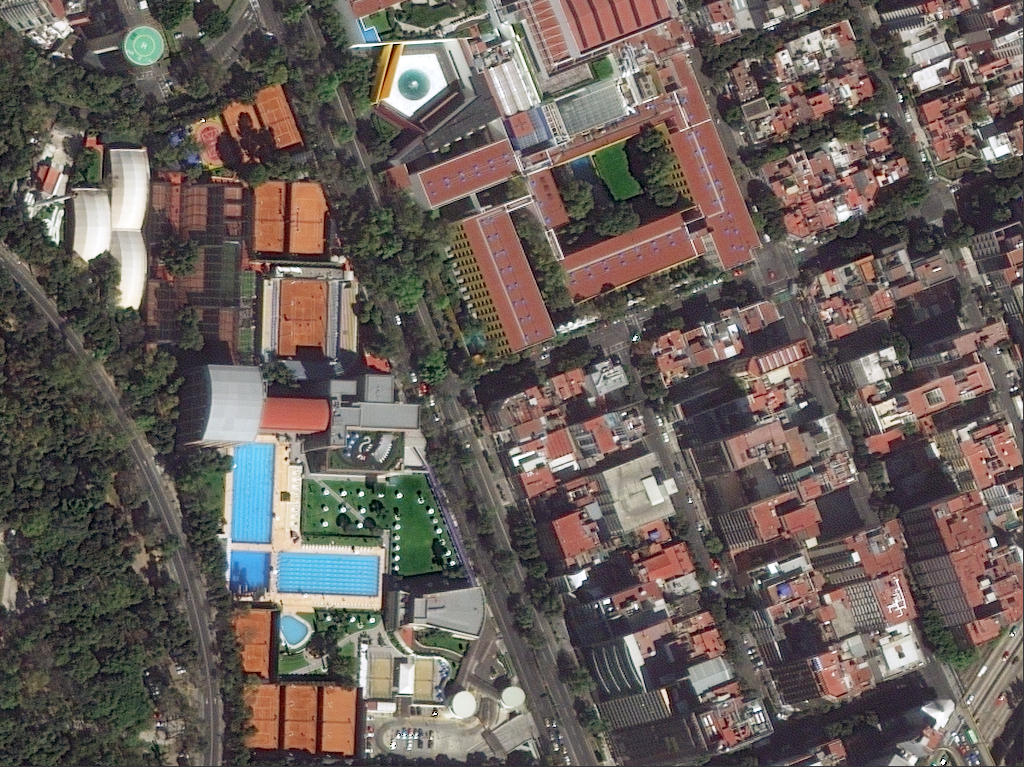
DigitalGlobe / Maxar Imagery API is a commercial satellite imagery delivery service and set of APIs provided by Maxar Technologies (formerly DigitalGlobe) in the United States. It is characterized by its ability to deliver sub-meter resolution optical satellite imagery, captured by high-performance Earth observation satellites such as WorldView and GeoEye, through an online API. Users can flexibly search, visualize, and download both the latest and archived imagery, making it a key foundational service for geospatial analysis, decision support, and both commercial and public applications.
2026-01-23 13:38:25Mapillary Map Traces / GPX Service
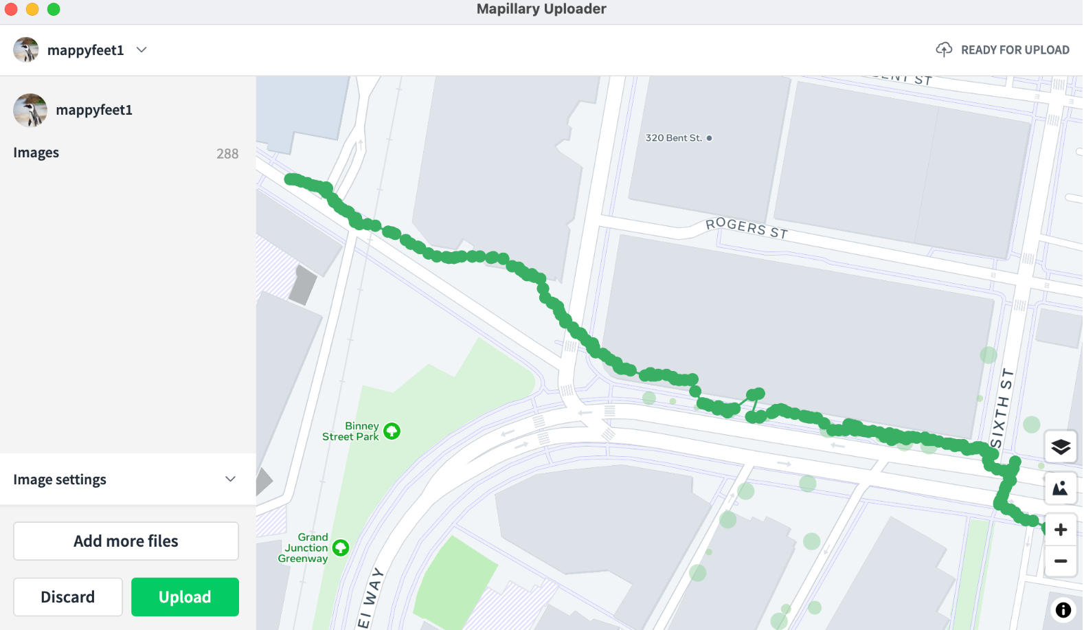
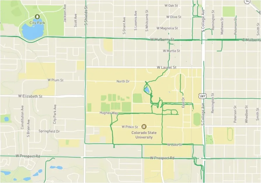
The Mapillary Map Traces / GPX service is an interface for providing trajectory data accompanying street-level imagery collection, offered by Mapillary. It enables the publication and retrieval of movement paths (traces) corresponding to street-level images captured and uploaded by users as geospatial data. Primarily delivered in standard formats such as GPX, it provides user movement trajectories—from walking, cycling, or driving—as time‑series coordinate data, allowing spatially‑linked analysis and visualization alongside street‑level imagery. These trace data are highly compatible with open‑map ecosystems like OpenStreetMap (OSM) and serve as an important supplementary data source for real‑world road and route information.
2026-01-23 13:33:37Geocodio API
Geocodio API is a geocoding service API primarily used to convert addresses into latitude and longitude coordinates (geocoding) or convert latitude and longitude coordinates into addresses (reverse geocoding). It supports various programming languages through HTTP requests and returns data in JSON or XML formats, widely used in map applications, location services, data analysis, and other scenarios.
2025-12-29 14:16:29Pelias/geocode.earth API
Pelias/geocode.earth API is an open-source geocoding service that provides bidirectional conversion between addresses and coordinates. It supports forward geocoding (finding location coordinates from an address) and reverse geocoding (retrieving specific location information from coordinates), and includes structured geocoding capabilities to handle segmented data (such as house numbers, streets, etc.). The API also offers autocomplete functionality, providing real-time suggestions for location names and returning detailed information including names, addresses, and coordinates. Its typical application scenarios include providing precise address search for mapping services, enabling real-time location navigation for mobile applications, and converting address data into geographic coordinates for spatial analysis.
2025-12-29 14:10:55OpenRouteService API
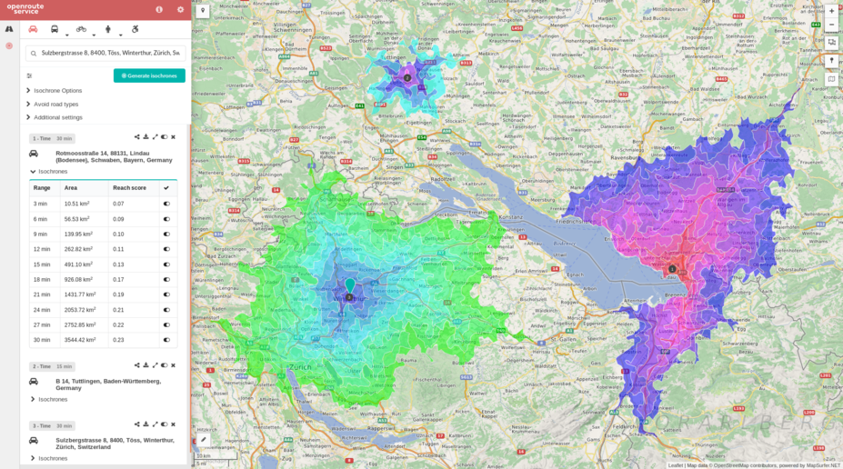
OpenRouteService API is an application programming interface (API) that provides route planning, navigation, and geocoding services. It supports multiple transportation modes (such as walking, cycling, driving, etc.) and can be integrated into map applications to enable route calculation and navigation functionality. Through its open interface, it offers location-based services for developers, making it suitable for application development requiring route optimization or navigation features.
2025-12-29 14:05:48GraphHopper Directions API
GraphHopper Directions API is a route planning and navigation service based on a RESTful architecture, provided by GraphHopper GmbH. It leverages OpenStreetMap data to provide global map coverage and supports route calculation for multiple modes of transportation (such as driving, cycling, walking, public transit, etc.). It integrates functionalities like real-time traffic information, route optimization, geocoding, and isochrone analysis. Developers can quickly integrate it into applications using its Java or JavaScript clients. It is suitable for scenarios like logistics and distribution, traffic navigation, and geographic information systems, combining open-source flexibility with commercial-grade performance.
2025-12-29 14:00:14OSRM API (Open Source Routing Machine)
OSRM API (Open Source Routing Machine) is a high-performance open-source routing engine based on OpenStreetMap data, providing route calculation services through RESTful HTTP interfaces. It supports multiple travel modes such as driving, cycling, and walking, and can quickly return the shortest path results. It is widely used in navigation application development, logistics delivery planning, travel time analysis, and other scenarios. Core features include route calculation, multi-point travel time matrix generation, GPS trajectory matching, etc., utilizing the Contraction Hierarchies algorithm to achieve millisecond-level response times.
2025-12-29 13:55:31Esri Spatial Analysis / Geometry API
ESRI Spatial Analysis is the core spatial analysis toolkit within the ArcGIS platform, supporting advanced spatial modeling techniques such as terrain modeling, location analysis, pattern recognition, and change detection. The Geometry API provides geometric object processing capabilities, including point/line/polygon operations, spatial relationship analysis, and geometric calculations, with support for standard formats such as GeoJSON and WKT. Both are integrated into ArcGIS Pro and the Python API, require specific licenses (such as a Spatial Analyst license), and it is recommended to migrate from ArcGIS Desktop to ArcGIS Pro for use.
2025-12-29 13:48:22Mapillary Image Matching API
Mapillary Image Matching API is an interface service based on image matching technology, which aims to achieve spatial consistency and feature correspondence between multiple images using computer vision algorithms. This API detects key points (feature points) such as SIFT and ORB, and calculates a homography matrix to geometrically align images taken from different viewpoints or at different times.
2025-11-05 14:43:52Mapillary Vector Tiles API
Mapillary Vector Tiles API is an interface that provides structured vector map data, providing developers with the geographic locations and attributes of real-world objects (e.g., road markings, traffic signs, lanes, and road shapes) collected by the Mapillary platform in the form of efficiently transportable "tiles." Developers can use this highly accurate vector data to build applications such as augmented reality (AR) navigation, detailed map analysis, and infrastructure management tools.
2025-11-05 14:42:28
 Service

