 Service


TileJSON
TileJSON is an open standard for describing map tile layers and their capabilities in a machine-readable JSON format. Originally developed by Mapbox as a specification for their mapping platforms, it has since evolved into a widely adopted community standard for declaring metadata about tile sets—whether they are raster tiles, vector tiles, or terrain tiles. A TileJSON file provides a structured, human-readable, and developer-friendly way to communicate essential information such as the tile server's endpoint URL, the tile format (PNG, MVT, GeoTIFF, etc.), the spatial extent (bounds), the coordinate reference system (commonly Web Mercator - EPSG:3857), the minimum and maximum zoom levels, attribution requirements, and other descriptive metadata. This standard enables map clients, styling tools, and data catalogues to automatically discover and consume tile services without requiring manual configuration or prior knowledge of the tile source's internal structure.
2026-02-25 14:29:21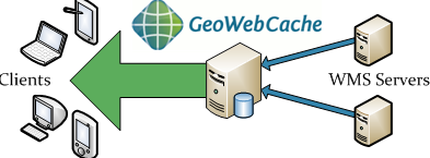
GeoWebCache
GeoWebCache is a high-performance, tile-caching server designed specifically for accelerating the delivery of geospatial map data over the web. It functions as a critical middleware component that sits between a map server (such as GeoServer, MapServer, or ArcGIS Server) and a map client (like OpenLayers, Leaflet, or MapLibre). By generating, storing, and serving pre-rendered map image tiles in standard web formats (PNG, JPEG, vector tiles), it dramatically reduces server load and improves response times for end users. Unlike rendering maps dynamically for each request, GeoWebCache serves pre-computed tiles, making it an essential tool for building scalable, fast, and responsive web mapping applications that serve large volumes of concurrent users.
2026-02-11 14:18:10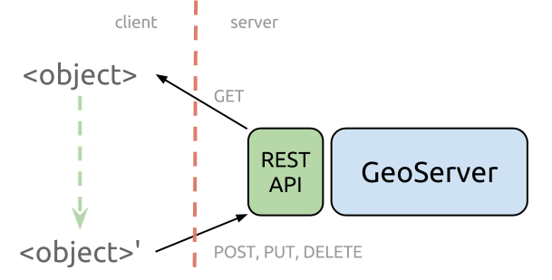
GeoServer REST API
GeoServer REST API is a comprehensive programmatic interface for configuring and managing the GeoServer open-source geospatial data server. As an integral component of the GeoServer software suite, the API provides a standardized HTTP-based mechanism to automate and control virtually all administrative and data publishing tasks within a GeoServer instance. It enables developers, system administrators, and GIS professionals to interact with GeoServer programmatically—creating workspaces, adding data stores, publishing layers, configuring styles (SLD), managing security, and adjusting service settings (WMS, WFS, WCS) without using the web administration interface. This API is essential for integrating GeoServer into automated DevOps pipelines, multi-instance deployments, and custom geospatial application backends.
2026-02-11 14:01:51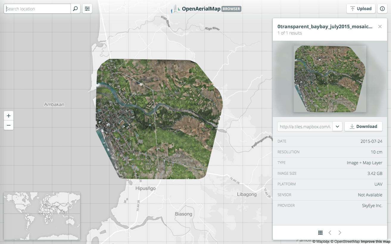
OpenAerialMap API
The OpenAerialMap API is a public API service for sharing and accessing aerial and drone imagery (aerial photographs and orthoimagery) operated under the principles of open source. It is primarily led by communities such as the Humanitarian OpenStreetMap Team (HOT) and provides access to metadata and actual imagery data worldwide for purposes including disaster response, humanitarian aid, research, and public use. Through the API, users can search and retrieve aerial imagery based on criteria such as geographic area, acquisition date, resolution, and license terms, promoting the reuse and transparency of geospatial data.
2026-01-23 14:10:52
USGS EarthExplorer / API
USGS EarthExplorer is an official geospatial data search and distribution platform provided by the United States Geological Survey (USGS). It primarily offers a diverse range of remote sensing and terrain data—including satellite imagery, aerial photographs, digital elevation models (DEM), and land cover data—free of charge. EarthExplorer features a web‑based interface and also supports automated access via an Application Programming Interface (API), providing researchers and engineers with an efficient environment for acquiring and processing large‑scale data.
2026-01-23 13:51:24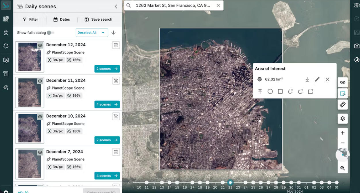
Planet Labs API
The Planet Labs API is an API provided by the US-based company Planet Labs for delivering Earth observation satellite data. It is characterized by its ability to programmatically search, retrieve, and analyze satellite imagery captured by a large number of small Earth observation satellites (known as the "Dove" constellation), offering high-frequency and high-temporal-resolution data. A key strength lies in its "daily revisit" capability, enabling near-real-time monitoring of surface changes—a significant departure from traditional satellite data services.
2026-01-23 13:45:39
DigitalGlobe / Maxar Imagery API
DigitalGlobe / Maxar Imagery API is a commercial satellite imagery delivery service and set of APIs provided by Maxar Technologies (formerly DigitalGlobe) in the United States. It is characterized by its ability to deliver sub-meter resolution optical satellite imagery, captured by high-performance Earth observation satellites such as WorldView and GeoEye, through an online API. Users can flexibly search, visualize, and download both the latest and archived imagery, making it a key foundational service for geospatial analysis, decision support, and both commercial and public applications.
2026-01-23 13:38:25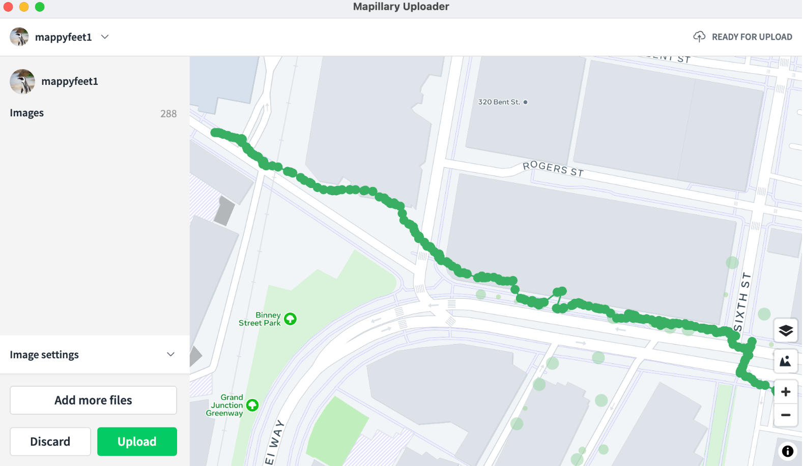
Mapillary Map Traces / GPX Service
The Mapillary Map Traces / GPX service is an interface for providing trajectory data accompanying street-level imagery collection, offered by Mapillary. It enables the publication and retrieval of movement paths (traces) corresponding to street-level images captured and uploaded by users as geospatial data. Primarily delivered in standard formats such as GPX, it provides user movement trajectories—from walking, cycling, or driving—as time‑series coordinate data, allowing spatially‑linked analysis and visualization alongside street‑level imagery. These trace data are highly compatible with open‑map ecosystems like OpenStreetMap (OSM) and serve as an important supplementary data source for real‑world road and route information.
2026-01-23 13:33:37
Geocodio API
Geocodio API is a geocoding service API primarily used to convert addresses into latitude and longitude coordinates (geocoding) or convert latitude and longitude coordinates into addresses (reverse geocoding). It supports various programming languages through HTTP requests and returns data in JSON or XML formats, widely used in map applications, location services, data analysis, and other scenarios.
2025-12-29 14:16:29
Pelias/geocode.earth API
Pelias/geocode.earth API is an open-source geocoding service that provides bidirectional conversion between addresses and coordinates. It supports forward geocoding (finding location coordinates from an address) and reverse geocoding (retrieving specific location information from coordinates), and includes structured geocoding capabilities to handle segmented data (such as house numbers, streets, etc.). The API also offers autocomplete functionality, providing real-time suggestions for location names and returning detailed information including names, addresses, and coordinates. Its typical application scenarios include providing precise address search for mapping services, enabling real-time location navigation for mobile applications, and converting address data into geographic coordinates for spatial analysis.
2025-12-29 14:10:55