
 Service


Madagascar Laborde Grid
Madagascar Laborde Grid is a historic oblique Mercator projection system designed in 1926 by French engineer Jean Laborde specifically for Madagascar's unique geography. Based on the Tananarive datum, it remains the legally mandated projection for the island nation.
2026-03-12 18:49:01
South Africa Lo System
South Africa Lo System (Lo System, short for "Landmeter-generaal Lo-sone" or "Surveyor-General Lo zones") is a suite of projected coordinate systems established by the Office of the Surveyor-General of South Africa to serve as the foundational mapping framework for the country. Developed as a national standard, this system employs a transverse Mercator projection divided into multiple 2° longitude-wide belts to support cadastral surveying, engineering projects, and topographic mapping throughout South Africa. While modern implementations like Hartebeesthoek94 / Lo zones (EPSG:2050-2058) provide WGS84-compatible alternatives, the historical Cape / Lo zones (EPSG:22275-22293) remain essential for interpreting the extensive archive of 20th-century geographic data across South Africa .
2026-03-11 13:34:54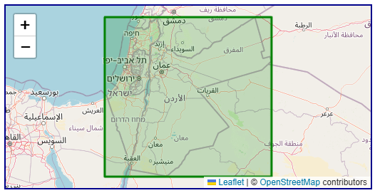
Palestine 1923 / Palestine Grid (EPSG:28191)
Palestine 1923 / Palestine Grid (EPSG:28191) is a historic projected coordinate system established by the British Military Survey in 1923 to serve as the foundational mapping framework for the region . Developed under the Palestine 1923 datum, this system was meticulously designed to support cadastral surveying, engineering projects, and topographic mapping throughout the British Mandate period . While modern systems like Israeli TM Grid (EPSG:2039) have largely superseded it for contemporary applications, the Palestine Grid remains essential for interpreting the vast archive of 20th-century geographic data across Israel, Jordan, and the Palestinian Territory .
2026-03-10 20:10:47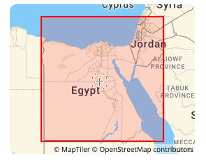
Egypt Red Belt Coordinate System (EPSG:22992)
Egypt Red Belt coordinate system is a national projected coordinate system established in Egypt during the 20th century, forming part of the Old Egyptian National Coordinate System of 1907, together with the Egypt Blue Belt and Egypt Purple Belt. Based on the Helmert 1906 ellipsoid and employing the Transverse Mercator projection, this system was primarily used for engineering surveys and topographic mapping in the Nile Delta and along the Red Sea coast. Although modern GNSS applications are increasingly prevalent, the Red Belt system remains irreplaceable for processing historical Egyptian land records, Suez Canal infrastructure archives, and 20th‑century national topographic map series.
2026-03-10 20:02:24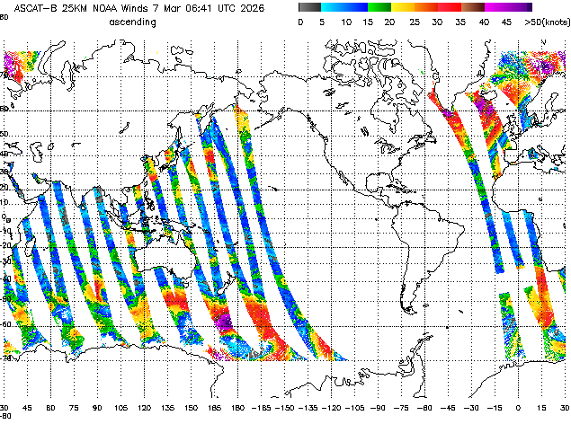
ASCAT (Advanced Scatterometer)
ASCAT (Advanced Scatterometer) is a active microwave radar instrument carried aboard the MetOp series of polar-orbiting satellites operated by EUMETSAT . As a real aperture radar scatterometer, ASCAT transmits C-band (5.255 GHz) microwave pulses and measures the backscatter from the Earth's surface to derive key geophysical parameters . The primary operational application is ocean surface wind vector retrieval, providing measurements of wind speed and direction over global oceans . Additionally, ASCAT data is used for soil moisture monitoring over land surfaces and sea ice detection . The instrument features two independent swaths of backscatter measurements, enabling wide spatial coverage and frequent revisit times.
2026-03-07 14:46:13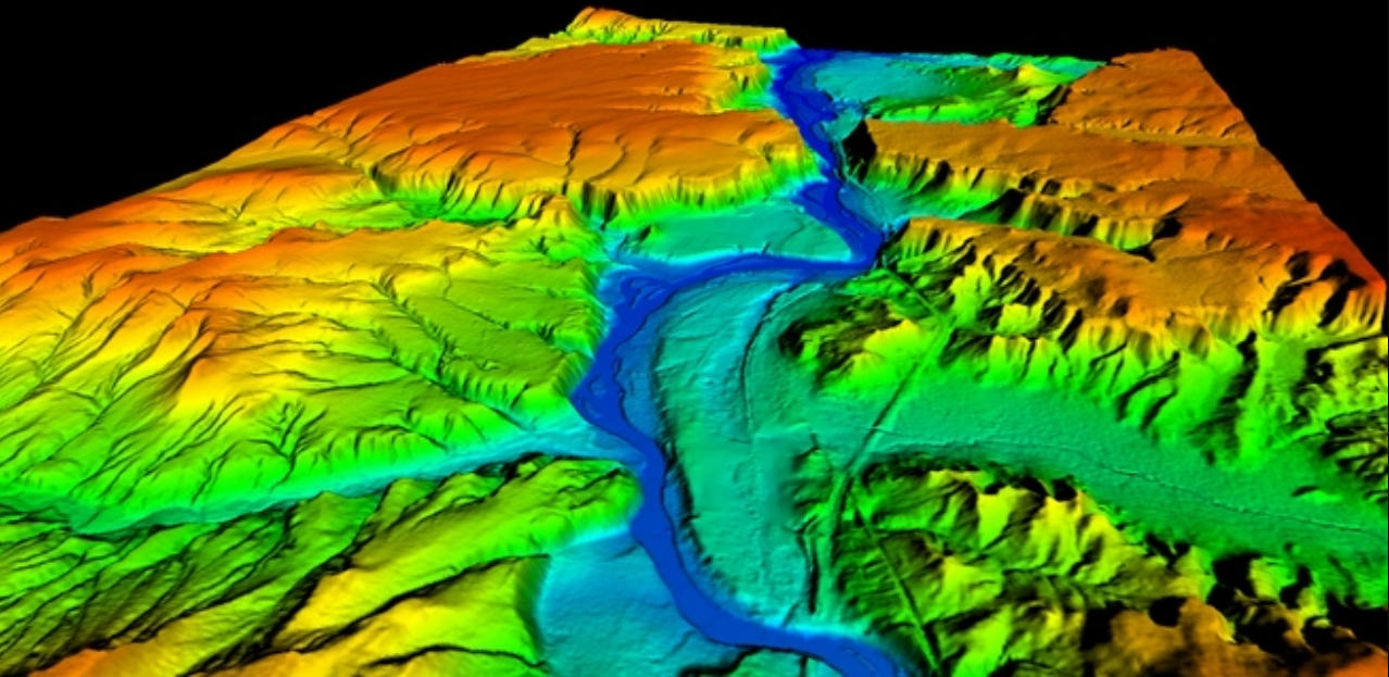
DTM (Digital Terrain Model)
DTM (Digital Terrain Model) is a type of geospatial data model that numerically represents the topography of the earth's surface. It records terrain relief, slopes, and topographic features in digital format, primarily focusing on ground elevation information, and is used for terrain analysis and geographic information processing. DTMs are typically expressed in formats such as grid-based raster data or TIN (Triangulated Irregular Network), and are characterized by representing "bare earth terrain" excluding features such as buildings and trees. They are often generated from survey data, airborne laser surveying (LiDAR), satellite remote sensing, and play an important role as foundational data in GIS and geographic analysis fields.
2026-03-07 14:41:07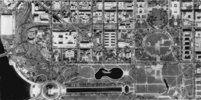
DOQ (Digital Orthophoto Quadrangle)
DOQ (Digital Orthophoto Quadrangle) is orthorectified aerial photograph data created in the United States. Primarily provided by the United States Geological Survey (USGS), it corrects distortions caused by terrain relief and camera tilt in aerial photographs, allowing it to be used as image data with the same coordinate accuracy as maps. DOQs are typically created for areas corresponding to quarter sections of 1:24,000 scale topographic maps (Quadrangles) and are characterized by their ability to accurately represent features such as roads, rivers, buildings, and vegetation based on actual geographic coordinates. Therefore, they are widely used as foundational data in diverse GIS applications including map creation, urban planning, and land use analysis.
2026-03-07 14:36:31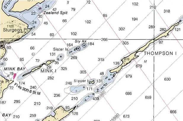
BSB (Nautical Chart Raster Format)
BSB (Nautical Chart Raster Format) is a raster data format primarily used for storing and distributing Raster Navigational Charts (RNC). Originally developed for chart distribution, it has now become one of the standard distribution formats for official raster navigational charts issued by hydrographic offices in various countries. The BSB format adds georeferencing information to scanned paper chart image data, enabling accurate position display on navigation support software. It is characterized by its design specifically tailored for maritime navigation applications.
2026-03-07 14:20:53
RLA (Run-Length Encoded Raster)
RLA (Run-Length Encoded Raster) is a format that efficiently stores raster data using Run-Length Encoding (RLE). By recording consecutive pixel sequences with the same value as "value + repetition count," it achieves high compression efficiency, particularly for classified raster data or data with many homogeneous areas. RLA has a relatively simple data structure and has been used as a lightweight raster data storage method in image processing and GIS fields. It is suitable for raster data with high value continuity, such as elevation models, land use classifications, and binary mask data.
2026-03-07 14:12:15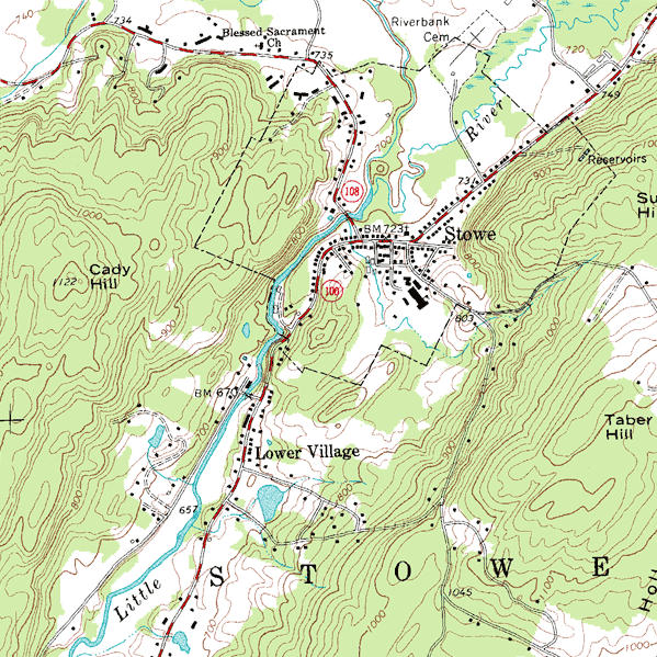
DRG (Digital Raster Graphic)
DRG (Digital Raster Graphic) is a raster data format created by scanning paper topographic maps at high resolution and adding georeferencing information. Primarily produced by the United States Geological Survey (USGS) through digitization of topographic maps, it preserves map information such as contour lines, roads, hydrography, and administrative boundaries as images. Since DRG contains geographic coordinate information, it can be overlaid with other geographic data in GIS and is widely used as base maps or reference maps.
2026-03-07 14:06:22